

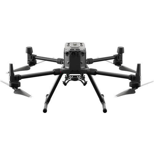
- View exclusive data sets, collected by heliguy™, using the DJI M300 RTK and DJI Zenmuse P1 photogrammetry camera;
- Flight tests show the capabilities of the drone and camera for efficient and accurate mapping;
- The P1's Smart Oblique Capture feature is a powerful tool for aerial mapping, collecting only essential imagery to shave up to 50% off post-processing times;
- The P1 achieved an impressive 1.18cm GSD at 80m, and sub 1-cm GSD at 50m - helping to produce highly-detailed and accurate maps and models;
- M300 RTK and P1 mapped the site in less than half-an-hour; compared to the DJI Phantom 4 RTK which would take up to two hours.


Key findings include:
- The M300 RTK and P1 achieved a 1.18cm ground sample distance (GSD) at 80m altitude;
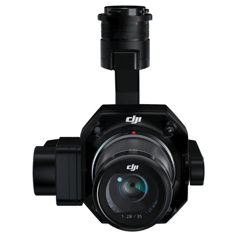
- The P1's 45MP camera captured crystal-clear imagery to build detailed and high-resolution 2D orthomosaics, as well as CAD-standard 3D models, like the one below.
- The Smart Oblique Capture mode captured vertical and oblique data in a single flight - enhancing efficiency and creating a more robust data set without needing to manually capture additional oblique imagery;
- Capturing only the essential data, Smart Oblique Capture collected less than half the number of images, shaving 50% off post-processing time;
- Improved efficiency: The M300 RTK and P1 captured the required data in less than 30 minutes. It would take the Phantom 4 RTK up to two hours to capture the same amount.

Mission Details


The collected data was processed using Esri's Site Scan for ArcGIS, with Pix4D working as the engine in the background. The P1 is compatible with a range of industry-leading photogrammetry software, including DJI Terra.
The Findings
| Mission One - Double Grid | Mission Two - Smart Oblique Capture | |
| Flight Details | Two flights: North to South, East to West | Single Flight |
| Survey Area | 0.057 km² / 5.7205 ha | 0.049 km² / 4.9249 ha |
| Data Collection Time | 28 minutes | 29 minutes |
| Photos Captured | 956 | 390 |
| Camera Angle | 60° - fixed | 90° - standard images 45° - oblique images |
| Overlap | 80% frontal, 75% side | 80% frontal, 75% side |
| Flight Height | 50m | 80m |
| Ground Sample Distance | 0.63 cm | 1.18 cm |
| Post-processing Time | 9 hours | 5 hours |
The two missions showed the quality of the P1 for surveying, but perhaps more importantly, they validated the capabilities of one of the camera's stand-out features: Smart Oblique Capture.
Benefits Of Smart Oblique Capture For Aerial Surveying
In this powerful mode, the P1's gimbal automatically rotates and captures five different images from five different angles while flying along its predetermined flight path.
Smart Oblique Capture is a tool for capturing vertical and oblique imagery in one flight, so the chosen flight parameters tell the P1 to avoid capturing unnecessary images - such as those at the periphery of the mapping area - and to only take those photos that are essential to the reconstruction of the region of interest. The algorithm also takes into consideration that more oblique imagery will be needed in the extents of the survey area and captures oblique images with an efficient overlap.
This was evident on our tests. When flying in Smart Oblique Capture mode, the P1 captured 390 images. In contrast, the double grid mission captured 956 images - that's 59.2% more!
This is further highlighted by these overlap graphics, which show the number of overlapping images for each pixel within the 2D orthomosaic. Red and yellow areas indicate low overlap, while green areas show an overlap of over 5 images for every pixel.

The double-grid graphic shows a high concentration of green across the whole survey site, while during the Smart Oblique Capture mission, the green is concentrated in the middle of the site, while the reds/oranges are more common on the periphery, showing that only the most important imagery was captured
This in turn has an impact on efficiency. On its website, DJI states that Smart Oblique Capture can shave up to 50% off post-processing time.
And this was the case following our tests: It took almost 10 hours to upload and process 956 images on SiteScan. In comparison, it took five hours to do the same with the 390 images. That's half the time - a 50% efficiency saving.
The efficiencies also come in the way that the P1 collects data, ie capturing vertical imagery and oblique imagery in the same flight.
The algorithm used to autonomously capture this data takes into consideration the overlap required between all oblique images and vertical images.
This helps to collect a more robust data set and means that less manual data collection is needed, pre or post flight.
This is highlighted in these two images. The first shows a part of the survey site taken using the double grid method, and the second is Smart Capture Oblique.


Notice how, in the first image, the point cloud is less dense with a greater amount of black spaces in the data set. This is because the camera was fixed at 60°, so struggled to capture parts of the building. To enhance the quality of this data set, manual imagery would need to be collected, filling in the gaps missed by the drone.
In contrast, the second image - created from the Smart Oblique Capture flight - is a much denser point cloud. For instance, the sides of the shed feature in their entirety, with clean and clear angles and lines. This more robust data set has been created because the gimbal, in Smart Oblique Capture mode, collected variable data from different angles, to generate a more complete model.
Yes, manual imagery could be collected to further enhance this model, but the quality of Smart Oblique Capture ensures that a single autonomous drone flight is capable of building a decent reconstruction - improving data collection efficiency in the process.
M300 RTK And P1 3D Models
3D modelling is an important asset for drone surveying. These digitised versions of the real world can be quickly shared with teams to monitor site progress, spot mistakes, and conduct calculations and measurements.
Considering no manual photos were taken during either survey, the M300 RTK and P1 created robust 3D models, as these images from the Smart Oblique Capture mission show.


Ben said: "No manual photos were taken during either survey and all of the data was captured autonomously.
"The 3D models of both could be better, but this would require manually captured flight data to supplement the autonomous flight paths.
"However, for single autonomous missions of just 30 minutes, the model - especially in Smart Oblique Capture mode - is very good and more importantly, the point cloud is dense on the facades of buildings, which means that it could be used for CAD."

DJI M300 RTK and P1 Mapping Accuracy
When it comes to surveying, accuracy is crucial. And the M300 RTK and P1 impressed in this department.
The 45MP full-frame sensor helped to build a detailed, precise, and high-resolution 2D orthomosaic.
Flying at a height of 80m, it was able to achieve a ground sample distance (GSD) of 1.18cm. This is impressive, and resulted in a crystal-clear map. For instance, in this series of images, watch how the quality of the digger remains in tact, even when zooming in.


Flying at 50m, the GSD further increased to 0.63cm - resulting in an even higher-resolution 2D map.
Once again, look how the detail remains sharp while zooming in: Thanks to the sub-1cm GSD, the quality is so high, you can clearly count 10 holes in one of the bricks on the ground to the left of the sandpit.


Ben said: "This high-resolution imagery is essential for surveyors, especially in industries such as construction, where small details on-site need to be spotted and analysed. The fact that the P1 could capture such sharp imagery at a height of 80m is impressive, and, flying at such altitudes helps to increase aerial mapping efficiency."
The accuracy of the P1 was further demonstrated when anaylsing the Absolute Camera Position and Orientation Uncertainties report, ie how accurate the georeferencing of the imagery was.
| Double Grid Mission | Smart Oblique Capture Mission | |
| X (m) | 0.007 | 0.010 |
| Y (m) | 0.007 | 0.011 |
| Z (m) | 0.003 | 0.012 |
As the table shows, the P1 yielded high georefencing accuracies, - which is a crucial ingredient for high-accuracy 3D modelling.
The M300 RTK and the P1 also performed well when it came to the absolute geolocation variance (AGV).
AGV relates to the number of geolocated and calibrated images that have been labeled as inaccurate. Or to put it another way, the difference between the initial image positions and the subsequent computed image positions.
| Geolocation Error | Double Grid | Smart Oblique Capture |
| X | 0.003832 | 0.029546 |
| Y | 0.003919 | 0.032357 |
| Z | 0.009031 | 0.165640 |
The table shows that the P1 is a reliable surveying solution. In this case, the double grid flight yielded very high AGV figures, while the Smart Oblique Capture flight was slightly less accurate (but still very good!); a consequence of the fast camera rotations.
M300 RTK and P1 Vs DJI Phantom 4 RTK
As these data sets show, the DJI M300 RTK and P1 photogrammetry camera is a powerful combination for surveying.
So how does this solution compare to the Phantom 4 RTK - DJI's compact, low-altitude mapping aircraft?

Quite simply, the M300 RTK and P1 combination outperforms it. This, though, is perhaps not surprising. After all, the P1 RTK has a 45MP full-frame sensor, compared to the P4 RTK's 20MP, 1" CMOS sensor.
But the results are startling. Take GSD, for example .
| GSD | P1 with 35mm lens flight height | P4 RTK flight height |
| 0.63cm | 50m | 23m |
| 1.18cm | 80m | 43m |
We know from our M300 RTK test flights that the P1 achieved a 0.63cm GSD at 50m and a 1.18cm GSD at 80m.
In contrast, the Phantom 4 RTK would have to fly much lower to the ground to achieve these accuracies; operating at 23m and 43m respectively.
As an aside, if the Phantom 4 RTK was to fly at 50m and 80m, to match our test flights, its GSD would be inferior to 0.63cm and 1.18cm; yielding 1.37 cm at 50m and 2.19 cm at 80m.
So what does this mean?
Ben said: "The M300 RTK and P1 increases mapping efficiency - especially when compared to the Phantom 4 RTK - because it can fly higher, and therefore cover a greater area, while collecting the equivalent GSD. This is thanks to its larger sensor and higher resolution camera.
"Also, the interchangeable lens options of the P1 mean that you can achieve very low GSDs, even when flying at a higher, or maximum, altitude.

"The M300 RTK also has a significantly longer flight time than the Phantom 4 RTK, so by virtue can collect more data during a single flight. As shown, the Smart Oblique Capture feature further increases efficiencies by capturing oblique imagery and vertical imagery on the same mission.
"We collected our data with the M300 RTK and P1 in less than half an hour; the P4 RTK would take approximately 60 minutes to capture the same size area, with the same GSD, in one flight direction. If doing a double grid, that would be around two hours."
Ben added: "Alternatively, instead of increasing efficiency by maintaining the same GSD at higher heights, the P1 can also be used to capture higher resolution data while flying at lower heights which ultimately creates higher resolution maps and models, just like our flight at 50m demonstrated.
"For high fidelity 3D modelling, the P1 can be used to capture ultra high-resolution imagery through manual capture and processed to produce photorealistic 3D models.

"No ground control was used for these tests, but when using as little as four control points in each of the four extents you would expect significantly improved accuracies of the 3D point cloud and 2D when compared to check points."
However, while the M300 RTK and P1 can outperform the Phantom 4 RTK, this is not to sat that the latter is a poor platform; far from it.
A dedicated surveying drone, its out-of-the-box capabilities ensure a quick launch and its user-friendly design and controls make it an ideal companion for surveyors, especially those who are starting out with drones on their job site. The Phantom 4 RTK is especially suited for low-altitude mapping missions, over smaller job sites.
Ben said: "While the P1 solution will provide a more efficient method of data capture and more high resolution models, the Phantom 4 RTK still has a important place in the market. Its portability makes it an ideal tool for data capture in rural areas, when carrying heavy equipment might not be an option.
"And its ability to capture survey grade data - especially over smaller areas - at a more affordable price than the M300 RTK-P1 solution means that it is still an attractive proposition, especially for smaller businesses."
For more information on the P4 RTK's surveying capabilities, read our accuracy report.
DJI M300 RTK And P1 For Aerial Surveying - Summary
The M300 RTK and P1 is an exciting and powerful combination for aerial surveying and mapping.
The specs of both the drone and the camera speak for themselves; enhanced flight time, a 45MP sensor, and Smart Oblique Capture mode, to name but a few highlights.
And our test flights demonstrated these capabilities. The 1.18cm GSD - without any ground control points - at 80m altitude was impressive, while Smart Oblique Capture proved a powerful tool for autonomous data collection.

In turn, this data was transformed into detailed and highly accurate 2D maps and nicely-crafted 3D point clouds and 3D models - which could become even more robust through additional manual data collection.
The versatility of the M300 (multiple payload configurations) and the P1 (interchangeable lenses), coupled by their capabilities, make a highly efficient and accurate solution for surveying.
Previously, fixed-wing aircraft have been a more powerful tool for aerial surveying over large areas and at higher altitudes, but the M300 RTK and P1 have changed this, providing a highly-effective alternative.
To buy the DJI M300 RTK and/or DJI Zenmuse P1, contact us to speak to our enterprise team.

Leave a comment