

- In-depth look at drone LiDAR and drone photogrammetry;
- Generally speaking, drone LiDAR is better in areas of high vegetation while drone photogrammetry is better for creating highly-visual digital assets;
- New DJI payloads - the P1 and L1 - have been released to aid drone photogrammetry and LiDAR missions.
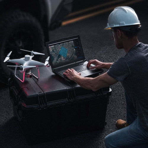
Drone surveying has become increasingly popular in recent years.
Aerial mapping with unmanned aircraft is helping teams collect valuable aerial insights quickly, efficiently, safely, and at an affordable price point - while helping to shape decision-making, improve communication, and drive revenues and outcomes.
As the drones for surveying trend accelerates, there is one question which pops up regularly: Which is the best data collection method - LiDAR or photogrammetry?
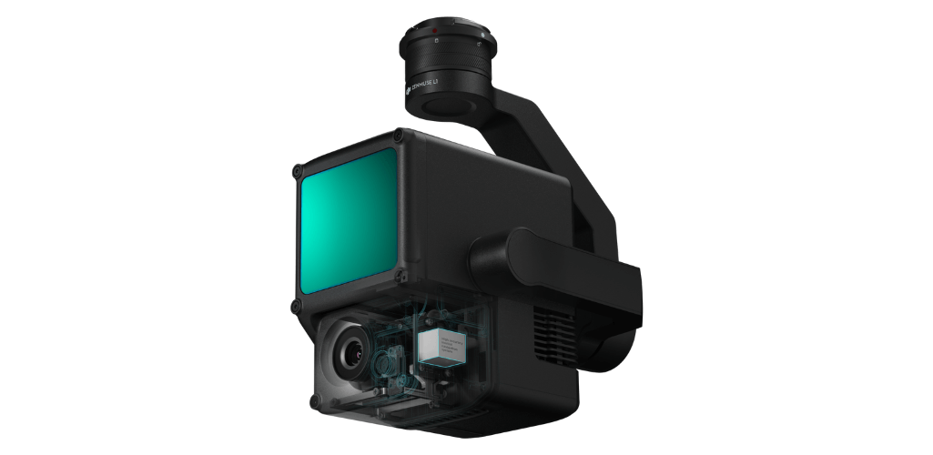
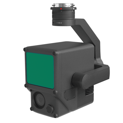
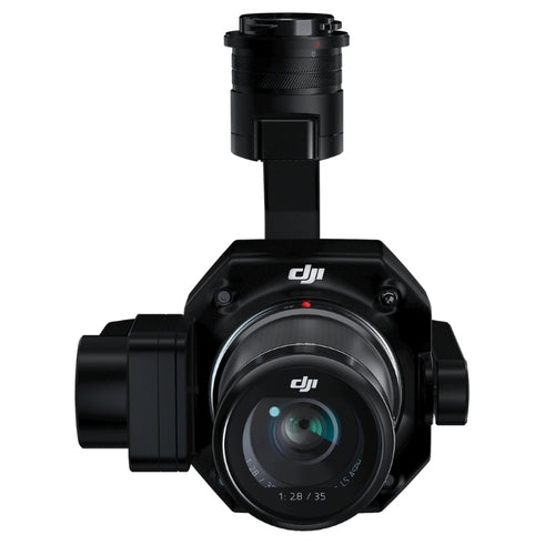
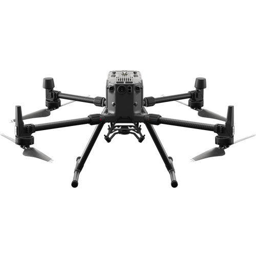
The recent release of DJI's L1 and P1 mapping payloads show the growing interest in, and demand for, these two aerial mapping practises; the L1 (below, right) being a LiDAR sensor (with photogrammetry capabilities), while the P1 (below, left) is a dedicated photogrammetry payload with a high-resolution 45MP full-frame sensor.

It seems pertinent, then, to compare these two aerial mapping methods. What are they? What are their advantages and disadvantages? When should you use them? And is one better than the other?
What Is LiDAR?
LiDAR stands for light detection and ranging.
So, how does LiDAR work? LiDAR - sometimes known as 3D laser scanning - works by sending pulses of light to the earth's surface or a feature on it and measuring the time it takes to reflect back.
The amount of time it takes to return to the LiDAR source indicates the exact distance of the object or feature. This is known as the Time of Flight (ToF) principle.
This gives an accurate positioning point of where on the earth's surface the laser hit. Depending on the sensor used, LiDAR units can blast hundreds of thousands of pulses per second, helping to build a detailed visualisation of what the sensor is focusing on.
This can then be used to create 3D point clouds; an accurate visualisation representing the scanned area's terrain, topography, and features.

The above image - of Shell's Bacton Gas Terminal, captured with the L1 - shows a LiDAR point cloud.
Drone LiDAR has emerged as a useful aerial surveying tool for many applications, such as forestry, agriculture, and construction.
What Is Photogrammetry?
Photogrammetry is the art of capturing high-resolution photographs to recreate a survey area.
These images are processed and stitched together using sophisticated software to create realistic, geo-referenced, and measurable 3D models of the real world.

Depending on the software, these digital twins can be fully navigable - helping teams access and digest key information quickly and easily.
Photogrammetry can also be used to create detailed 2D maps. These orthomosaic data sets provide accurate photo representations of an area, with georeferenced information.
To illustrate this, the first image is a 2D orthomosaic of a farm, while the second image is a 3D model of the site - both captured with the P1 photogrammetry camera.


The number of images needed for valuable photogrammetry datasets ranges from hundreds to thousands - depending on the size of the site and the desired accuracy.
Photogrammetry use-cases are wide-ranging, including project management, crime-scene mapping, marketing, conducting stockpile calculations and measurements, topographical mapping, and building surveys.
LiDAR vs Photogrammetry - Pros And Cons
Like anything, LiDAR and photogrammetry have their upsides and downsides.
These factors, coupled with the mission brief, may well determine the preference for either application.
Mission Versatility
One of the major advantages of using LiDAR over photogrammetry is the enhanced performance during certain missions.
For instance, LiDAR is more effective - and thus, more accurate - in survey areas with high vegetation cover.
Why? Because LiDAR pulses are able to penetrate gaps between leaves and branches to reach ground level.
In contrast, in traditional photogrammetry, vegetation can stop you from acquiring an accurate representation of what the ground topography looks like.
For this reason, LiDAR is a more accurate solution than photogrammetry for building a Digital Terrain Model (DTM); a model of the bare earth (without any objects/buildings in it) containing elevation data of the terrain.
This dataset, shared with heliguy™ by Ben Bishop, Technical Director at Flythru Limited, shows the differences between LiDAR and photogrammetry for capturing ground levels for DTM generation.

Considering the density of the vegetation in this example, photogrammetry (blue) did a good job, but the graphic shows the advantage of LiDAR (pink) in this situation.
Notice, for instance, the thick line of pink (and absence of blue) on the ground in the areas directly underneath the trees, demonstrating how LiDAR pulses can hit the ground in areas of high vegetation, over and above that of photogrammetry.
This is different from a Digital Surface Model (DSM) which represents the earth's surface and includes all objects on it. Both LiDAR and photogrammetry are good solutions for building DSMs.
One statistic states that LiDAR can penetrate areas with up to 90% vegetation, whereas photogrammetry is closer to the 60% mark.
It is for this reason that LiDAR has become a firm favourite for professionals in forestry.

Not only is LiDAR more effective in high-vegetation areas, it is also better suited to missions performed in low-light, or even at night, without needing an external light source.
In contrast, the results of a photogrammetry drone flight can be severely impacted by low light, dust, or cloud cover.
Thanks to high-density point sampling and the direct measurement nature of LiDAR, it is also more effective for measuring and capturing small/narrow objects, such as power cables, pipelines, and sharp-edge features.
This is demonstrated in these two datasets. Powerlines are visible in the centre of the left-hand image - captured with the L1 LiDAR sensor - but are not visible in the 2D orthomosaic of the same scene, as captured with the P1 photogrammetry sensor.

For this reason, LiDAR can also be used to collect intricate measurements between cables and trees, like the below image shows, as demonstrated by Keltbray in this case study

Ease Of Use
Accessibility is one of the biggest differences between LiDAR and photogrammetry.
LiDAR is fairly complex and requires a high level of understanding, which can widen the room for error and increases the demand on an experienced professional.
However, the DJI L1 is helping to bridge that gap by simplifying LiDAR workflows and making them more accessible to more people.
That said, generally speaking, photogrammetry is a more straightforward surveying method.
Yes, there are things to think about, such as what flight height will provide the best ground sample distance (more of that shortly), and what image overlap rate is needed to ensure the most accurate model.
But, generally, advancements in drone photogrammetry have enabled simplified workflows, helping to bring accurate maps and models within the grasp of any organisation with a decent camera drone.
Data Sets
The difference between LiDAR and photogrammetry data sets is night and day.
A LiDAR data set is made up of thousands of points - or returns - to create a detailed 3D point cloud outlining the terrain and elevation.
Because of this, a LiDAR data set does not always create a pretty picture and can require a high level of skill to interpret. And sometimes, when it comes to fine-detailed surfaces and features, LiDAR can be unspecific, meaning you can be unsure of what you are actually seeing.

That said, you can achieve a more visually-accessible model by using colour from separate data sets.
Also, some LiDAR systems, including the L1, have photogrammetry capabilities to help add more detail to a point cloud and aid cross-referencing. Indeed, L1 operators benefit from its ability to generate true-color point cloud models in real-time.
But, forget the aesthetics for a minute: People who can interpret a LiDAR data set will know its true value for certain applications.
In contrast, photogrammetry creates models based on hundreds or thousands of real-world images which are stitched together.
For this reason, a 2D map or 3D model created through this surveying technique is instantly recognisable and relatable, helping teams to access, share and understand digital twins quickly and easily.
Because photogrammetry involves high-resolution imagery, it is able to capture visual details of every feature on a site and, unlike some LiDAR point clouds, takes the abstract out of a data set.
For example, these two images of buildings in Downtown Henderson, taken by the City of Henderson Engineering Department, show the differences between LiDAR (top image) and photogrammetry (bottom image) data sets. You can read the full case study, here.


For these reasons - and the fact a drone survey can capture repeatable data - photogrammetry has become a crucial tool for aerial visualisations, tracking changes, and monitoring progress on a job site, for example.
Cost
LiDAR uses lasers, whereas photogrammetry relies on images collected from a camera.
And traditionally, LiDAR sensors were large, so a bigger aircraft was needed.
Therefore, photogrammetry has become known as a more affordable solution than LiDAR.
However, this gap is closing. Take DJI's L1 LiDAR payload, for instance, which represents a more cost-effective and compact solution than other LiDAR sensors on the market.
And with ongoing innovation, there's every chance that LiDAR will continue to become more accessible (in terms of price and application).
LiDAR v Photogrammetry - Which Is More Accurate?
When it comes to surveying, one of the most important considerations is accuracy.
Done correctly, LiDAR and photogrammetry are reliable and accurate methods.
But, before digging deeper into this, here's the definition of two terms which are integral to this section:
- Relative (Vertical) Accuracy: Relative accuracy refers to the accuracy of a dataset’s data points between one another. If the distance between point A and point B is 62.128m on the ground then with an overall relative accuracy of +/- 20mm you would expect the model distance to be between 62.126m and 62.130m. Data with relative accuracy WILL be collected with reference to a coordinate reference system, but not to a high accuracy.
- Absolute (Vertical) Accuracy: Absolute accuracy refers to the accuracy of the dataset in relation to a coordinate system or datum. For example, with a 20mm absolute accuracy, there would be a 40mm margin for error (20mm each way).
Drone LiDAR Accuracy
When accuracy is king, LiDAR is an extremely reliable solution.
Remember, LiDAR works by hitting the earth's surface, or a feature on it, by firing out laser pulses from above and measuring the reflection. It, therefore, represents a direct measurement.
This, coupled with its integration with GNSS data, helps to give your digital terrain map high levels of vertical accuracy.
LiDAR is also an ideal solution to achieve absolute accuracy, especially if the intention is to create a realistic bare earth model, because of its ability to account for elevation and vegetation.
In fact, thanks to LiDAR's high data point density (with sensors emitting hundreds of points per square metre), surveyors can create a really robust data set.

As a side note, when looking at different LiDAR solutions, the laser pulse rate is a key specification. A higher pulse rate collects more measurements per second, creating more detailed models and reduces the number of flights needed to cover a specific area.
But, LiDAR is a complex system, and many factors determine accuracy.
It's not just about the LiDAR sensor: Other high accuracy systems such as satellite positioning (GNSS data) and an inertial measurement unit (IMU) need to be of high quality to build an accurate point cloud that accurately reflects the survey area, its terrain, topography, and features.
But, overall, LiDAR tends to produce scans with greater detail and accuracy compared to photogrammetry.
Drone Photogrammetry Accuracy
However, that is not to say that photogrammetry is not an accurate survey solution.
To the contrary. In fact, some drone solutions can yield centimetre-level accuracies.
But there are some important factors to consider which can impact accuracy.

For instance, the quality of the drone and the camera.
Sensor size, its resolution, and focal length all affect ground sample distance (GSD) and the required flight altitude.
For the record, GSD is defined as the length (in inches, centimetres, or millimetres) between the centres of two consecutive pixels on your map.
So, if a drone achieves a GSD of 5 cm/px, that equates to one pixel on your digital map corresponding to 5 cm in reality.

The smaller the GSD, the higher the accuracy. Take the below images as an example: The orthomosaic with a GSD of 5 cm (left) is far more detailed than the one on the right with a GSD of 30 cm. This is because the bigger the value of the image GSD, the lower the spatial resolution of the image and the less visible the details.

For more information, read our in-depth guide to GSD.
It is also important to:
- Ensure the correct overlap between each image to improve the accuracy and the quality of the model when it is being stitched by photogrammetry software;
- Ensure the image quality is high;
- In most cases, ground control points (GCPs) need to be used.
If all these elements are in place, photogrammetry is a great tool and can achieve suitable relative accuracies.
However, absolute accuracy is harder to achieve without GCPs or an RTK or PPK enabled drone.
As a side note, some aerial drone surveying solutions (M300 RTK/P1 sensor) are emerging which can achieve high accuracies without GCPs, or certainly very few.
Read our P1 surveying workflow blog to find out how the M300 RTK makes a GCP-free surveying operation possible.
In contrast, LiDAR does not require GCPs to obtain accurate data. This can be seen as another advantage of LiDAR, as laying out GCPs can be a time-consuming process.
What is a Ground Control Point?
GCPs are marked points on the ground that have a known geographic location.
For aerial survey applications, GCPs are typically required as they can enhance the positioning and accuracy of the mapping outputs. Indeed, GCPs allow the survey drone to obtain fairly accurate data.
What Is RTK?
RTK (real-time kinematic) is a GPS correction-technology technique that provides real-time corrections to location data when the survey drone is capturing photos of a site. Real-time correction is a major industry advantage.
What Is PPK?
PPK (post-processed kinematic) is another GPS correction-technology technique that works to correct location data, except in the cloud after the drone data has been captured and uploaded.
When Is Best To Use Drone LiDAR?
LiDAR can be a key tool in a surveyor's arsenal.
While it can be used for a range of applications, there are perhaps specific mission types where it really comes into its own.
These include:
- Mapping complex terrain with vegetation cover
- During low-light conditions or during the night
- When you need to detect small/narrow objects like cables or pipelines, which may be missed or not recognised by alternative methods.
LiDAR is also an effective method when accuracy is especially crucial and for projects where precision is a priority.

When Is Best To Use Drone Photogrammetry?
More and more businesses, organisations, and departments across a growing range of industry verticals are embracing drone photogrammetry.
And there are certain scenarios which are perfectly suited to this aerial surveying technique. These include:
- Data sets that need visual assessment
- Projects which need easy-to-understand maps and models
- Context-rich scans that are accessible and require minimal post-processing and expertise

A 2D map or 3D model can be invaluable for monitoring progress on a building site, improving communication between teams and stakeholders, city planning and management, and checking for mistakes/damage.
Read our guide to drones for construction.
Drone LiDAR And Photogrammetry: What Solutions Are Available?
A number of solutions are available across the DJI ecosystem to help collect LiDAR and photogrammetry data.
Click for more information on LiDAR drones and LiDAR scanners.
LiDAR Drone
DJI's flagship commercial platform, the M300 RTK, can be used as a LiDAR drone thanks to the release of the Zenmuse L1 sensor.

The L1 integrates a Lidar module, a 20MP RGB camera, and a high-accuracy IMU.
Its key features include:
- Highly efficient, can cover up to 2 km² in a single flight
- IP54 weather-protection rating
- Supports three returns
- Point Rate of 240,000 pts/s
- 5cm vertical accuracy / 10cm horizontal accuracy
- 450m Detection Range
- Point Cloud LiveView
The M300 RTK and L1 can also be used in conjunction with DJI's mapping software platform, DJI Terra. This enables surveyors to access 3D data, details of complex structures, and precise visual reconstructions. Terra is also highly efficient when it comes to processing L1 LiDAR data.
The dataset below was created using the L1 and DJI Terra. Read full review here.

Meanwhile, software package Terrasolid can be used in conjunction with DJI Terra to enables more in-depth analysis of L1 data, such as classification, cleaning and other important tools.
Photogrammetry Drone
M300 RTK And Zenmuse P1
The M300 RTK can be integrated with the Zenmuse P1 camera. This payload has a 45MP full-frame sensor, making it a highly-capable solution for photogrammetry.

Other key features include:
- Capable of achieving 3cm horizontal and 5cm vertical accuracies, without any GCPs
- Highly efficient, cover 3km² in a single flight
- 3-axis stabilised gimbal with Smart Oblique Capture, ideal for large surveying sites
- Global mechanical shutter with a shutter speed of 1/2000 seconds
- TimeSync 2.0, enables microsecond-level synchronisation
- Interchangeable fixed-focus lenses (24/35/50mm)
An update has also enabled the P1 to be used in conjunction with DJI mapping solution, Terra.
The dataset below shows a 3D model as captured by the P1 and processed through DJI Terra. Read the full review here.

Thanks to its 45MP full-frame sensor, among other features, the P1 can achieve a sub 1cm GSD from 50m flight altitude, as proven in tests by heliguy™.
Phantom 4 RTK
The Phantom 4 RTK is DJI's low-altitude mapping solution. It is particularly suited to small surveying areas, but, because of its accessibility, it offers a good introduction to those who are new to drone surveying.

Its key features include:
- RTK module
- 20MP 1" CMOS sensor
- Mechanical shutter reduces risk of rolling shutter blur
- TimeSync System, which aligns the flight controller, camera, and RTK module
LiDAR v Photogrammetry - Which Is Best?
There's a good reason why LiDAR and photogrammetry have become popular drone surveying techniques: They can capture quality data and provide valuable insights.
But which is best?
In truth, it is a difficult question to answer, because both have their values.
In many ways, it boils down to the job at hand.
LiDAR is extremely powerful for specific missions, such as challenging projects where elevation accuracy, complex structures, or areas involving high vegetation are key.

Thanks to innovation, such as DJI's new L1 payload, LiDAR is increasingly becoming more accessible and affordable, but the fact remains that it is a highly-specialised surveying technique.
Therefore, for broader surveying needs, photogrammetry will be more than adequate: it is generally more affordable, more accessible, and, if done correctly, it is accurate enough to suit most needs.
And for teams needing a highly-visual digital asset, drone photogrammetry is a powerful method of aerial surveying.

But, regardless of your preferred technique, the innovation in both fields is exciting; a fact epitomised by the new L1 and P1 sensors from DJI.
Continued growth in these areas will only enhance the ability of aerial surveyors to capture highly detailed and accurate maps and models - quicker, safer, and cheaper than before.
To find out more about LiDAR and photogrammetry and to discuss the available solutions, contact us and speak to a member of Heliguy's enterprise team.

I just love the review of lidar vs photogrammetry mapping. Will love to invest in the two for my mapping operations.
Leave a comment