
- DJI M300 RTK drone and P1 camera used to map the Angel of the North - resulting in incredible 3D model;
- Digitised recreation is highly detailed and offers a different perspective of the iconic landmark;
- Survey completed in a matter of hours, capturing more than 2,000 aerial images;
- Stunning model shows the capabilities of the P1 photogrammetry camera and the advantages of using drones for mapping and surveying;
- The Angel was mapped by commercial drone services provider RUAS, using equipment supplied by heliguy™.
Check out this incredible 3D model of the Angel of the North, as captured by the P1 photogrammetry camera and DJI M300 RTK drone.

VIEW THE MODEL VIA RUAS OR VIEW THE MODEL VIA SKETCHFAB
The impressive digitisation is an accurate and highly-detailed representation of the iconic North East landmark.
It offers a different perspective of the 75-metre-high sculpture, enabling parts like the head and wings to be viewed up close, in stunning resolution.


The Angel was mapped by commercial drone services provider RUAS, using equipment supplied by North East drone company, heliguy™. The video below shows part of the mapping mission, with footage courtesy of RUAS.
It took a two-pilot team - flying with an Operating Safety Case - just a matter of hours to collect more than 2,000 aerial images of the Angel, using automated and manual data capture with the P1 to map the entire structure.
The imagery was then processed in-house to create a dense point cloud...

...and a 3D model.

The model can also be viewed without colour, which highlights a more accurate perception of the detail.

The recreation shows the benefits of using drones for mapping and surveying - collecting high-resolution imagery quickly and safely to build data-rich and crystal-clear digital assets. These in turn can be used to conduct remote inspection and be stored for heritage documentation.

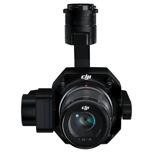
It also shows the quality of the P1 photogrammetry camera, which features a full-frame sensor capable of capturing 45MP stills. It is compatible with the rugged DJI M300 RTK, which benefits from high endurance to further boost the efficiency of surveying missions.
Another example of a stunning 3D model, built using imagery collected with the P1 camera, can be viewed here.
RUAS has a history of creating 3D models for its clients and is currently embarking on a project to map and digitally preserve iconic UK structures and monuments. The Angel of the North is part of this exciting project.

Leave a comment