Technical
The Value Of Drone Data
Drone data: What it is, how it helps you, the best drones to collect it, how it can be turned into actionable management information that meets precise organisational requirements, and how the drone in a box will facilitate remote and auton ... Read More

Drone data is highly valuable: Find out what it is, how it helps you, and the best drones to collect it, depending on your use case;
Find out how drone data can be turned into actionable management information that meets precise organisational requirements;
Learn about drone data pitfalls which can impact the effectiveness of drone data;
Find out about some of the industry-leading drone data processing and management software;
Autonomous and remote solutions, such as the DJI Dock drone in a box, will transform drone data collection;
heliguy™ helps organisations collect quality data: Consultancy, dedicated data software training, and Drone Assistive Programme.
A recent PwC study predicted that drones could contribute up to £46bn to the UK economy by 2030.
However, this was caveated by several factors which need to be unlocked to help realise this potential.
One of these integral components was data. Or more specifically, how effectively a drone programme is able to capture, process and integrate UAS data into its existing workflows.
But how do teams go about doing this?
This blog will help. It will explain how drone programmes can convert drone-captured data into actionable management information that meets precise organisational requirements.
It will also highlight the various types of drone data and the value of it; list industry-leading drone software programmes which streamline and centralise drone data; and explore how the industry is moving towards automated and remote data collection through drone in a box solutions.
And it will focus on how heliguy™ helps teams utilise drone data and integrate it into existing workflows, including industry-specific training, dedicated surveying workflow courses, and the Drone Assistive Programme.
What Is Drone Data?
So, what exactly is drone data?
Drone data is exactly as it sounds: Aerial data collected by a drone. It is cost-effective, safe, highly accurate and versatile. As such, it benefits many industry applications for a variety of tasks, from helping police analyse crime scenes through to enabling construction professionals to keep tabs on their jobsite.
Another advantage of drone data is it is digital. It is interactive, can be quickly shared with teams to improve communication, and gives teams the ability to reference historical data and trends to make smart decisions about future work.
Drone Data: Efficiency
Drone data enables organisations to collect information efficiently. For instance, leading construction engineering specialist Aureos has doubled the efficiency of its powerline inspections - while slashing its carbon emissions and minimising downtime.
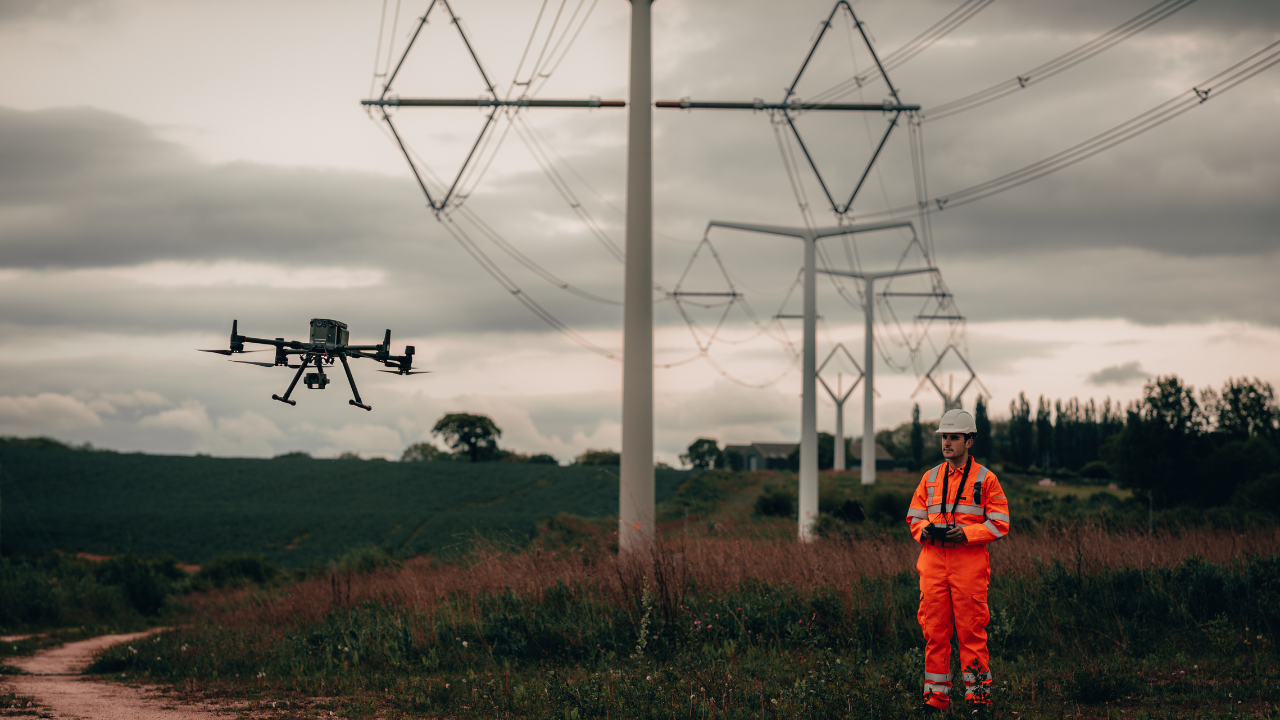
And it's easy to see why. This picture shows how Aureos used the DJI M300 RTK and H20T to collect 35 high-resolution images of a powerline in one go, streamlining condition-based monitoring. Read the full story here.

Drone Data: Safety
Drone data is safe. Take wind turbine inspections, for instance. Teams no longer have to scale the blades at height using rope-access techniques, or install scaffolding in other instances. Rather, the drone can capture this information from afar, with boots safely on the ground.

Drone Data: Cost-effective
Drone data is cost-effective. It achieves this through a combination of factors, such as increased efficiency, removal of the need to erect costly scaffolding or deploy helicopters, and is less labour intensive.
As Richard Clement, from Komatsu, says: "Drones enable firms to create highly accurate maps and point clouds, discover costly job site mistakes, and predict schedule delays, saving up to tens of thousands of pounds per week.”
Drone Data: Detailed and Accurate
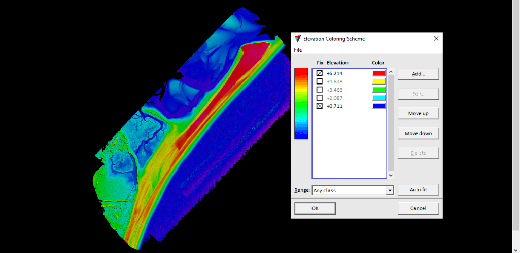
Drone data is highly detailed and extremely accurate. For instance, a coastal erosion survey involving the heliguy™ in-house surveying team showed that the L1 LiDAR sensor can achieve 15mm accuracy from 100m flight altitude. Read the full story here.
As an added bonus, drone data can be automated to collect repeatable data - extremely useful for year-on-year comparisons. Drone survey data can also be georeferenced.
Drone Data: Vital Insights
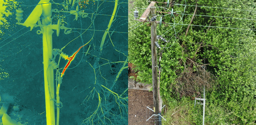
Drone data provides vital insights: Information that could otherwise have been missed. This image shows how a thermal camera drone identified an overheating cable joint, not visible with the naked eye...
...while this missing person was found by a drone, in a location that was difficult to see by ground crews.

Drone Data: Consumable Information That Can Be Shared
Drone data is shareable and easily consumable.
For instance, this picture of SUEZ's treatment facility in the North East of England, shows how one drone image provides a complete real-time snapshot of site progress - including vehicle movements and earth works.
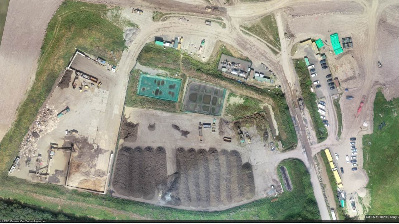
These digitised assets can then be shared and accessed remotely to engage stakeholders and colleagues and help proliferate information about a jobsite, survey area or incident.
Drone Data: Versatility
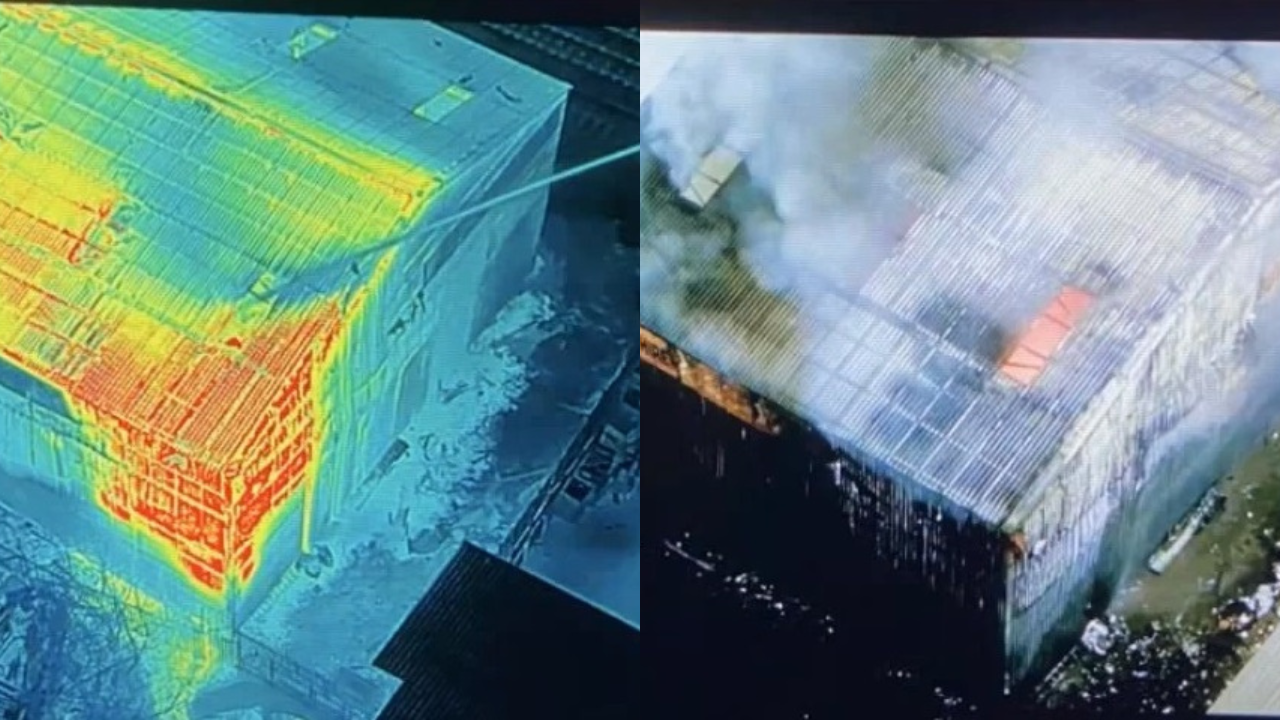
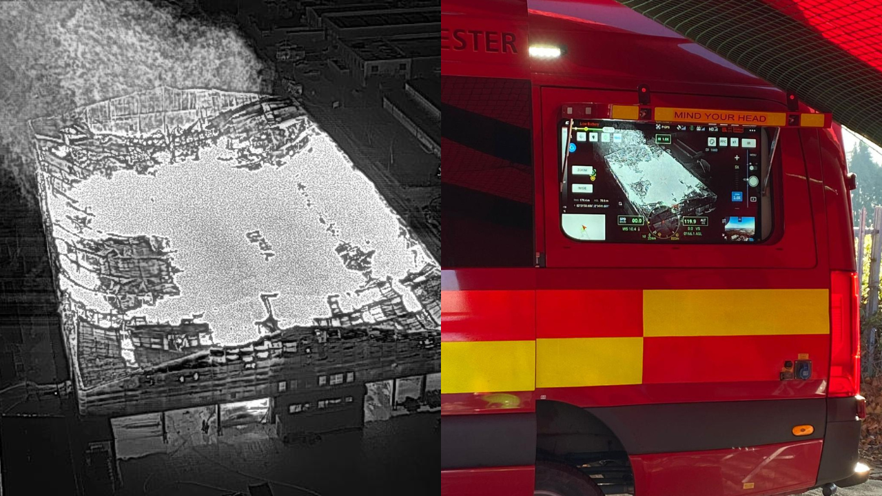
Drone data is versatile. For instance, this image shows how fire crews fought a blaze using side-by-side thermal and visual data...
...while this image shows three different survey outputs of the same farm.

Drone Data Workflows
It is important that organisations have a drone data workflow to help capture the best data possible.
This workflow includes processing the data and then sharing it. Analysis can come before or after sharing the data - depending on the specific workflow and type of job at hand.
The graphic below provides an indicative version of the drone data workflow.
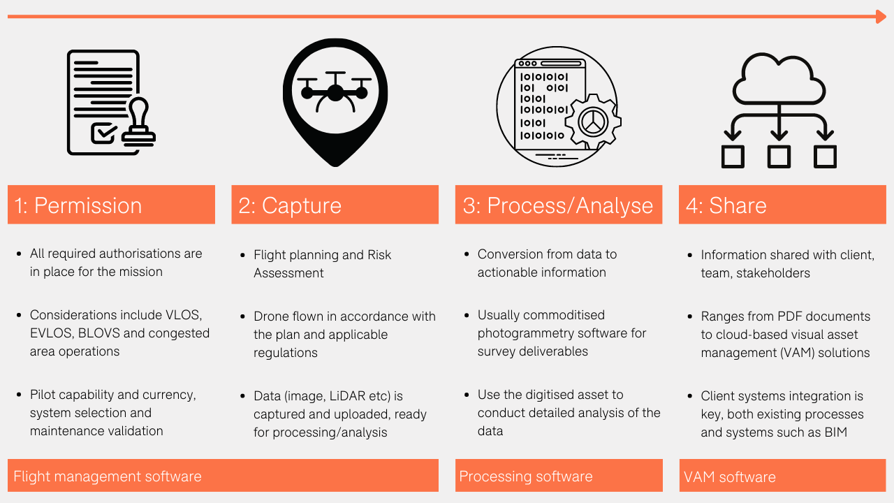
So, how does this transfer to the real world? The following examples illustrate this.
Heritage Survey
heliguy™ and the 360 Group conducted a survey of an 'at-risk' heritage gatehouse in Alnwick, Northumberland. The aim was to create a digital asset for condition-based inspection and heritage documentation, on behalf of custodians, The Northumberland Estates. Read the full story here.
Step 1 - Permission: The team obtained the necessary permissions to fly in Alnwick town centre. This included closing the tower to traffic. Incidentally, the speed of the drone survey enabled the road to be reopened quicker than it would have been by conducting a survey using more traditional methods.
The DJI M300 RTK drone and P1 photogrammetry camera were chosen for the survey: The M300 RTK has a long flight time and IP rating, while the P1 has a 45MP full-frame sensor for high efficiency and detailed data capture.
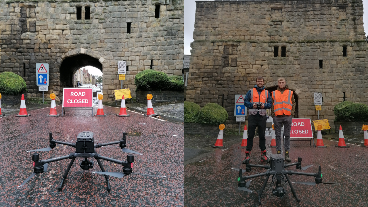
Step 2 - Capture: Using the DJI Pilot app, the team conducted the mission, flying around the gatehouse to capture thousands of images. The data was collected in less than a day.
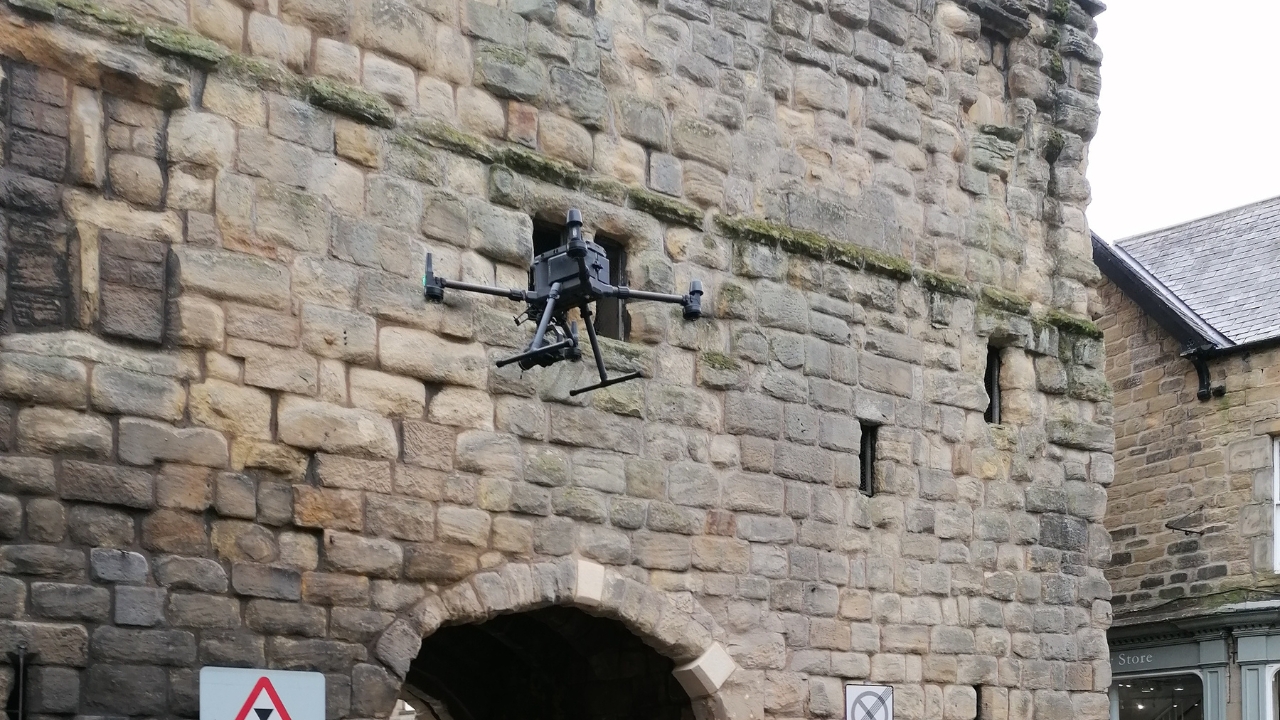
Step 3 - Processing: The data was then uploaded into data processing software, Context Capture, from Bentley, to create a crisp 3D model.
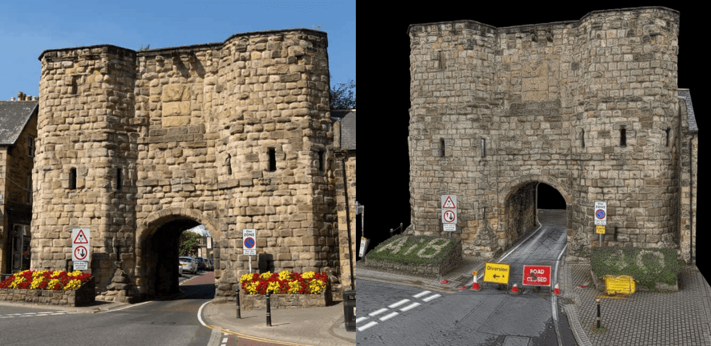
Step 4 - Sharing: The data was then uploaded to Nira and transferred to The Northumberland Estates for analysis, such as measuring parts of the structure...

...and up-close inspection for condition management.
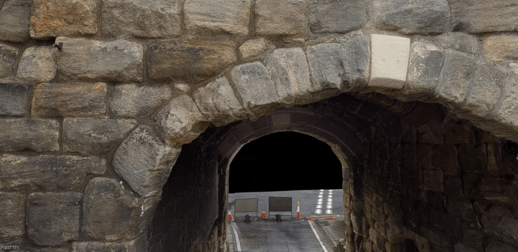
The dataset can be viewed in Nira here. Please note that the performance and download speed may vary based on your device/internet connection.
Public Safety/Search and Rescue
In some cases, the drone data workflow lends itself more to real-time observation, rather than post-capture observation/analysis.
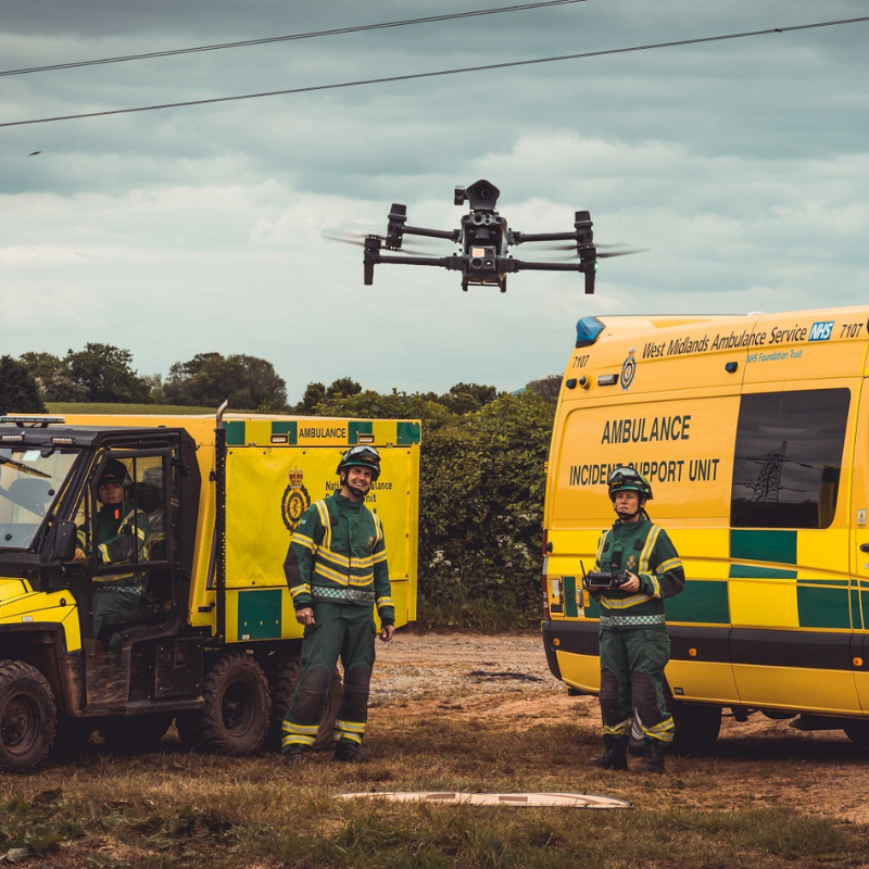
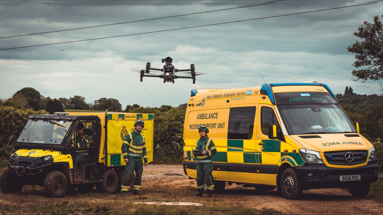
For instance, West Midlands Ambulance Service Hazardous Area Response Team's drone footage of a fire was streamed directly to incident commanders in real-time to shape data-driven decision-making. Read the full story here.
What Data Is Collected By Drones?
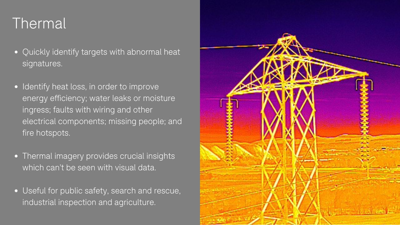
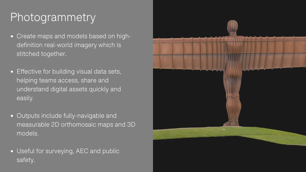
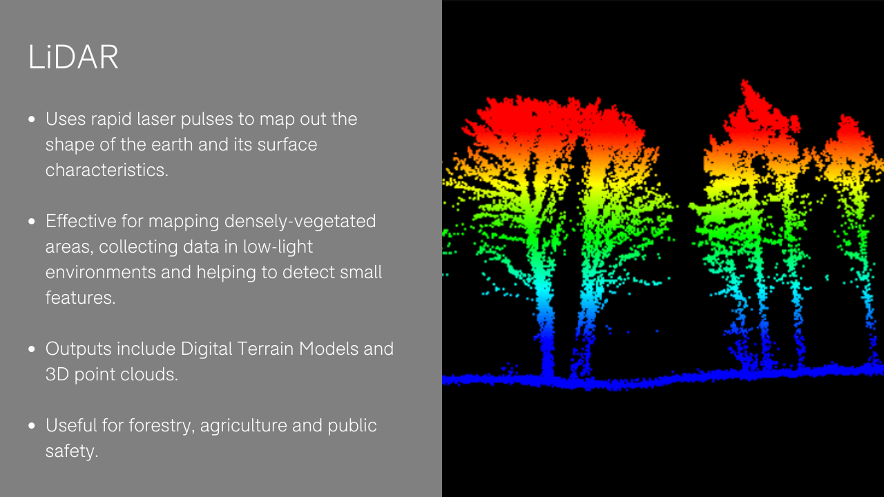
Drones can carry different sensors to enable operators to collect a range of data - such as visual, LiDAR, photogrammetry and thermal - depending on the job at hand. Types of drone data includes:



Best Data Capture Drones
Once you know what data you want to collect, picking the best drone and sensor is crucial.
Below is a table showing some of the best drones and payloads for specific data capture. Heliguy can assist drone programmes is selecting the best drone for their specific data capture needs.
Data Capture | Drone & Payload Solution |
Visual | • DJI M300 RTK + H20 Series • DJI M30 Series • DJI Mavic 2 Enterprise Advanced • DJI Mavic 3 • DJI Inspire 2 + X7 • DJI Phantom 4 Pro V2.0 • DJI Mini 3 Pro |
Thermal | • DJI M300 RTK + H20T • DJI M30T • DJI Mavic 2 Enterprise Advanced |
Night Vision | |
Photogrammetry | |
LiDAR | |
Gas Detection | |
Multispectral |
heliguy™ also supplies a range of fixed-wing drones for longer-range data capture. heliguy™ also has a drone rental fleet.
Best Drone Date Capture Software
Drone data processing software can be a vital component in the drone data workflow.
Drone data software - such as surveying software - processes and stitches the drone data together to create datasets (ie maps and models) which can be used for calculations, measurements and to offer other vital insights
Some of the best drone data software includes:
Software | Description |
Mission planning, data capture and analysis and visualise your environment: An industry-leading mapping software for the DJI surveying ecosystem developed to help industry professionals transform real-world scenarios into digital assets. Different licences available. Data can also be uploaded to Terrasolid for further analyis. | |
Industry standard software for pint clouds and image progessing, developed for the demanding requirements of geospatial, engineering, operations and environmental professionals. Can be used in conjunction with DJI Terra. | |
DroneDeploy: Drone mapping software tool, featuring real-time mapping, autonomous flights and a 360° virtual walkthrough mode. | |
Professional drone mapping and phtogrammetry software. Vast ecosystem, such as Pix4Dmapper (for professional drone mapping); Pix4Dsurvey (bridging the gap between photogrammetry and CAD); and Pix4Dmatic (for large-scale photogrammetry). Also, industry-specific applications, such as Pix4Dinspect (inspection), Pix4Dfields (crop analysis), Pix4Dreact (emergency response). | |
Stand-alone software product that performs photogrammetric processing of digital images and generates 3D spatial data. Different packages offer different data outputs, processing and analytical capabilities. | |
Software suite for GeoSLAM LiDAR scanners. GeoSLAM Connect creates clean, georeferenced point clouds automatically, while Draw is an optional add-on software, designed to further enhance points clouds. | |
Process and analyse radiometric thermal drone imagery collected using DJI Enterprise solutions (M30T, H20T, Mavic 2 Enterprise Advanced). Identify temperature information of specific/critical areas of a data set; ideal for detecting and pinpointing temperature abnormalities or fire hotspots. |
heliguy™ offers workflow support to enable organisations to integrate the above data software.
As part of this, the heliguy™ in-house surveying team has compiled dedicated online training for the DJI L1, to help surveyors maximise data collection with the payload and process data in DJI Terra and Terrasolid.
What Is Drone Data Analysis?
Drone data can be analysed to help teams derive crucial insights and make decisions based on up-to-date, real-time information. This in turn can increase ROI and enhance incident response. These insights can save money through real-time data-driven forecasts.
For instance, in construction, drone data can be turned into 3D models to conduct volume calculations or heights of stockpiles.
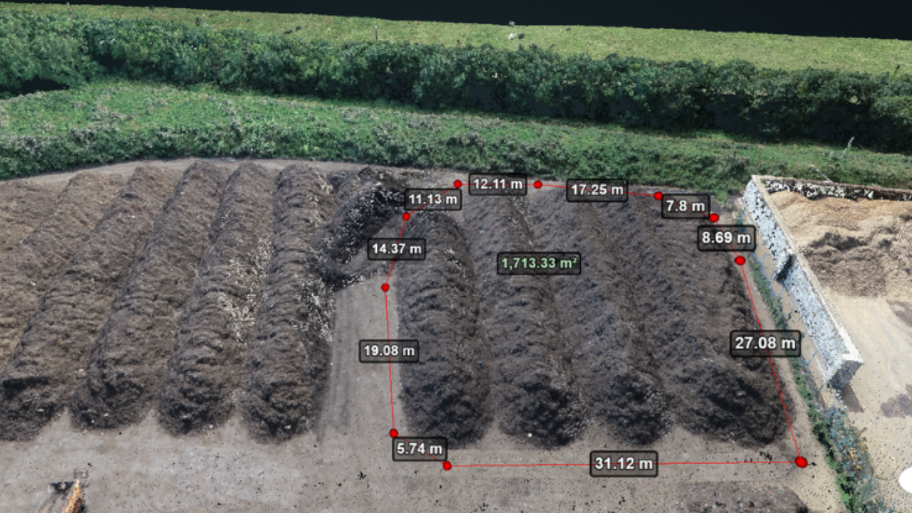
This helps site managers analyse how a stockpile has changed over time and work out how much material has been added and removed.
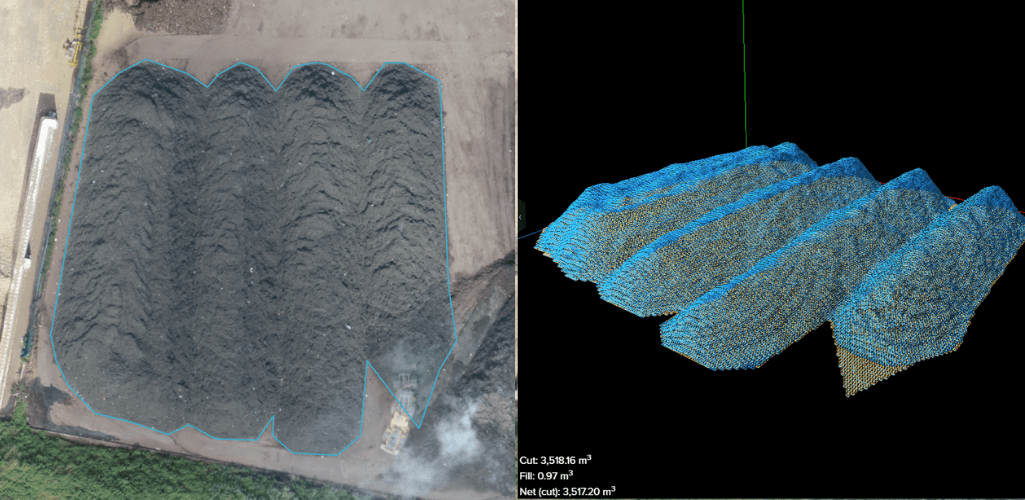
This information enables site managers to position material in suitable places, make informed decisions about how much material is required for purchase or extraction, and make detailed forecasts. Find out more in our Drones for Stockpile Measurements blog.
Drone data analysis also provides comparative information, such as tracking progress on a construction site. This is ideal for ensuring work stays on schedule - and within budget - and for the early identification of mistakes.
The below graphic, courtesy of Balfour Beatty, shows how drone footage helped track progress of the construction of the A45 Daventry development link road, in Northamptonshire.

Drone data can also be analysed before a project. For example, this image shows how Aureos uses drone photogrammetry data to obtain a deeper understanding of terrain, slopes, gradients and assets of an inspection area to help with pre-flight planning and operational requirements.

This information provides insights into potential project risks such as access routing issues, water management (runoff), and early identification of environmental constraints.
Drone Data Pitfalls
Data is powerful, and the above examples illustrate the benefits of using drones to collect it.
However, there are numerous pitfalls which can prevent organisations from utilising the data to full effect. These include:
Purchasing the wrong drone for the job. heliguy™ can assist in this process, providing consultancy, case study data, and drone hire to enable proof of concept.
More focus on flying or buying drones than on how to generate fit-for-purpose data that is integrated with existing systems.
Drone data not shared effectively with all stakeholders.
Siloed drone use in different areas of the company or project, resulting in data of varying standards and often in duplication of data capture.
These issues emerge when a company does not consider the entirety of the drone workflow before starting the implementation.
Indeed, it is vital that drone implementation is driven by a clear need and meets the precise end-user requirements.
After all, effective corporate implementation requires a disciplined focus throughout the process to capture quality data, process it into actionable information that exceeds current capabilities, share it across relevant stakeholders and integrate it seamlessly.
Drone Assistive Programme
The heliguy™ Drone Assistive Programme is a fully-managed, multifaceted drone training and support package.
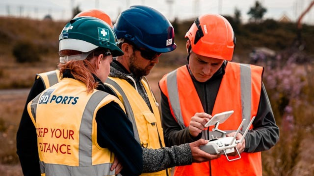
This hybrid model - which bridges capability gaps and features industry-specific classroom learning and on-site hands-on mentorship on real-world assets - helps organisations maximise their data collection and incorporate drone data into their workflows.
Click to find out more about the Drone Assistive Programme.
Drone Data Management Software
There are numerous software tools available to overcome some of the drone data pitfalls.
These platforms centralise and streamline drone data management, enabling better data sharing communication, and enhanced visibility and organisation to help teams make smarter decisions and deploy resources more effectively.
Some of the best drone data management software solutions include:
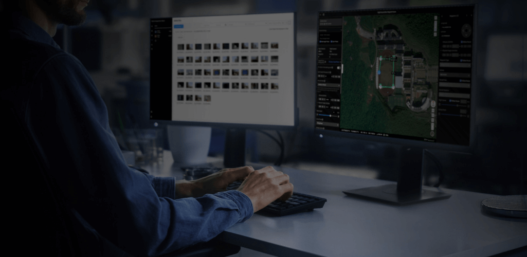
FlightHub 2
DJI FlightHub 2 is an all-in-one cloud-based drone operations management platform providing comprehensive, real-time situational awareness. Access all the information you need to plan drone missions, supervise your fleet, and manage the data you create from a secure cloud-based environment.
Read about the top features of DJI FlightHub 2.
Esri Site Scan
A cloud-based software for the AEC industry, Esri Site Scan provides a central hub to plan flights and manage drone fleets, automate data collection, process imagery and analyse data. Share reports, maps and 3D models via ArcGIS Online or ArcGIS Enterprise.
Find out how DJI drones and the Site Scan software improved workflows at a £7bn development in North London.
Remote Drone Data Collection
One of the most exciting prospects within the drone industry is the move towards remote drone data collection.
A drone in a box - such as the DJI Dock - is designed to enable persistent and round the clock data collection - as well as spontaneous data collection - with drones autonomously taking off and landing from a docking station, located on site, but centrally managed from afar.
As a DJI Dock partner, heliguy™ will work with organisations to help them adopt the DJI Dock, offering end-to-end support and consultancy - including integration plans and consultancy, and facilitating extended line of sight operations through an Operating Safety Case (OSC) consultancy, Level 5 UAS Operations Manager course, and dedicated training provision.
Drone Data: Summary
These days, data is everything, and drones have established themselves as an innovative tool to collect it - saving money, boosting efficiencies and improving safety in the process.
Selecting the right drone and payload for the task is crucial, but effective aerial data collection goes beyond this.
A thorough workflow is required to ensure capture is the best it can be and that the subsequent datasets are analysed properly and put in front of the right people.
It is vital that this complements and improves existing procedures, instead of disrupting them.
Get this right and drones will benefit each specific use case - from driving ROI to saving lives.
Contact heliguy™ for full end-to-end support to help you start or scale your drone programme.
