News
New extended drone no-fly zone in place from today
New legislation to extend the no-fly zone around airports has come into force today, meaning it is now illegal to fly a drone within 5km of an airport ... Read More
New legislation to extend the no-fly zone around airports has come into force today (Wednesday, March 13).
The rules mean that it is now illegal to fly a drone within 5km of an airport, with major penalties for those who break the law.
Drone users can only fly within the restriction zones if they have the correct permission from air traffic control or the airport.
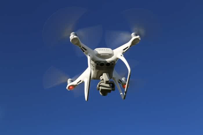
The Government has acted to bring the law change in ahead of a new Drones Bill which will give police significantly increased powers to deal with those using drones illegally.
From November 30, 2019, it will be a legal requirement for all owners of drones weighing 250 grams or more to register their drone with the Civil Aviation Authority (CAA) and complete an online safety test. Drone pilots who fail to register and sit the tests will face fines of up to £1,000.
Penalties for breaking the law on misusing drones range from fines to life imprisonment if the device is intentionally used to cause violence.
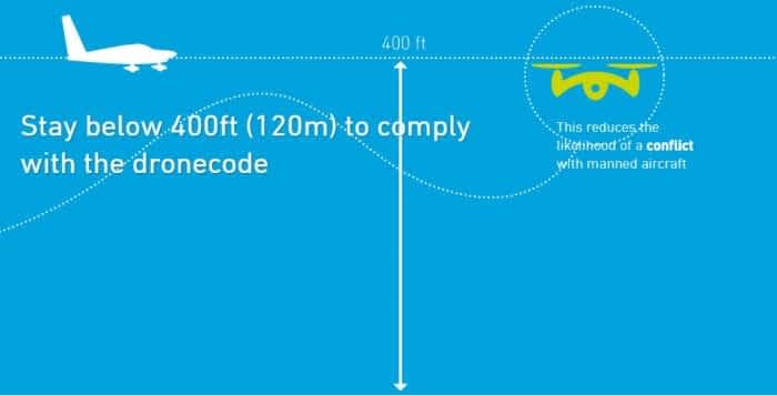
All drone users should be aware that flying a drone within 5km of an airport or over 400ft is a serious criminal act, one which could put lives at risk and risks penalties ranging from significant fines to a life sentence.
Transport Secretary Chris Grayling
Next Wednesday, the Aviation Minister Liz Sugg will meet global leading drone manufacturers to discuss how to tackle criminal drone use. They are expected to discuss a range of topics, including counter-drone technology.
The Government is set to discuss counter-drone technology, as it looks at ways to protect national infrastructure
The Home Office is also reviewing the UK’s approach to countering the malicious use of drones, and will consider how best to protect the full range of the UK’s critical national infrastructure – including testing and evaluating technology to counter drones.
Flight Restrictions Around Aerodromes In More Detail
Flights of drones around airfields or airports that are designated as ‘protected aerodromes’ are tightly restricted. Unmanned aircraft of any kind must not be flown within the Flight Restriction Zone (FRZ) of a protected aerodrome, without appropriate permission.
The Flight Restriction Zone consists of the following three elements:
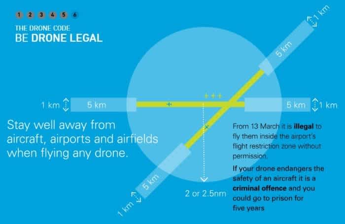
The Aerodrome Traffic Zone (ATZ): A 2 or 2.5 nautical mile radius ‘cylinder’ around the aerodrome, extending 2,000ft above ground level, centred on the longest runway.
Runway Protection Zones: A rectangle extending 5Km from the threshold of the runway away from the aerodrome, along the extended runway centreline, and 500m either side - also to a height of 2,000ft above ground level.
Additional Zones: In the case where the 1Km boundary of an aerodrome extends beyond the ATZ, and so would not be protected by it, the flight restriction zone will include a ‘bump’ (the airfield boundary + 1Km) to protect this part of the aerodrome.
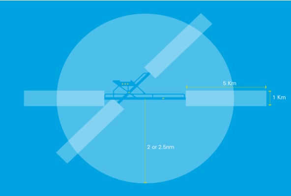
The exact shape of the Flight Restriction Zone varies depending on the specific aerodrome that it protects. Prior to flight, remote pilots should check to ensure that they are operating well outside these areas. For more details, click here.
The list of protected aerodromes also includes heliports, these only comprise the ATZ portion of the FRZ (and additional zones where applicable), i.e. do not include runway protection zones.
In the case of a protected aerodrome without an ATZ, the FRZ includes an ATZ shaped FRZ, with a 2nm radius (regardless of the runway length).
Permission must be obtained from the relevant person before a small drone may fly within a FRZ. This person is usually whoever is ‘in the Tower’ (i.e. an Air Traffic Controller or Airfield Flight Information Service Officer). If neither of these are available, because the airfield has closed or there was no ATC/AFIS provision in the first place, then permission must be sought from the Aerodrome Operator.
Heliguy Helping With Drone Detection At Airports
The no-fly zone extension – from 1km to 5km – follows the disruption at Gatwick – allegedly caused by a UAV – in December. The incident thrust the issue of defending against drone attacks into the spotlight.
Heliguy is an expert in drone detection, specialising in DJI’s AeroScope solution.
Heliguy's Guide to Drone Detection.advgbbtn-08dbc0df-7b65-4fe3-a447-6eb15ff6755f { font-size: 18px; color: #fff; background-color: #0232a0; padding: 6px 12px 6px 12px; border-width: 1px; border-color: #0232a0; border-radius: 50px; border-style: solid; } .advgbbtn-08dbc0df-7b65-4fe3-a447-6eb15ff6755f:hover { color: #fff; background-color: #2196f3; box-shadow: 3px 3px 1px 0px #ccc; transition: all 0.2s ease; }
Following the Gatwick incident, Heliguy has been a key drone-detection partner, installing and testing AeroScope at a number of major UK airports as well as putting the sites’ existing defence systems through their paces.
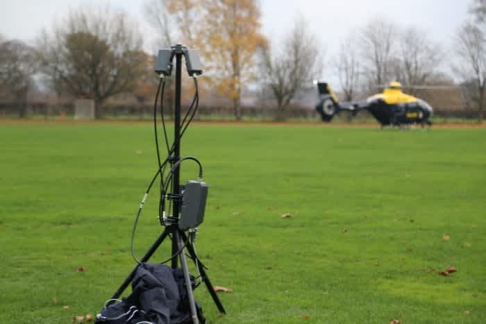
A DJI AeroScope system.
Heliguy is an expert in drone detection, specialising in DJI's AeroScope solution. We have installed this system at a number of major UK airports
Two versions of AeroScope are available, either portable or stationary, meaning the defence can be used not just to cover static locations, but also as a portable tool when additional control over airspace is needed.
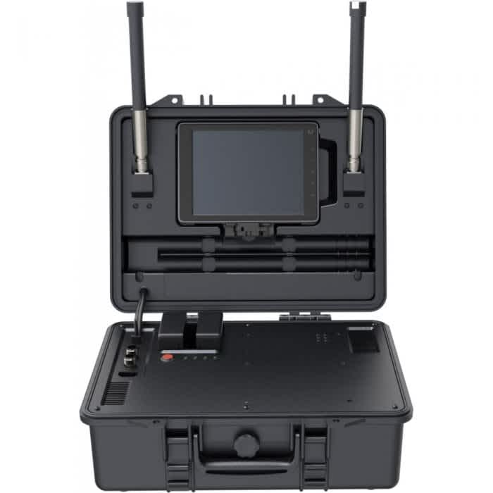
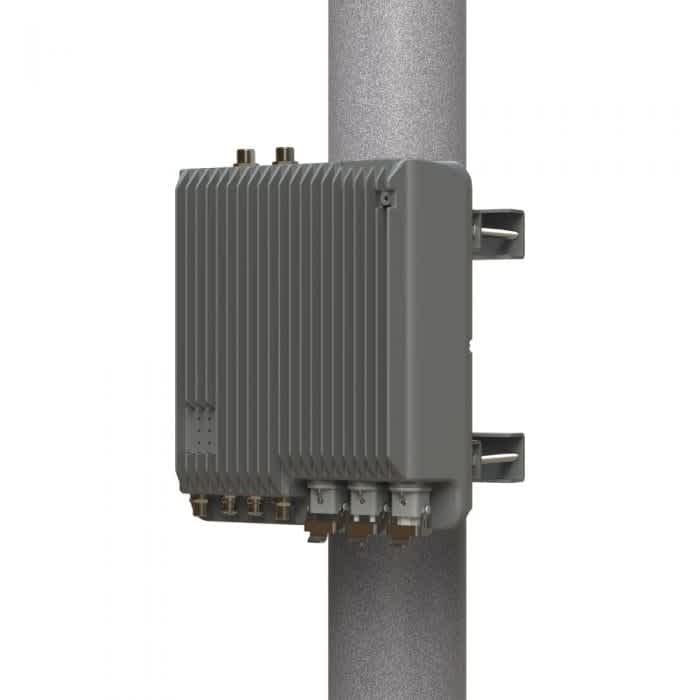
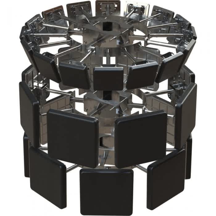
The DJI AeroScope system is a sophisticated and comprehensive platform that rapidly identifies UAV communication links, gathering real-time information such as flight status, paths, serial number, speed, direction and home position, as well as the make and model of the drone.
Inquire About AeroScope.advgbbtn-08dbc0df-7b65-4fe3-a447-6eb15ff6755f { font-size: 18px; color: #fff; background-color: #0232a0; padding: 6px 12px 6px 12px; border-width: 1px; border-color: #0232a0; border-radius: 50px; border-style: solid; } .advgbbtn-08dbc0df-7b65-4fe3-a447-6eb15ff6755f:hover { color: #fff; background-color: #2196f3; box-shadow: 3px 3px 1px 0px #ccc; transition: all 0.2s ease; }
This monitoring data stream helps AeroScope users make an informed response and security decision as soon as possible.
To take drone detection to the next level and to have a comprehensive and all-encompassing strategy, a layered solution is an extremely effective cause of action. We have an exclusive partnership with Operational Solutions (OSL) to offer an incredibly capable setup.
In partnership with OSL, Heliguy is offering a layered drone-detection solution, utilising the power of multiple systems
Harnessing the power of multiple systems – including DJI AeroScope – this integrated approach offers a complete detection package.

This integrated solution features AeroScope, working in tandem with the OSL Face interface – a one-stop-shop piece of visual software. This intelligent platform integrates all radars onto one map.
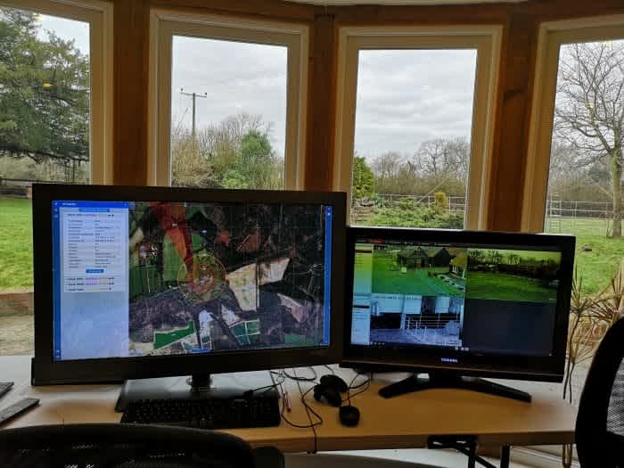
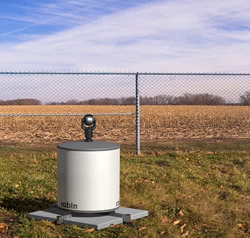
To take your drone defence even further, the advanced Robin ELVIRA can be integrated into this layered solution and is the final piece in the jigsaw. ELVIRA is a purpose-built drone detection and tracking tool, combining smart software with affordable radar, offering a large coverage area.
Inquire About A Layered Drone-detection Solution.advgbbtn-08dbc0df-7b65-4fe3-a447-6eb15ff6755f { font-size: 18px; color: #fff; background-color: #0232a0; padding: 6px 12px 6px 12px; border-width: 1px; border-color: #0232a0; border-radius: 50px; border-style: solid; } .advgbbtn-08dbc0df-7b65-4fe3-a447-6eb15ff6755f:hover { color: #fff; background-color: #2196f3; box-shadow: 3px 3px 1px 0px #ccc; transition: all 0.2s ease; }
Clamping Down On Drone Misuse
Aviation Minister Liz Sugg said that the majority of people using drones want to do so responsibly, so the Government has expanded a national campaign to ensure they know the rules – and the penalties.
Liz Sugg
Aviation Minister
Flying drones illegally puts others at risk both in the air and on the ground, so it’s vital they are used safely. The new Drones Bill, which is currently being drafted, will give new powers to the police to clamp down on those misusing drones and other small unmanned aircraft - including the power to access electronic data stored on a drone with a warrant. It will also include stop and search powers for drone users near aerodromes.
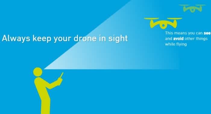
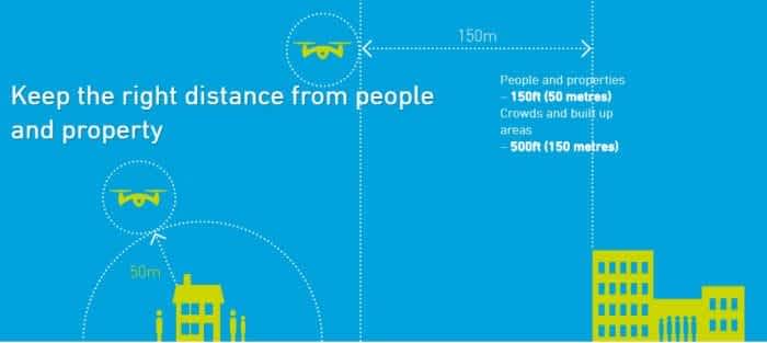
The CAA’s Dronecode provides advice on how to fly your drone safely and follow the rules at all times. This includes:
