News
Why Use SLAM For Surveying?
In-depth guide to SLAM, including its advantages for surveying, the difference between visual and LiDAR SLAM, and how it can be used for different applications. heliguy™ has partnered with GeoSLAM to offer the ZEB Horizon, which can be moun ... Read More

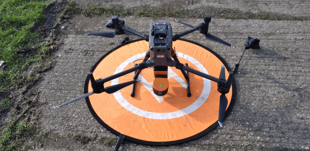
In-depth guide to SLAM, after heliguy™ partners with GeoSLAM to offer the ZEB Horizon LiDAR sensor, which can be handheld or mounted to drones such as the DJI M300 RTK;
SLAM is an innovative method of on-the-go mapping, building a map and providing locational data simultaneously;
SLAM does not require GPS. Other benefits include its mobility and versatility;
SLAM can be used for a range of applications, such as AEC, real estate, conservation, and public safety;
heliguy™ has partnered with GeoSLAM to add the innovative ZEB Horizon LiDAR sensor to our product portfolio.
It's a powerful surveying module which can be handheld or mounted to vehicles, such as drones like the DJI M300 RTK.
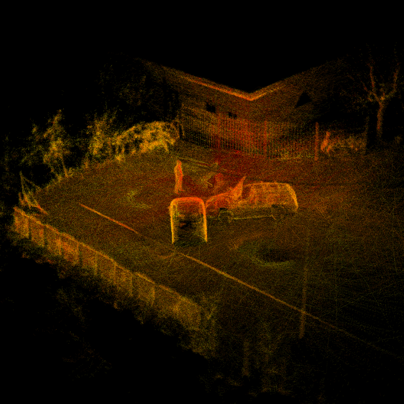
As the company's name suggests, its range of technology which includes the ZEB Horizon and other sensors, benefit from SLAM. And SLAM technology can be used to build quality models like this.
But what exactly is SLAM and how does it help mapping and surveying applications?
Find out in this in-depth guide to SLAM.
What Is SLAM?
SLAM stands for Simultaneous Localisation and Mapping.
It is the process of computing the position of a device or robot, while building a map of the environment simultaneously.
This process enables surveyors to map an unknown environment as they go, making mobile mapping possible.
As such, SLAM simplifies data collection - removing the dependency on multiple static set-ups of bulky tripod-based systems - and can be used outdoors, indoors, from the skies and underground.
How Does SLAM Work?
SLAM solves two problems:
Localisation: Estimating the location, answering the question of where.
Mapping: Building a map, answering the question of what the environment looks like.
As we've mentioned, SLAM tackles these two challenges simultaneously - providing positional data at the same time as construction a map.
But how? After all, typically a map is needed to estimate a position, while a good positional estimate is required to build a map. It makes for a chicken and egg situation.
SLAM overcomes this through a combination of sensors and algorithms.
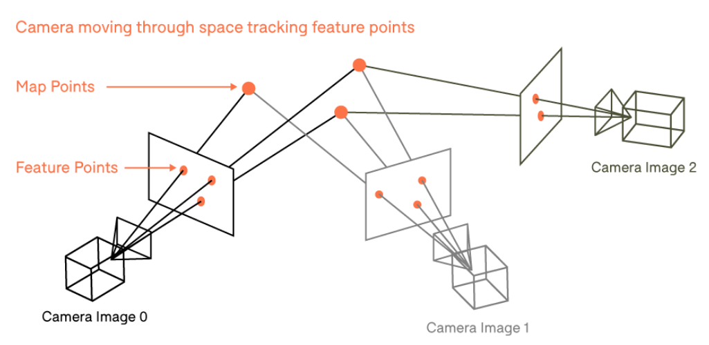
Sensors on a SLAM device can use visual data (or non-visible data sources) as well as basic positional data via an inertial measurement unit. The device computes an initial estimate of where it is, as well as building up a rough map.
As the device moves around its environment, it makes new and improved positional estimates, which in turn updates the map. This process is repeated, tracking the device's path, while adding more and more layers to create a highly-detailed map.
What Are The Benefits Of SLAM?
There are multiple benefits of deploying SLAM:
No GPS Requirement
One of the principle advantages is that SLAM does not require GPS. This unlocks the potential to survey previously troublesome GPS-denied environments, such as underground mines, urban areas with high-rise buildings and forests, where tree canopies can be a hindrance for signal.
Mobile
SLAM systems are mobile and facilitate on-the-go mapping, capturing huge swathes of data on the move.
Simply walk - or fly - through an environment to build a map: No longer do you need to worry about time-consuming set up, being confined to a dedicated position or needing to constantly reposition hardware like total stations or other traditional equipment.
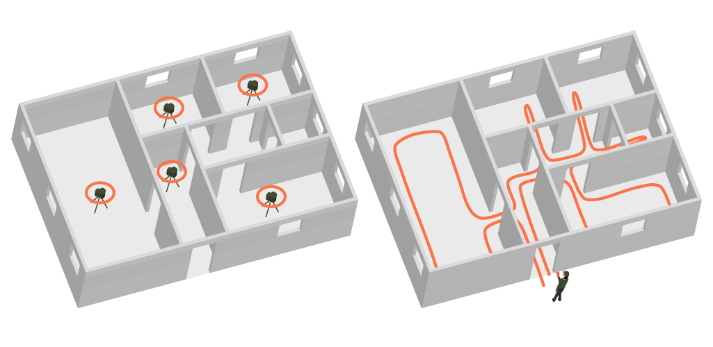
As such, data capture using SLAM mobile mapping can be more than 10 times quicker than traditional methods, slashing survey times and costs and fueling fast, comprehensive documentation - especially useful in large or complex environments.
This opens large opportunities, helping professionals build fast and accurate 3D models.
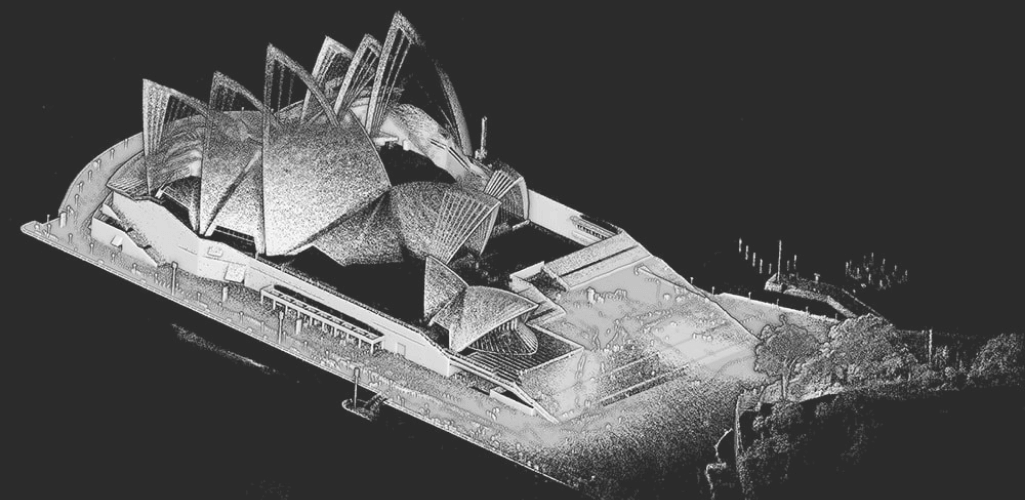
These can help with:
Fast, weekly progress monitoring of construction sites;
Real-time surveys of residential, commercial and industrial facilities;
Comprehensive site surveys of existing structures to be refurbished, remodelled or extended.
Versatile
Not only is SLAM mobile, but it is incredibly versatile, available in different formats.
For instance, GeoSLAM's ZEB Horizon unit can be handheld, or can be mounted to drones, cars and poles - opening up a wider surveying environment.
Visual SLAM Vs LiDAR SLAM
There are many different types of SLAM algorithms and approaches to SLAM, but two of the key ones are Visual SLAM and LiDAR SLAM.
So, what's the difference?
Visual SLAM
Visual SLAM uses images acquired from cameras or other visual sensors. In other words, it maps the environment and distinguishes its location by using only visual inputs from a camera.
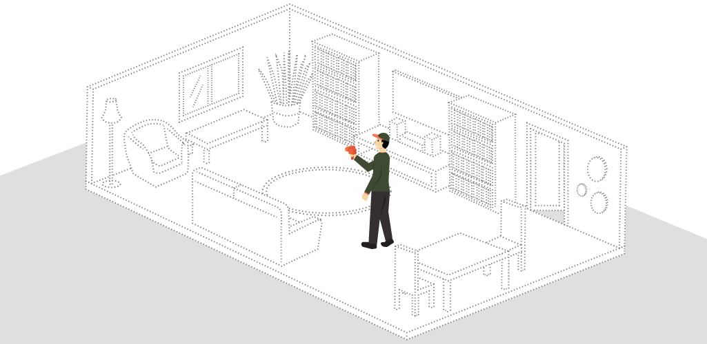
It typically tracks points of interest to triangulate the 3D position of the camera: Information which is then used to build a 3D map.
LiDAR SLAM
LiDAR SLAM uses a laser sensor to build a map of its environment. LiDAR stands for Light Detection and Ranging and works by sending pulses of light to a feature and measuring the time it takes for them to reflect back. This in turn indicates the exact distance of the object or feature.
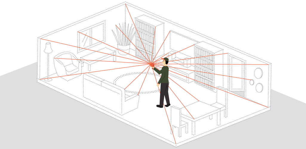
The output values from laser sensors are generally 2D (x, y) or 3D (x, y, z) point cloud data. The laser sensor point cloud provides high-precision distance measurements, and works very effectively for map construction with SLAM.
LiDAR is both a fast and accurate approach and can be used in a wide range of environments and conditions.
Not all LiDAR SLAM data contains RGB colour values. For instance, when using the ZEB Horizon, models will instead be coloured by factors such as intensity and elevation. However, an RGB camera can be added to the scanner to provide RGB data. Also, GeoSLAM's ground-based systems, such as ZEB Cam, can be RGB colourised.
Visual Vs LiDAR SLAM - Which Is Best?
Visual and LiDAR SLAM are powerful and versatile technologies, but each has its advantages for specific applications.
LiDAR SLAM is ideal for creating extremely accurate 3D maps of an underground mine, inside a building or from a drone. On the other side of the coin, Visual SLAM is preferential for computer vision (AR) or unmanned robots.
SLAM - Applications
SLAM can be utilised by a range of applications. These include:
Mining and Quarries: High-accuracy mapping of underground mines and quarries and detailing inventory of stockpiles.
Surveying And Real Estate: Fast scanning to create inventory data bases, floorplans and DTMs (Digital Terrain Models).
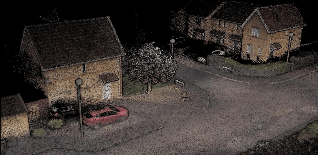
Facilities and Asset Management: Condition reports, modelling and asset identification.
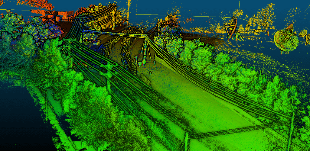
AEC: BIM (Building Information Modelling), buildings under construction and as built.
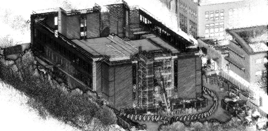
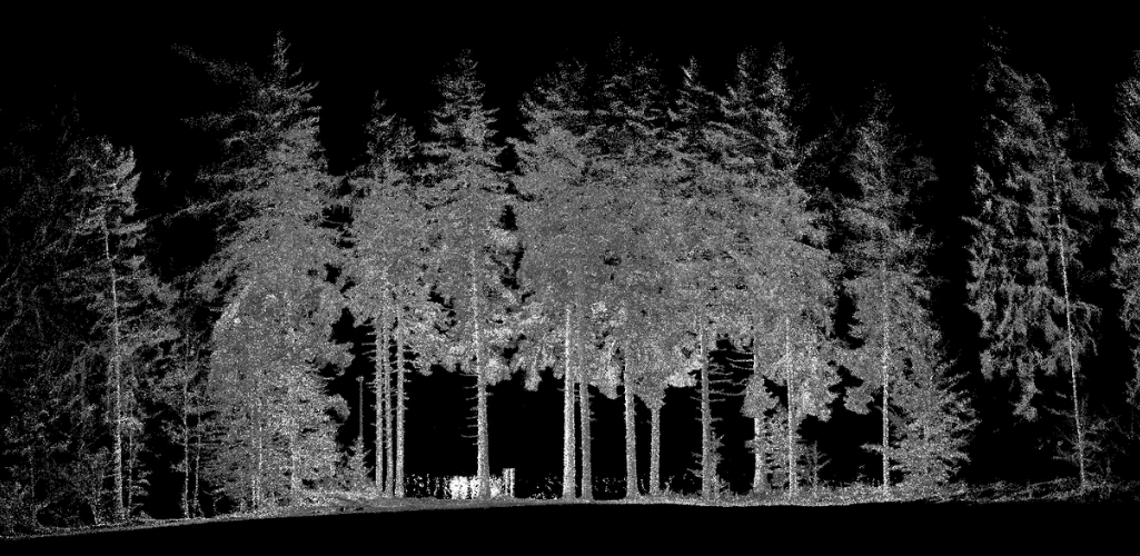
Conservation: Forestry management and inventory, historical buildings for preservation and condition management.
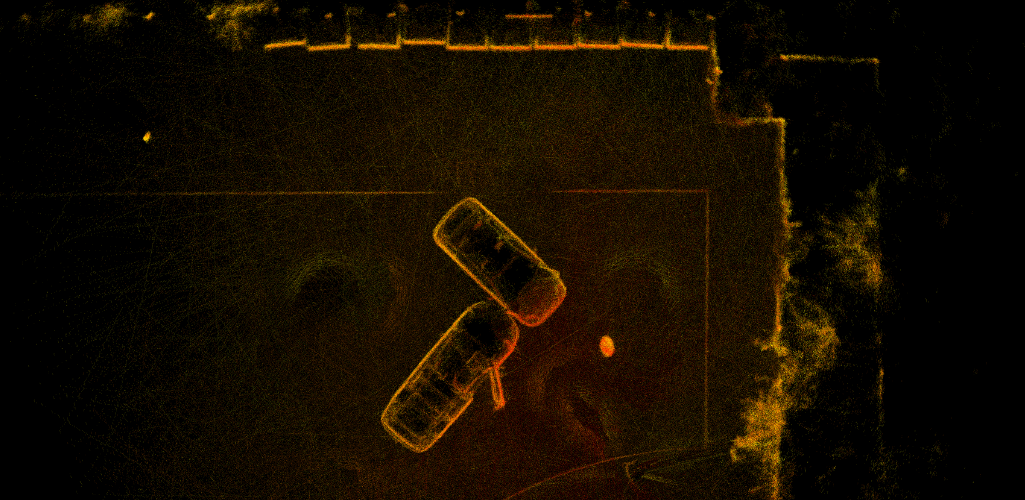
Security, Public Safety and Forensic: Pre-active planning, emergency response, forensics and accident reconstruction. Knowing the layout of a building helps to reduce first responder times by up to 25% and is critical in keeping crews safe.
A Guide To SLAM: Summary
SLAM is an extremely useful for building detailed maps and models on the go. Indeed, its mobility and versatility make it a very attractive proposition.
Recognising its advantage to surveyors, heliguy™ has partnered with GeoSLAM to add its innovative technology to our portfolio. The ZEB Horizon - which utilises LiDAR slam - can be used as a handheld device, or mounted onto DJI drones, such as the M300 RTK.
Contact us our in-house GIS specialists to discuss adding GeoSLAM technology to your fleet.
