Improving the BIM Workflow with Drones

Improving the BIM Workflow with Drones

Learn more about BIM (Building Information Modelling) methodology and how drones are set to disrupt the traditional methods of data acquisition.

Last updated: Dec 09, 2021

8 minute read

The construction industry has been one of the most vocal supporters of the drone market as it has moved from hobbyist pastime to viable enterprise solution. It’s not hard to see why, the whole process of putting a structure together, from planning to subsequent checks, can be benefitted by having access to a bank of aerial imagery and data. This article looks at one of the most interesting collaborations between construction companies and drones, BIM (Building Information Modelling), a crucial information management system that oversees projects from inception to completion. Read on to find out more about BIM itself and how unmanned aircraft are changing construction workflows.  

BIM Explained

If you are involved in construction, the acronym BIM will already be familiar to you. For the uninitiated, it is a process of managing information gathered throughout a construction project. This is to be collated into a common format, from feasibility planning through initial design, onto construction, operation and, if necessary, demolition. This uniformity ensures that those involved in the project are able to efficiently use and interpret all available information. The BIM process is made up of three elements:
  • Consistent labelling and naming of all documents and collected data: This is crucial for finding relevant data throughout the lifespan of the project, ensuring all those involved in the workflow are following the same procedure.
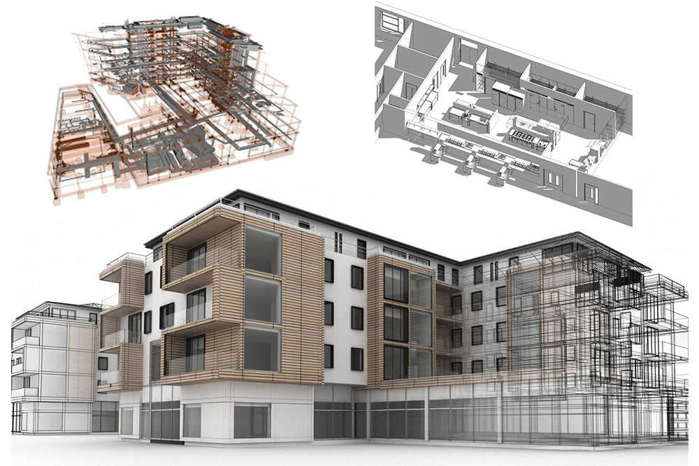
  • A process in place for storing and extrapolating information: This involves the use of 3D representations of the structure in fit-for-purpose modelling software. Fundamentally, the BIM process offers a shared representation and spatial database for recording the location and attributes of every part of the project.
  • A method for exchanging or issuing information (e.g. construction, operation, performance and maintenance): This part works exactly how it sounds, involving the exchange of drawings, documents and data. When using BIM, this process is streamlined as the information is generated directly from the Business Information Model, rather than numerous separately prepared documents that could lead to confusion and costly mistakes.
An effective use of BIM methodology increases project efficiency and reduces the number of errors. Using the data gathered during initial stages, 3D models are built before any work begins on-site. All the essential attributes of the structure are included in this visualisation and any potential spatial issues can be spotted and ratified in the model before construction as opposed to becoming a problem further into the project.  

BIM Maturity Levels

BIM isn’t a catchall system, there are different levels of implementation which are known as ‘Maturity Levels’. Here is the outline for each of these levels to give you more of an idea of the scope covered by the BIM method:
  • Level 1: A project team using 2D CAD drafting with paper-based or electronic print information and data exchange are considered to be operating at Level 1.
  • Level 2: When using a mixture of 2D or 3D CAD supported by a common data environment for the sharing of drawings and data with a standardised structure and format, you’ve reached Level 2. However, collaboration is limited amongst the various project teams with each controlling and disseminating its own information.
  • Level 3: Collaborating across all disciplines with all teams using 3D CAD models that are integrated but not shared as a priority. Design info is shared via a common file format such as IFC or COBie to keep everyone on the same page throughout the project.
  • Level 4: The peak of BIM operation, Level 4 is a fully collaborative workforce sharing all information across all disciplines using a single, shared project model which is stored centrally and is accessible by all the stakeholders to allow for essential modifications and data sharing.
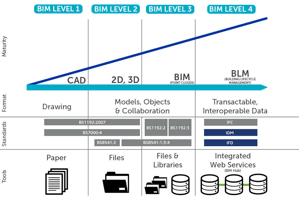
An example of the importance of these Maturity Levels has been playing out since 2011 in the UK. Finalised in 2016, the government developed and rolled out a mandate to enforce the use of BIM Level 2 in all major public sector construction projects moving forwards. This displays confidence in the methodology and a commitment to streamlining workflows during major infrastructure projects which is a win-win situation for both the construction companies and the governmental departments providing the funding.  

Drones & BIM

As has been the case with a growing number of industries over the past couple of years, those in the construction sector have been quick to embrace the potential of drones. So, it’s no surprise to see an increasing number of companies employing unmanned aircraft to support their BIM methodology. Proving themselves to be an asset for this type of data-driven approach, drones can undertake the following tasks to aid the BIM workflow:
  • Site inspections and land surveying before construction begins
  • Point cloud scanning to aid Building Information Modelling
  • Aerial photography at different stages of construction for marketing campaigns
  • Monitoring site activity to ensure an accurate, issue free workflow
  • Conducting structural inspections to ensure safety procedures are in place
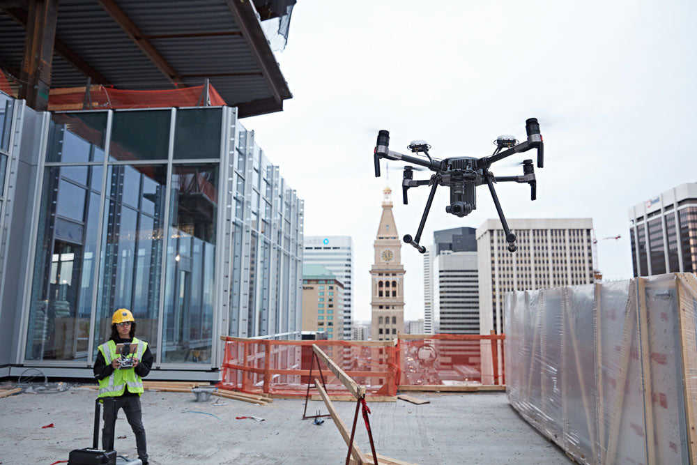
Before construction begins, as architects and planners are making their initial designs, land survey information is crucial. Drones offer a precise, rapid solution to gathering a comprehensive overview of the site, identifying challenges before they become issues further into the project. They also have an advantage over traditional point cloud methods which can sometimes overlook uneven topography due to obstructions. This isn’t an issue with an aerial perspective which makes for more consistency and data density for use in the creation of the initial BIM showing how the structure will look after construction. Once it’s time to start building the structure it’s imperative to make sure that each stage is properly documented and photographed. This is obviously limited when you’re only using feet-on-the-ground team members to capture images which won’t make for the most thorough of reports. The addition of drones to this process gives construction companies the ability to capture a selection of high-quality aerial imagery and video footage to support their documentation. Also, the addition of light detecting sensors mounted to a drone can offer real-time point cloud data for the accurate creation and updating of BIMs which you can feed into a number of Autodesk programmes including BIM, Inventor, AutoCAD and Revit. With this centralised trove of information, project engineers and external stakeholders can pull up any data they need as and when they require it. The usefulness of drones doesn’t come to an end once the project has been completed as there are plenty of checks and evaluations to take place to ensure that it’s structurally sound. This can take the form of aerial photography to make sure that everything has been put together properly as well as offering the potential of thermal imagery surveys to ascertain the energy efficiency through identification of hot and cold regions. Throughout the entire process, drones can also keep people who are off-site up to date with progress via live streams enabling inspections by trained engineers to be carried out from remote locations, in some cases even allowing them control of the camera while an on-site pilot manoeuvres the drone.  

Which Drones are Suitable for BIM Modelling?

While, if properly customised, a large range of aircraft could be set to work on a construction site. However, speaking from experience and contact with numerous clients, we believe the following drones are best placed to carry out the range of data gathering activities need to successfully meet the requirements laid on in the BIM methodology.

The DJI Inspire 1
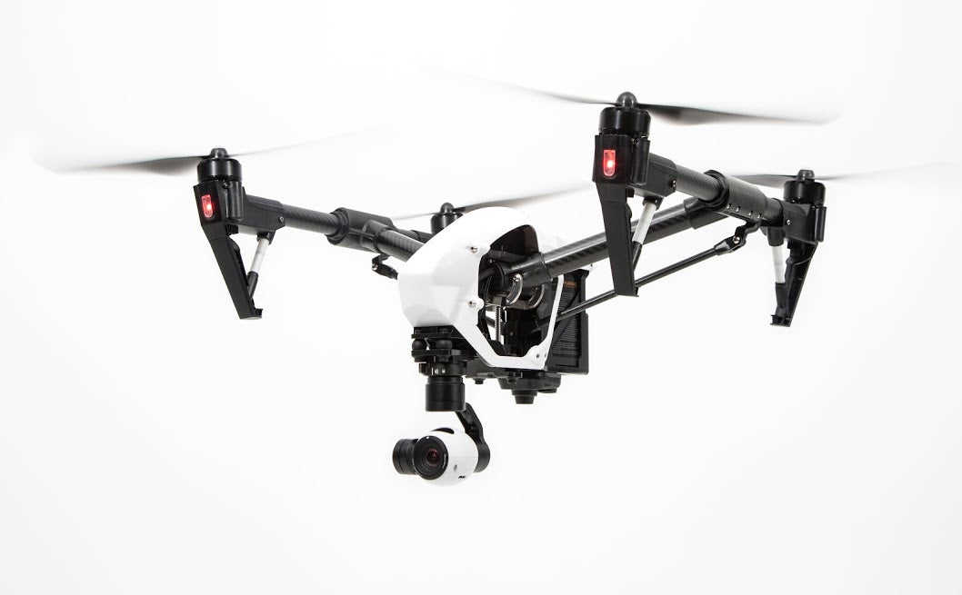
DJI’s original workhorse. There’s a reason these versatile aircraft proved so popular with professional operators and it’s mainly down to the wide range of compatible cameras which include the ever-growing X5 series and DJI’s thermal sensor the Zenmuse XT. Couple this with a robust design, depth of functionality and ease of use and you’ve got yourself one highly sought after bit of kit. LEARN MORE HERE

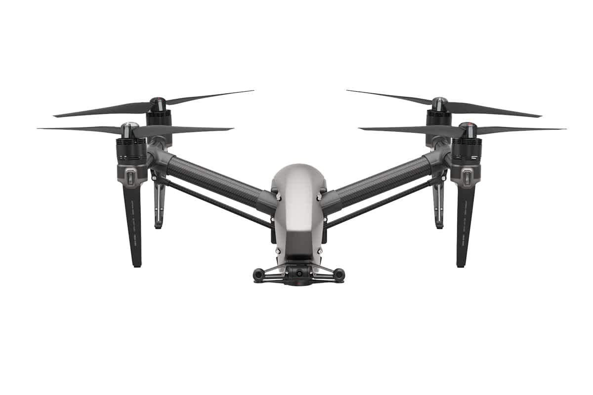
The DJI Inspire 2

An upgraded follow-up to DJI’s hugely successful Inspire 1 quadcopter, the Inspire 2 was created based on user suggestions received throughout its predecessor’s lifespan. Inspire 2 While it’s primarily geared towards professional filmmakers, the Inspire 2’s access to the Zenmuse X4S and X5S cameras make it the perfect tool for capturing high-quality imagery and footage to help create effective BIM data. The aircraft itself has been upgraded while retaining all the features that made the original so popular. LEARN MORE HERE

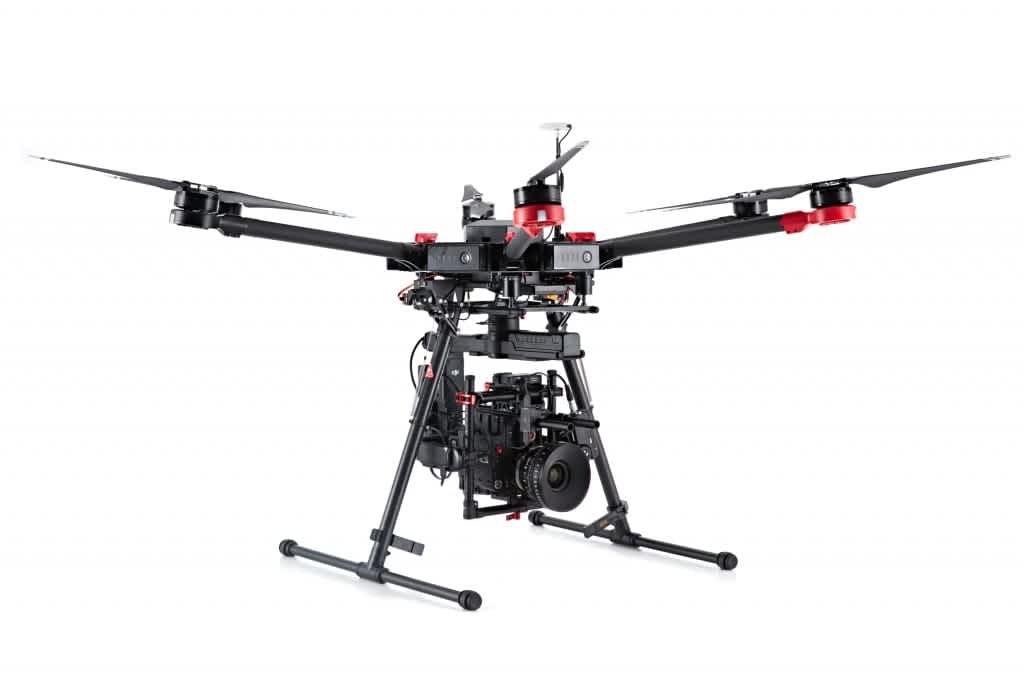
The DJI Matrice 600 & M600 Pro

DJI’s Matrice 600 (and it’s ready-built successor the M600 Pro) sets the standard for heavy-lift drones. Designed for use by both industrial professionals and filmmakers, the M600 is compatible with DJI’s Ronin-MX gimbal allowing for a huge variety of camera configurations. A hexacopter with the ability to carry heavier payloads that the other models on this list, if you’re looking for an all round industrial-grade solution to aerial imagery, you can’t go wrong with the Matrice 600. On top of this, there’s the M600’s multi-battery redundancy meaning it’s not only great to fly on-site, but also very safe. LEARN MORE HERE

The DJI Matrice 200 Series

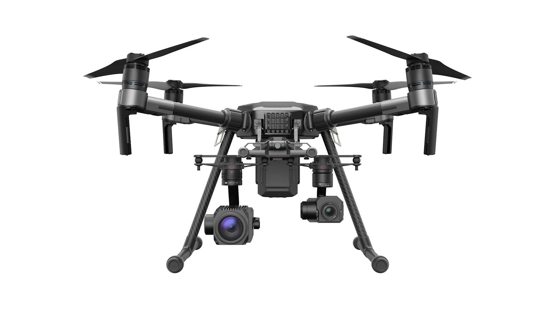
The DJI Matrice 200 series displays the Shenzhen manufacturer’s commitment to entering the commercial market as a serious contender. With three models available (200, 210 & 210 RTK) you’re able to decide which best suits your needs. Matrice 200 Dual Payload If you opt for the 210 or 210 RTK you’ll be able the dual mount cameras (e.g. a Z30 zoom and XT thermal capturing data simultaneously) or alternatively top-mount a camera for activities such as bridge inspections. The top tier product (the 210 RTK) also comes with Real Time Kinematic GPS positioning for up-to-centimetre accuracy. This also has the added benefit of protecting the aircraft from strong RF / EMF interference such as power lines, radio towers. LEARN MORE HERE

Get in Touch

If you would like to find out more about how drones can be a real asset on-site with construction companies, you can get in touch with our team by calling 0191 296 1024 or emailing info@heliguy.com.  

Keep checking back to Heliguy’s Insider Blog for more insights into the commercial applications of unmanned aircraft and, of course, the latest news from the drone industry.

Leave a comment

Please note, comments must be approved before they are published

If you have a question or require urgent assistance, please contact us to ensure your query is dealt with quickly.

Please note, this hidden field is to prevent bot submissions and entering data will result in your comment being discarded without moderation.