Technical
How Different Focal Lengths Impact Drone Mapping
Explore how different focal lengths affect drone mapping accuracy and find the perfect lens for your surveying needs with heliguy™.
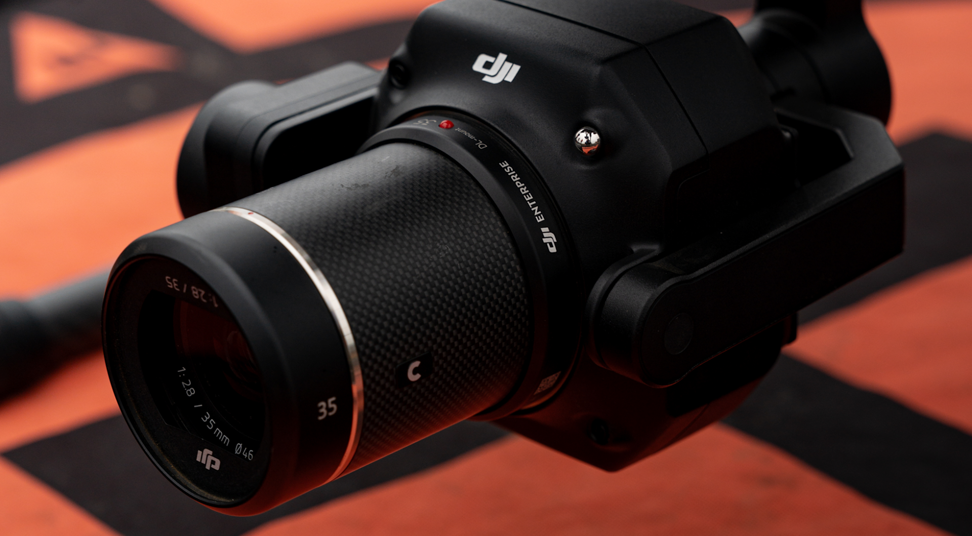
heliguy™ conducted a comprehensive survey with DJI M350 RTK with P1 Photogrammetry camera to ascertain the optimal lens choice for various surveying applications.
In-depth look at the exclusive data heliguy™ gathered.
Discover the most suitable lens for your survey requirements.
Exclusive datasets collected by heliguy™'s in-house geospatial team and processed using DJI Terra demonstrate the impact of different focal lengths on drone photogrammetry.
We flew the DJI M350 RTK and DJI Zenmuse P1 payload at one of our test sites in the North East of England to show how switching between its range of lenses impacts data quality and mission efficiency.
The 45MP full-frame sensor can be deployed with 24mm, 35mm, or 50mm lenses - we tested all three.

Overview
The data shows that the 24mm lens was the most efficient option, but the data collected with the 50mm lens was the most detailed and achieved the best GSD (Ground Sampling Distance).
Meaning that when it comes to focal lengths, there is a trade-off between efficiency and quality, and which is most important depends on your specific surveying needs.
Keep reading this blog to view the full results and to see sample datasets. Find out why different focal lengths impact speed/accuracy; and which option is best for you.
Flight Parameters
For consistency, we repeated the same mission with each lens.
The flight parameters were:
Flight Altitude: 50m
Data Collection Type: Nadir
Flight Overlap: 70 Side / 80 Forward Leap
24mm vs 35mm vs 50mm: The Results
Speed
The bullet points below show the length of time it took to conduct the mission with each lens.
24mm: 1.22 minutes
35mm: 4.28 minutes
50mm: 7.35 minutes
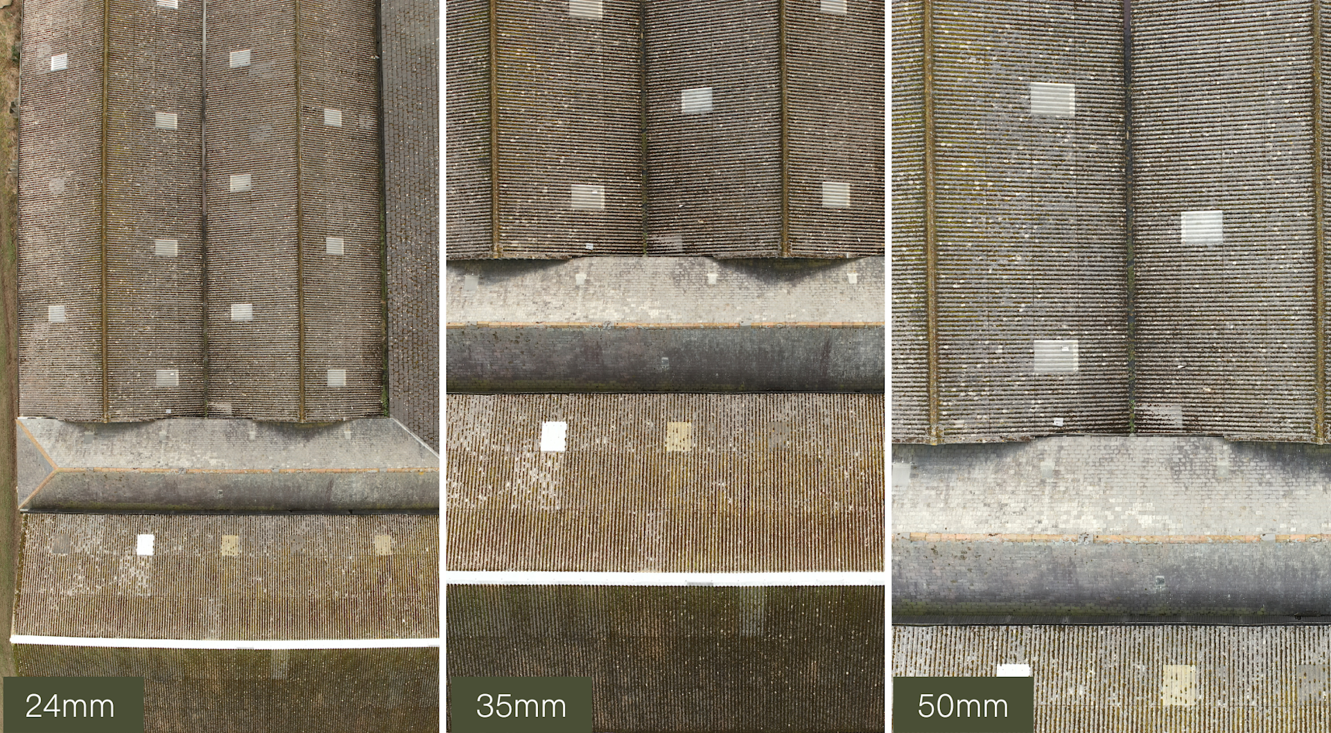
Surveying with the 24mm lens proved to be the most efficient, thanks to its expansive field of view, enabling it to capture more of the surrounding area in a single shot - evidenced in the image below.

This is further demonstrated by the number of images taken during the flight.
24mm: 56
35mm: 122
50mm: 186
Data Quality
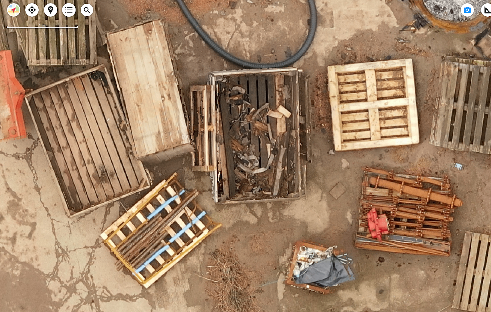
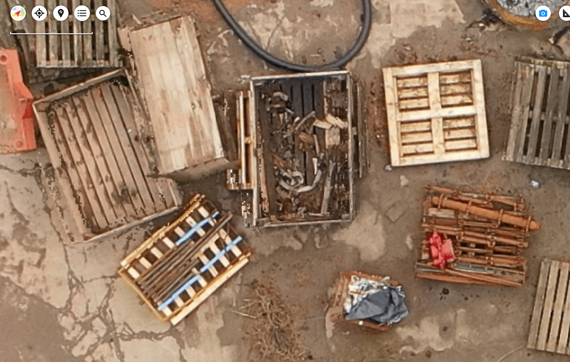
The series of images below demonstrate the difference in data quality between the 24mm and 50mm lenses. We chose to focus on these two to best evidence the contrast of the lenses' capability to hone in on details.
For instance, when zooming in on the datasets, look at the enhanced detail and clarity that the 50mm lens offers...

...compared to the 24mm lens.

The improved quality with the 50mm lens is due to its narrower field of view which provides higher detail of specific features due to less distortion and compression.
Data Accuracy
The image below clearly shows how the three different lens types compare in data accuracy - and by extension, quality. Each lens was focused on zooming in on the GCP, allowing us to see their zooming abilities and the level of pixilation produced by each.

As shown above, the 50mm lens was most capable of zooming in the closest without as much pixilation and blur as the other two lenses, and the centre point of the GCP is more visible with the 50mm lens.
Since the 50mm lens captures a sharper image of the GCP, it optimises the measurement accuracy when processing the survey data.
Ground Sampling Distance
Ground Sample Distance (GSD) impacts the accuracy of drone photogrammetry surveys.
GSD is defined as the length (in inches, centimetres, or millimetres) between the centres of two consecutive pixels on your map.
In a nutshell, the better the GSD, the more accurate is the data. You can find out more by reading our guide to GSD for drone surveying.
Our test flights demonstrated that, from 50m flight altitude, the 50mm lens yielded the best levels of GSD.
24mm: 0.932 cm/px
35mm: 0.6222 cm/px
50mm: 0.443 cm/px
The 50mm lens achieved the best GSD because its narrower field of view meant the camera captured a smaller area in each image frame.
It therefore collected more detail of the ground within the smaller area, resulting in higher resolution imagery. This meant that each pixel in the image represented a smaller area on the ground, leading to a better Ground Sampling Distance.
Surveyors are able to collect data with the same GSD with the 24mm lens, but would need to fly lower, extending the flight time.
Matthew Sharples, Geospatial Specialist at heliguy™ said:
As evidenced by the data, lower Ground Sampling Distance values correspond to higher data accuracy and facilitate easier Ground Control Point marking.
Data Processing
The choice of lens impacted the data processing time - with the 24mm lens taking the shortest amount of time because of the reduced number of images and less detail in each.
The table below demonstrates the time it took to process the data through DJI Terra with each lens.
24mm | 35mm | 50mm | |
Number Of Images | 56 | 122 | 186 |
2D Reconstruction | 9 min 43s | 22 mins 15s | 32 min 29s |
3D Reconstruction | 24 min 32 sec | 54 min 46s | 1 hr 17 min 39s |
Total Consumption Time | 34 min 15s | 1 hr 17 min 1s | 1 hr 50 min 8s |
For context, each dataset was processed on the same computer, with the following specs.
CPU: Intel 12th Gen Intel(R) Core(TM) i7-12700H 20 cores
GPU Count: 1GPU 0: NVIDIA GeForce RTX 3060 Laptop GPU
RAM: 32452 M
Data processing times will vary depending on the quality of the computer hardware.
Which Lens Meets Your Survey Requirements?
Ultimately, which lens is best for you depends on where, what and why you are surveying your chosen area.
As such, the choice of lens should be based on the specific requirements of the surveying task. For example, for mapping large areas quickly, a wide-angle lens like the 24mm may be preferred.
For detailed inspection or monitoring of specific features, in applications such as construction monitoring or infrastructure inspection, a longer focal length lens like the 50mm may be more suitable.
In many cases, the go-to lens is the 35mm - as it reaches that middle ground between efficiency and data quality.
Richard Dunlop, Head of Geospatial at heliguy™ said:
Irrespective of the chosen lens, it's crucial to prioritise a fixed focal length to maintain sharp imagery and prevent distortion.
Summary
In summary, the choice between a 24mm, 35mm, or 50mm lens for drone surveying depends on factors such as the size of the area to be surveyed, the level of detail required, the presence of obstacles, and the specific objectives of the surveying task.
The heliguy™ in-house geospatial department can help you start and scale your drone surveying programme through consultancy, proof of concept, industry-specific training, and data processing. To find out more, contact us.
