Sold Out
DeltaQuad Pro #Cargo

DeltaQuad Pro #Cargo

£10,349.00 Regular price
/
Tax included in UK  & Free Delivery
Notify Me When Available

What's in the Box

Take a look

Updated on variant change.

Explore what's inside the box.

heliguy™ Repair Refresh

Free Repair or Replacement

Protect against accidental damage.

Need advice on this product?

Ask a Question

Our experts are on hand to help you.

Full Description

DeltaQuad Pro CARGO VTOL Drone

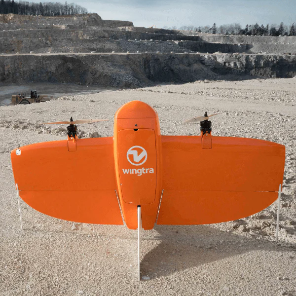
The DeltaQuad Pro #CARGO is an industrial-grade Vertical Takeoff and Land (VTOL) fixed-wing drone engineered for cargo transport and customisation.

Missions can be conducted autonomously with this fully-electric vehicle, which can be easily controlled from a tablet or laptop and can take-off and land just about anywhere.

The DeltaQuad Pro #CARGO provides a large payload bay and will fly well, with or without a payload, and does not require re-balancing.

The aircraft is made from a rugged EPO material, making it resistant to impact, safe to use and easy to customise.

Key Features Of The DeltaQuad #CARGO

The DeltaQuad Pro #CARGO is a powerful fixed-wing solution, packed with smart features and technology. Its key features include:

  • Fully autonomous from takeoff to landing
  • Covering up to 100km in a single flight with a 1.2kg payload
  • Covering up to 150km in a single flight with an Auxiliary LiPo
  • Terrain following mission planning
  • Both radio and 3G/LTE connectivity option
  • Capable of missions beyond telemetry range
  • Tool-less 1 minute field assembly
  • No pre-flight calibrations required
  • DSPS Advanced safety system
  • DeltaQuad Simulator
  • Online mission validation & log analysis tools


Controlling The DeltaQuad Pro #CARGO

The DeltaQuad Pro #CARGO is available can be deployed via the following Transmission and Control systems:

DeltaQuad Controller

The DeltaQuad Controller is an easy-to-use hand-held remote control solution that can stream HD video over long distances.

  • Control range up to 30km via radio & unlimited range via LTE.
  • Instantly monitor mapping data through a live video feed.
  • Live dual camera switching for enhanced safety and situational awareness.
  • Instant switching between Radio and LTE communications.
  • Touch-screen mission planning and flight control.
  • Autonomous control or manual joystick control.
  • Encrypted 2.4Ghz ISM band, worldwide license-free operation.
  • CE, FCC certified & IP67 all-weather operation.
  • Command and Control sharing on remote devices via WiFi or LTE.

20KM 900Mhz Digital Data Link with 10″ Android GCS

The omnidirectional 900Mhz digital radio offers up to 20km telemetry range.

The package includes a 10-inch Android tablet for pilot operation.

Please note that the system does not stream live video.


Payload Drop Mechanism

The DeltaQuad Pro can be integrated with a payload dropping mechanism.

This device enables dropping payloads, with parachute if required, on a target that was planned in the mission, or instructed from the ground control station.

The Payload Drop Mechanism sits inside the payload bay and is equipped with two payload doors that will open when scheduled.

The payload bay inner dimensions allow for packages up to 15 x 10 x 9 cm and support payloads up to 1kg.

Key Features Of DeltaQuad Pro VTOL Drones

Commercial-grade Fixed Wing platform packed with smart technology

The DeltaQuad Pro is the most powerful VTOL (Vertical Takeoff and Landing) drone on the market.

This commercial-grade platform is packed with smart technology to maximise commercial drone operations, providing high efficiency, accurate data collection and incredible endurance.

Key features include:

High Endurance

Up to 150km of airtime using the Auxiliary Battery option, or up to 100km with a 1.2kg payload. Depending on the weight of payload, the DeltaQuad Pro can fly for almost two hours.

Wide Payload Compatibility

Compatible with a range of quality, mission-specific payloads, such as the 61MP Sony A7R mark IV for aerial surveying or the Micasense Altum for agriculture.

Fully Autonomous

Conduct fully-autonomous missions, even beyond communication range.

Long-range Communication

Up to 50KM radio and video range or even unlimited range using VPN-secured mobile networks.

1.2KG Payload Capacity

The DeltaQuad can carry payloads up to 1.2KG, ranging from thermal sensors to high-resolution cameras and multi-spectral imaging.

Weather Resilient

The DeltaQuad Pro is a hardy and resilient aircraft. Smart technology gives the platform the unique ability to safely fly in rain and snow.

Rapid Field Assembly

The DeltaQuad Pro is shipped in an easy-to-handle box and the aircraft can be assembled in the field in under two minutes.

European Manufacturing

The DeltaQuad Pro is manufactured in The Netherlands. Its combination of flight autonomy, high endurance and vast payload capacity make it a reliable and effective commercial fixed-wing solution.

DeltaQuad Pro #MAP

Powerful fixed-wing VTOL for long range mapping missions

A powerful, long-range fixed-wing drone for mapping, surveying and inspection which can carry a 61MP camera and obtain CM-level accuracy geo-referencing for detailed maps and models.

The DeltaQuad Pro #MAP can cover 1200HA in one flight, be integrated with RGB, multispectral and thermal/infrared sensors, and has a live video connection with the drone.

DeltaQuad Pro #VIEW

Powerful fixed-wing VTOL for long range mapping missions

Engineered to enable effective and persistent surveillance and reconnaissance strategies, with long endurance, thermal/IR night vision and autonomous object following and tracking.

It can be integrated with a 80x zoom RGB controllable turret gimbal, and benefits from live HD video up to 50 KM.

DeltaQuad Pro #CARGO

Powerful fixed-wing VTOL for long range mapping missions

Industrial-grade VTOL UAV for cargo transport and custom payloads. Covers up to 150km in a single flight, is fully autonomous and easy to control.

Customisation is possible and a payload drop mechanism can be integrated. Operators also benefit from live FPV video.

DeltaQuad Pro: Industry Applications

Versatile VTOL drone for multiple commercial uses

Agriculture

The DeltaQuad Pro #MAP provides actionable intelligence for agriculture using high-quality camera sensors.

It can be integrated with a 61 MP camera to create highly-detailed orthomosaic maps and 3D models. These can be used to monitor growth and expectant yield, identify problems without damaging healthy crops, and manage irrigation and minimise soil erosion.

The DeltaQuad Pro can also carry Micasense RedEdge or Altum payloads to monitor plant health or the Agrowing’s A7RivQuad sensor for high resolution multispectral & RGB mapping.

With the DeltaQuad Pro #MAP, survey up to 1200Ha at 3cm per pixel in a single flight.

Infrastructure

The DeltaQuad Pro can survey up to 100km of railways or roads in a single flight, and monitor remote sites up to 50km distance, using high-resolution thermal and RGB video.

It does this fully-autonomously and can fly predefined corridors with automatic terrain following.

The DeltaQuad Pro can be used to inspect overhead contact lines, identify road damage, monitor vegetation encroachment, and measure frost heave, snow and ice-related problems.

Geospatial - Aerial Surveying

Collect high-resolution geospatial data, with sub-CM-level accuracy, with the DeltaQuad Pro #MAP. The DeltaQuad Pro #MAP is ideal for autonomous large-area surveys.

Perform mapping with up to 61MP cameras to build highly-detailed orthomosaic maps, 3D point clouds and Digital Surface Models (DSMs). This data can be used to calculate volumes for 3D models, produce accurate land measurements in unreachable areas, and process contour lines and elevations profiles.

The Emlid Reach PPK solution - integrated with the DeltaQuad Pro #MAP - attaches seamlessly to your camera’s hot-shoe for exact geo-referencing of imagery.

Security & Defence

The DeltaQuad Pro #VIEW provides live thermal and HD RGB video for aerial reconnaissance.

Security teams benefit from 50km encrypted video and telemetry link, or unlimited range VPN-secured mobile connectivity.

The DeltaQuad Pro #VIEW is the only VTOL UAV to provide automatic object following and provides up to two hours of flight time for persistent surveillance.

Meanwhile, the DeltaQuad Pro #MAP can be used for large-area surveying: Useful for charting unknown territory with highly-accurate 3D maps, obtaining strategic advantage with up-to-date situational awareness, and inspecting the landscape for mines and threats.

Oil & Gas

Deploy the DeltaQuad Pro #MAP to survey up to 100km of pipeline and monitor remote sites at up to 50km distance, using high-resolution thermal and RGB video.

The drone can conduct fully-autonomous missions and can fly predefined corridors with automatic terrain following.

With its high endurance and top-class payload array, the DeltaQuad Pro can be used to detect pipeline defects, leaks and corrosion; monitor remote, offshore or isolated sites; and identify potential hazards to underground pipelines.

The DeltaQuad Pro #MAP can also provide high-resolution imagery and CM-level accuracy geo-referencing to produce highly-accurate orthomosaic maps, 3D models and Digital Surface Models.

These digital assets can be used to plan and prepare trench digging or construction sites; monitor and report on pipe laying progress; map road access conditions and access construction costs; and prepare and optimise rig or platform moves.

Utilities

Deploy the DeltaQuad Pro #MAP to survey up to 100km of pipeline and monitor remote sites at up to 50km distance, using high-resolution thermal and RGB video.

The drone can conduct fully-autonomous missions and can fly predefined corridors with automatic terrain following.

With its high endurance and top-class payload array, the DeltaQuad Pro can be used to detect pipeline defects, leaks and corrosion; monitor remote, offshore or isolated sites; and identify potential hazards to underground pipelines.

The DeltaQuad Pro #MAP can also provide high-resolution imagery and CM-level accuracy geo-referencing to produce highly-accurate orthomosaic maps, 3D models and Digital Surface Models.

These digital assets can be used to plan and prepare trench digging or construction sites; monitor and report on pipe laying progress; map road access conditions and access construction costs; and prepare and optimise rig or platform moves.

Mining & Construction

The DeltaQuad Pro #MAP delivers CM-level-accurate high-resolution GIS data.

Integrated with up to 61MP high-resolution cameras, the DeltaQuad Pro can help build quality 2D maps and 3D models, specifically suited to mining and construction.

These digital assets can be used to calculate volumes of stockpiles; chart, plot and plan new mining or construction sites; process contour lines and elevations profiles; and to create 3D models of quarries to extract break lines.

The DeltaQuad Pro’s high-endurance makes it ideal for large-area surveying and collecting data in hard-to-access or dangerous on-site locations - particularly useful for the mining industry.

DeltaQuad Pro Fixed Wing Drone Training

Where you can fly the DeltaQuad Pro in the UK

Operators of the DeltaQuad Pro can fly in the Open Category’s A3 subcategory and/or the Specific Category, under an Operational Authorisation as part of the GVC Drone Training Course. Read our in-depth blog for more information on UK Drone Laws.

The table below provides a breakdown of what is required ahead of deploying the DeltaQuad Pro in each operational category.


Operating Category Required Qualification
Open Category CAA Operator/Flyer ID; Remote Pilot has read the aircraft user manual; EC785/2004 compliant insurance (if commercial operation).
Specific Category CAA Operator/Flyer ID; Remote Pilot is qualified to either PfCO or GVC (Fixed-wing certificate); UAS Operator is in possession of a valid CAA Operational Authorisation inclusive of Fixed-wing authorisation; EC785/2004 compliant insurance (if commercial operation).

Training by Drone
heliguy™ Training Tools