Sold Out
DeltaQuad Pro #Map

DeltaQuad Pro #Map

£10,349.00 Regular price
/
Tax included in UK  & Free Delivery

What's in the Box

Take a look

Updated on variant change.

Explore what's inside the box.

heliguy™ Repair Refresh

Free Repair or Replacement

Protect against accidental damage.

Need advice on this product?

Ask a Question

Our experts are on hand to help you.

Full Description

DeltaQuad Pro Map Drone

The DeltaQuad Pro #MAP offers state-of-the-art features for easy and productive aerial mapping and can carry a 61MP surveying sensor.

This versatile VTOL aircraft can be integrated with RGB, thermal and multi-spectral payloads to build high-quality maps and models, benefiting a range of surveying missions, from geospatial data collection to agricultural insights.

The DeltaQuad Pro #MAP is a highly-efficient mapping solution, thanks to its flight time of up to 110 minutes. Operators can achieve sub < 1 cm high precision PPK and conduct automatic survey mission generation with terrain following.


Large-area Coverage

The DeltaQuad Pro #MAP is the only commercial-grade fixed-wing VTOL UAV that offers a 61MP full-frame mapping sensor, together with a flight time of up to 110 minutes, adding up to an unsurpassed coverage of up to 1200HA (3000AC) at 3cm per pixel in a single flight.

Long-range Transmission

Using the latest innovations in transmission technology, the DeltaQuad Pro #MAP can offer up to 50km video and control range from a hand-held remote controller. If available, a 4G/LTE network can enable unlimited range and provide redundancy.

Live Video Mapping

The DeltaQuad Pro #MAP equipped with the DeltaQuad Controller provides live video from the mapping camera. This enables you to assess the quality of your mapping data during the flight.


Rapid Deployment

The unique design of the DeltaQuad does not require any lengthy pre-flight calibrations. Combined with the 1 minute tool-less field assembly, this allows the DeltaQuad to be airborne in as little as 2 minutes.

Fully Autonomous

Fully-autonomous missions from takeoff to landing, even beyond communication range. This rugged aircraft can be safely flown in rain or snow.

High Precision

The DeltaQuad Pro #MAP can carry a 61MP surveying sensor, which can achieve sub-1cm precision in the horizontal and vertical directions.

Fixed-wing Mapping Drones - How They Compare

The DeltaQuad Pro #MAP is an industry-leading fixed-wing surveying solution. The table below shows how it compares to other fixed-wing aircraft.


DeltaQuad Pro #MAP WingtraOne Trinity F90+ Marlyn Ebee X
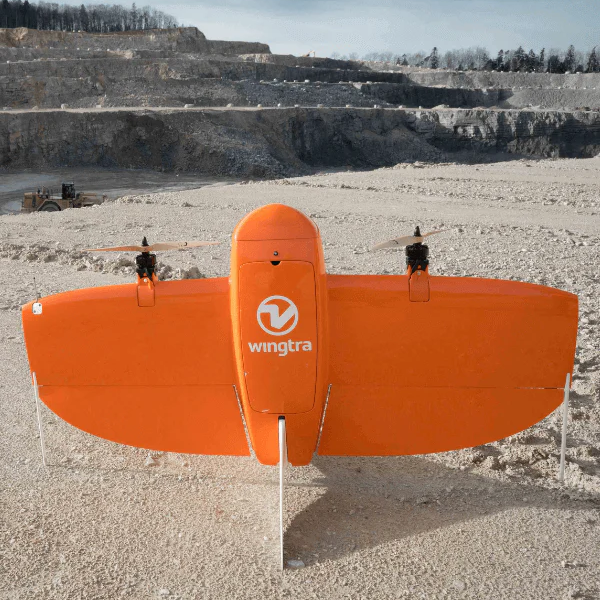
Max Flight Time 110 minutes 59 minutes 90 minutes 50 minutes 60/90 minutes
Coverage at 3cm/px 1200HA 450HA 800HA 360HA 220HA/500HA
Precision <1cm <1cm 2-5cm <1cm >3cm
Control Range 20km/30km/50km/Unlimited 10km 7km 7km/20km 8km
Max Resolution 61 MP 42 MP 42 MP 42 MP 24 MP
Live Video Yes No No No No
Swappable Payloads Yes Yes Yes No Yes

The DeltaQuad Pro #MAP is also the most cost-effective solution out of the ones mentioned above.

Mapping Payload Options

The DeltaQuad Pro platform is a versatile, high performance UAV solution. Using swappable payloads it allows you to configure multiple different set-ups for RGB, multispectral and thermal purposes.

Such a dynamic aircraft enables you to save on your investment by not having to buy multiple UAVs for each specific application.


Mapping With RGB Cameras

The DeltaQuad Pro #MAP is available with four RGB camera payloads, including the 61MP Song A7R mark IV.

These high-quality visual sensors enable you to collect data to build orthomosaics, 3D models, point clouds, Digital Surface Models and contours.

Sony A7R mark IV

The Sony A7R mark IV combined with the Sonnar T 35mm lens offers 61MP resolution, fast shutter speeds and a high dynamic range. The speed of this system allows for < 1 cm/pixel resolution and this makes it our recommended mapping sensor.

  • 61 MP
  • 35.9mm x 24.0mm
  • 35mm Focal Length
  • Up to 1200HA (3000ac) at 3cm/px

Sony A7R mark III


The Sony A7R mark III combined with the Sonnar T 35mm lens offers 42MP resolution, fast shutter speeds and a high-dynamic range. The speed of this system allows for < 1 cm/pixel resolution.

  • 42 MP
  • 35.9mm x 24.0mm
  • 35mm Focal Length
  • Up to 1000HA (2500ac) at 3cm/px

Sony RX1R mark II


The Sony Cybershot DSC-RX1R mark II camera is combined with the Carl Zeiss 35mm lens and offers a 42MP full-frame sensor.

  • 42 MP
  • 35.9mm x 24.0mm
  • 35mm Focal Length
  • Up to 1000HA (2500ac) at 3cm/px

Sony A6000

The Sony A6000 Sonar Lens 24MP sensor with 35mm lens provides an affordable, high-resolution mapping sensor.

  • 24 MP
  • APS-C (23.5mm x 15.6mm)
  • 35mm Focal Length
  • Up to 750HA (1800ac) at 3cm/px

The following table provides a comparison of the key features for each sensor package.

Sensor Sony A6000 Sony RX1R Mark II Sony A7R Mark III Sony A7R Mark IV
Megapixel 24 MP 42 MP 42MP 61MP
Resolution 6000 x 4000 7952 x 5304 7952 x 5304 9504 x 6336
Focal length 35 mm 35 mm 35 mm 35 mm
Sensor size 23.5mm x 15.6mm 35.9 x 24 mm 35.9 x 24 mm 35.7 x 23.8 mm
Maximum shutter speed 1/4000 sec 1/4000 sec 1/8000 sec 1/8000 sec
Image stabilisation No No Yes Yes
Environmentally sealed No No Yes Yes


Multispectral Sensors

The MicaSense solution is available as the RedEdge MX offering five bands, and as the Altum that includes the thermal band. The DeltaQuad Pro #MAP can also be integrated with the Agrowing A7R-IV QUAD - a high-resolution multispectral and RGB mapping sensor.

This camera array can be used to produce a range of outputs, such as Index Map (NDVI), Chlorophyll map, Digital Surface Models, Weeds 1/2 and RGB.

Micasense Altum PT

Best-in-class multispectral sensor with synchronized thermal. Built for both high-end research and assessing water stress and irrigation systems in production agriculture.

  • Blue, Green, Red, Red edge, and Near-infrared, LWIR.
  • Generates plant health indexes and RGB images from one flight.
  • Embedded GPS for direct geo-referencing.

Micasense Rededge MX

The Micasense Rededge MX is a professional multispectral sensor kit that captures five narrow spectral bands to analyse crop health.

  • Blue, Green, Red, Red edge, and Near-infrared.
  • Generates plant health indexes and RGB images from one flight.
  • Embedded GPS for direct geo-referencing.

Agrowing A7R-IV QUAD

The Agrowing A7R-IV QUAD is a high-resolution multispectral and RGB mapping sensor that comes with the Agrowing QUAD multispectral lens for 12MP multispectral imagery, and the 35mm Zeiss lens for 61MP RGB mapping.

  • 10 narrow bands of 20-30nm wide.
  • 12 megapixel per band or 61MP RGB.
  • Connect seamlessly with the PPK & Sub CM PPK referencing.


Thermal Sensors

Thermal sensors capture differences in radiant energy to show the relative temperature of objects (in comparison to one another).

Thermal imaging sensors are vital for showing defects, spotting faults, and detecting fire hotspots.

When combined with the Workswell WIRIS Pro thermal sensor, the DeltaQuad Pro #Map can be used for applications such as utilities inspection, irrigation, and covering wildfires.

Workswell WIRIS Pro

The Workswell WIRIS Pro is a specially-designed thermodiagnostic device. Its thermal camera is equipped with an LWIR microbolometric sensor with 640 x 512 px resolution (in the 7.5 – 13.5 μm range), and its Super Resolution Mode functionality can deliver a final thermogram in 1266 x 1010 px resolution.

  • 30hz or 9hz (depending on country)
  • Full HD RGB resolution
  • Optical zoom 10x in real-time
  • 640 x 512 Thermal (IR) video or interval images

Transmission System

Control your DeltaQuad #Map with one of two control and transmission systems.

DeltaQuad Controller

The DeltaQuad Controller is an easy-to-use hand-held remote control solution that can stream HD video over long distances.

  • Control range up to 30km via radio & unlimited range via LTE.
  • Instantly monitor mapping data through a live video feed.
  • Live dual camera switching for enhanced safety and situational awareness.
  • Instant switching between Radio and LTE communications.
  • Touch-screen mission planning and flight control.
  • Autonomous control or manual joystick control.
  • Encrypted 2.4Ghz ISM band, worldwide license-free operation.
  • CE, FCC certified & IP67 all-weather operation.
  • Command and Control sharing on remote devices via WiFi or LTE.

DeltaQuad Range Booster

A DeltaQuad booster package is also available and increases the operational range of the DeltaQuad Controller up to 50km. The package consists of an easy-to-remove panel antenna, an 8 Watt ground booster with powerbank, and a 3 Watt booster inside the UAV. The DeltaQuad Controller will also include the standard antennas for omnidirectional use up to 30KM


Android Ground Control Station

The omnidirectional 900Mhz digital radio offers up to 20km telemetry range. This includes a 10 inch Android tablet for pilot operation. This system does not stream live video.

  • 10.1 inch touch screen
  • Up to 6 hour connected battery life
  • 4G/LTE capable for live maps
  • Internal GPS receiver

PPK & RTK Solutions For Precise Positioning

The DeltaQuad Pro #Map can use PPK and RTK precise positioning solutions.

Differential GPS for centimetre or sub-centimetre level accuracy for your mapping data. The range of Emlid Reach PPK systems provides an easy-to-use solution for absolute accuracy in your mapping results. The base stations can also operate in RTK mode using NTRIP.

Emlid Reach RS2 PPK Kit

The Reach RS2 Post Processing Kinematics (PPK) kit offers both a ground and air unit to offer sub-centimetre level accuracy for your images.

  • Connects to 3.5G modem
  • GPS/QZSS L1C/A, L2C, GLONASS L1OF, L2OF, BeiDou B1I,
  • B2I, Galileo E1-B/C, E5b
  • 184 channel tracking L1/L2

Emlid Reach RS+ PPK Kit

The Reach RS+ Post Processing Kinematics (PPK) kit offers both a ground and air unit to offer centimetre level accuracy for your images.

  • Connects to 3.5G modem
  • GPS/QZSS L1C/A, L2C, GLONASS L1OF, L2OF, BeiDou B1I,
  • B2I, Galileo E1-B/C, E5b
  • 72 channel tracking

DeltaQuad Image Processing

Converting aerial data into actionable intelligence.

After gathering the data from your mapping UAV there are several options to convert this data into actionable intelligence.

Depending on your use case there are several soft-ware solutions with a range of unique features.

Vertical Technologies has partnered with Pix4D as a market-leader in image post-processing to provide the most elaborate tools for a variety of solutions. The images from your DeltaQuad Pro #MAP are geo-referenced in such a way that virtually every image post processing software can process them.

Surveying With The DeltaQuad Pro #MAP

A workflow for fixed-wing surveying with the DeltaQuad Map VTOL

The DeltaQuad Pro #MAP provides an end-to-end drone surveying solution.

The streamlined workflow is below:

1.

Tool-less Field Assembly

The UAV is assembled - on site - in 60 seconds, without the need for additional tools.

2.

On-site Mission Planning

Using the smart mission planning software on the integrated DeltaQuad Controller, missions can be planned on site, or in advance from the comfort of your own computer. Planning missions is easy with automatic terrain following, generated survey paths and smart mission plan validation.

3.

Swipe To Start

The DeltaQuad performs a fully-autonomous mission, from takeoff to landing.

4.

Monitor Your Mission

The vehicle’s position and mission progress is displayed on a satellite map. You are instantly alerted when other air traffic approaches. With live video of the mapping sensor you can monitor the quality of your mapping results in real-time. At any point, the pilot can take manual control of the vehicle, or command it to return home or land.

5.

Back To Base

When the mission is complete, the UAV automatically returns to base, and lands vertically at the indicated location. It can do this fully automated, and if needed, guided with simple joysticks from the pilot.

6.

Packing Up

Packing the DeltaQuad is as easy as the assembly; a pilot will need about 60 seconds to successfully pack away the UAV.

DeltaQuad Pro #MAP

Powerful fixed-wing VTOL for long range mapping missions

A powerful, long-range fixed-wing drone for mapping, surveying and inspection which can carry a 61MP camera and obtain CM-level accuracy geo-referencing for detailed maps and models.

The DeltaQuad Pro #MAP can cover 1200HA in one flight, be integrated with RGB, multispectral and thermal/infrared sensors, and has a live video connection with the drone.

DeltaQuad Pro #VIEW

Powerful fixed-wing VTOL for long range mapping missions

Engineered to enable effective and persistent surveillance and reconnaissance strategies, with long endurance, thermal/IR night vision and autonomous object following and tracking.

It can be integrated with a 80x zoom RGB controllable turret gimbal, and benefits from live HD video up to 50 KM.

DeltaQuad Pro #CARGO

Powerful fixed-wing VTOL for long range mapping missions

Industrial-grade VTOL UAV for cargo transport and custom payloads. Covers up to 150km in a single flight, is fully autonomous and easy to control.

Customisation is possible and a payload drop mechanism can be integrated. Operators also benefit from live FPV video.

DeltaQuad Pro: Industry Applications

Versatile VTOL drone for multiple commercial uses

Agriculture

The DeltaQuad Pro #MAP provides actionable intelligence for agriculture using high-quality camera sensors.

It can be integrated with a 61 MP camera to create highly-detailed orthomosaic maps and 3D models. These can be used to monitor growth and expectant yield, identify problems without damaging healthy crops, and manage irrigation and minimise soil erosion.

The DeltaQuad Pro can also carry Micasense RedEdge or Altum payloads to monitor plant health or the Agrowing’s A7RivQuad sensor for high resolution multispectral & RGB mapping.

With the DeltaQuad Pro #MAP, survey up to 1200Ha at 3cm per pixel in a single flight.

Infrastructure

The DeltaQuad Pro can survey up to 100km of railways or roads in a single flight, and monitor remote sites up to 50km distance, using high-resolution thermal and RGB video.

It does this fully-autonomously and can fly predefined corridors with automatic terrain following.

The DeltaQuad Pro can be used to inspect overhead contact lines, identify road damage, monitor vegetation encroachment, and measure frost heave, snow and ice-related problems.

Geospatial - Aerial Surveying

Collect high-resolution geospatial data, with sub-CM-level accuracy, with the DeltaQuad Pro #MAP. The DeltaQuad Pro #MAP is ideal for autonomous large-area surveys.

Perform mapping with up to 61MP cameras to build highly-detailed orthomosaic maps, 3D point clouds and Digital Surface Models (DSMs). This data can be used to calculate volumes for 3D models, produce accurate land measurements in unreachable areas, and process contour lines and elevations profiles.

The Emlid Reach PPK solution - integrated with the DeltaQuad Pro #MAP - attaches seamlessly to your camera’s hot-shoe for exact geo-referencing of imagery.

Security & Defence

The DeltaQuad Pro #VIEW provides live thermal and HD RGB video for aerial reconnaissance.

Security teams benefit from 50km encrypted video and telemetry link, or unlimited range VPN-secured mobile connectivity.

The DeltaQuad Pro #VIEW is the only VTOL UAV to provide automatic object following and provides up to two hours of flight time for persistent surveillance.

Meanwhile, the DeltaQuad Pro #MAP can be used for large-area surveying: Useful for charting unknown territory with highly-accurate 3D maps, obtaining strategic advantage with up-to-date situational awareness, and inspecting the landscape for mines and threats.

Oil & Gas

Deploy the DeltaQuad Pro #MAP to survey up to 100km of pipeline and monitor remote sites at up to 50km distance, using high-resolution thermal and RGB video.

The drone can conduct fully-autonomous missions and can fly predefined corridors with automatic terrain following.

With its high endurance and top-class payload array, the DeltaQuad Pro can be used to detect pipeline defects, leaks and corrosion; monitor remote, offshore or isolated sites; and identify potential hazards to underground pipelines.

The DeltaQuad Pro #MAP can also provide high-resolution imagery and CM-level accuracy geo-referencing to produce highly-accurate orthomosaic maps, 3D models and Digital Surface Models.

These digital assets can be used to plan and prepare trench digging or construction sites; monitor and report on pipe laying progress; map road access conditions and access construction costs; and prepare and optimise rig or platform moves.

Utilities

Deploy the DeltaQuad Pro #MAP to survey up to 100km of pipeline and monitor remote sites at up to 50km distance, using high-resolution thermal and RGB video.

The drone can conduct fully-autonomous missions and can fly predefined corridors with automatic terrain following.

With its high endurance and top-class payload array, the DeltaQuad Pro can be used to detect pipeline defects, leaks and corrosion; monitor remote, offshore or isolated sites; and identify potential hazards to underground pipelines.

The DeltaQuad Pro #MAP can also provide high-resolution imagery and CM-level accuracy geo-referencing to produce highly-accurate orthomosaic maps, 3D models and Digital Surface Models.

These digital assets can be used to plan and prepare trench digging or construction sites; monitor and report on pipe laying progress; map road access conditions and access construction costs; and prepare and optimise rig or platform moves.

Mining & Construction

The DeltaQuad Pro #MAP delivers CM-level-accurate high-resolution GIS data.

Integrated with up to 61MP high-resolution cameras, the DeltaQuad Pro can help build quality 2D maps and 3D models, specifically suited to mining and construction.

These digital assets can be used to calculate volumes of stockpiles; chart, plot and plan new mining or construction sites; process contour lines and elevations profiles; and to create 3D models of quarries to extract break lines.

The DeltaQuad Pro’s high-endurance makes it ideal for large-area surveying and collecting data in hard-to-access or dangerous on-site locations - particularly useful for the mining industry.

DeltaQuad Pro Fixed Wing Drone Training

Where you can fly the DeltaQuad Pro in the UK

Operators of the DeltaQuad Pro can fly in the Open Category’s A3 subcategory and/or the Specific Category, under an Operational Authorisation as part of the GVC Drone Training Course. Read our in-depth blog for more information on UK Drone Laws.

The table below provides a breakdown of what is required ahead of deploying the DeltaQuad Pro in each operational category.


Operating Category Required Qualification
Open Category CAA Operator/Flyer ID; Remote Pilot has read the aircraft user manual; EC785/2004 compliant insurance (if commercial operation).
Specific Category CAA Operator/Flyer ID; Remote Pilot is qualified to either PfCO or GVC (Fixed-wing certificate); UAS Operator is in possession of a valid CAA Operational Authorisation inclusive of Fixed-wing authorisation; EC785/2004 compliant insurance (if commercial operation).

Product Specification

DeltaQuad Pro MAP

Specification

Value

Wingspan

235 cm

Length

90 cm

Wing Area

90 sq. dm.

Standard Box Dimensions

118 x 49 x 40 cm

Flightcase Dimensions

114 x 48 x 44 cm

Payload Bay

20 x 12 x 8 cm

Weight And Payload

Empty Weight

3.3 Kg

Empty Weight Including Battery

5 Kg

Maximum Takeoff Weight

6.2 Kg

Payload Capacity

1.2 Kg

Flight Characteristics Without Payload

Cruise speed

18 m/s (65 Km/h)

Maximum Speed

28 m/s (100 Km/h)

Stall Speed

12 m/s (43 Km/h)

Maximum Flight Time*

2+ hours

Range Through Air*

120 km

Flight Characteristics at 1KG payload

Cruise Speed

16 m/s (60 Km/h)

Maximum Speed

25 m/s (90 Km/h)

Stall Speed

13 m/s (47 Km/h)

Maximum Flight Time*

1 hour 50 minutes

Range Through Air*

100 km

Flight Characteristics with Auxiliary LiPo

Payload Capacity

400 g

Maximum Flight Time*

2 hour 45 minutes

Range Through Air*

150 km

Power

Battery Type

LiPo

Battery Cells

4s

Battery Capacity

23Ah

Tolerances

Maximum Takeoff/Landing Wind**

9 m/s (33 Km/h)

Maximum Wind In Cruise Flight **

14 m/s (50 Km/h)

Maximum Precipitation

Drizzle

Operating Temperature

Between -20 and +45 Celsius

Maximum Altitude

13.000ft (4000m)


* These values assume 90% battery usage, low wind conditions and include a low altitude vertical takeoff and landing at sea level.
** These values are based on measurements at flight altitude, levels measured at ground level are usually 20% lower. Requires both a front and back transition into the wind.

PPK Systems

Specification

Value

Emlid Reach M+/RS+ PPK Kit (3CM)

Ground Unit

Mechanical

Size

145 x 145 x 85 mm

Weight

690g

Operating Temperature

-20ºC to +65ºC

Ingress Protection

IP67 (water and dustproof)

Electrical

Battery Life

30 hours

Charging Port

MicroUSB 5V

External Power Input

5-40V

Certifications

FCC, CE

Positioning

Static Horizontal

5 mm + 1 ppm

Static Vertical

10 mm + 2 ppm

Kinematic Horizontal

7 mm + 1 ppm

Kinematic Vertical

14 mm + 2 ppm

Connectivity

Radio

LoRa 868/915 MHz

WiFi

802.11a/b/g/n

Bluetooth

4.0/2.1 EDR

Interfaces

USB, RS232, PPS, Event

Data

Internal storage

8 GB

Correction input

RTCM2, RTCM3

Solution Output

NMEA, ERB, plain text

Logs

RINEX2.X, RINEX3.X

GNSS

Signals

GPS/QZSS L1, GLONASS G1, BeiDou B1, Galileo E1, SBAS

Tracking Channels

72

IMU

9DOF

Update Rate

14 Hz / 5 Hz

Air Unit

Mechanical

Size

56.4 x 45.3 x 14.6 mm

Weight

20 g

Operating Temperature

-20ºC to +65ºC

Electrical

Input voltage on USB and JST GH connectors

4.75 - 5.5 V

Antenna DC bias

3.3 V

Average current consumption @5V

200 mA

Data

Internal Storage

8 GB

Correction Input

RTCM2, RTCM3

Solution Input

ERB, plain text, NMEA (RMC, GGA, GSA, GSV)

Logs

RINEX2.X, RINEX3.X

GNSS

Signals

GPS/QZSS L1, GLONASS G1, BeiDou B1, Galileo E1, SBAS

Tracking Channels

72

IMU

9DOF

Update Rate

14 Hz / 5 Hz

Connectivity

Wireless

Wi-Fi (802.11a/b/g/n), Bluetooth (4.0/2.1 EDR)

Interfaces

USB, UART, Event

Positioning

Static

H: 5mm + 1ppm, V: 10mm + 2ppm

Kinematic

H: 7mm + 1ppm, V: 14mm + 2ppm

Emlid Reach M2/RS2 PPK Kit (1CM)

Ground Unit

Mechanical

Dimensions

126 x 126 x 142 mm

Weight

950 g

Operating Temperature

-20ºC to +65 ºC

Ingress Protection

IP67 (water and dust)

Electrical

Autonomy

16 hrs as 3.5G RTK rover,

22 hrs logging

External Power Input

6–40 V

Charging

USB Type-C 5 V, 2 A

Certification

FCC, CE

Positioning

Static

H: 4 mm + 0.5 ppm

V: 8 mm + 1 ppm

PPK

H: 5 mm + 0.5 ppm

V: 10 mm + 1 ppm

RTK

H: 7 mm + 1 ppm

V: 14 mm + 1 ppm

Convergence Time

~5 s typically

Connectivity

3.5G modem

Regions

Global

Bands

Quad-band, 850/1900,

900/1800 MHz

SIM Card

Nano-SIM

WiFi

802.11b/g/n

Bluetooth

4.0/2.1 EDR

Ports

RS-232, USB Type-C

Data

Corrections

NTRIP, VRS, RTCM3

Position Output

NMEA, LLH/XYZ

Data Logging

RINEX with events

with update rate up to 10 Hz

Internal Storage

16 GB

160+ days of logging at 1 Hz

GNSS

Signal

Signal tracked GPS/QZSS L1C/A, L2C

GLONASS L1OF, L2OF

BeiDou B1I, B2I

Galileo E1-B/C, E5b

Number of Channels

184

Update Rates

10 Hz GNSS

IMU

9DOF

Air Unit

Mechanical

Dimensions

56.4 x 45.3 x 14.6 mm

Weight

35 g

Operating Temperature

-20 ºC to +65ºC

Electrical

Input voltage on USB and JST GH

4.75 - 5.5 V

Antenna DC bias

3.3 V

Avg. consumption @5V

200 mA

Positioning

Static Horizontal

4 mm + 0.5 ppm

Static Vertical

8 mm + 1 ppm

Kinematic Horizontal

7 mm + 1 ppm

Kinematic Vertical

14 mm + 1 ppm

Connectivity

WiFi

802.11b/g/n

Bluetooth

4.0/2.1 EDR

Ports

USB, UART, Event

Data

Corrections

NTRIP, VRS, RTCM3

Position Output

NMEA, LLH/XYZ

Data Logging

RINEX with events

with update rate up to 20 Hz*

*coming with a software update,

up to 10 Hz now

Internal Storage

16 GB

GNSS

Signal

Signal tracked GPS/QZSS L1C/A, L2C

GLONASS L1OF, L2OF

BeiDou B1I, B2I

Galileo E1-B/C, E5b

Number of Channels

184

Update Rates

20 Hz* GPS / 10 Hz GNSS

*coming with a software update,

up to 10 Hz now

IMU

9DOF


Control Systems

Specification

Value

DeltaQuad Controller Ground Unit

Processor

Pinecone S1

Working Frequency

2400-2483 Mhz

Transmission Power

23DB (FCC) / 20DB (CE)

Bandwidth

20Mhz

Frequency hopping

FHSS

Operating voltage

4.2V

Battery capacity

20.000mah

Operating time on a full charge

6 Hours

Screen size

7 inch LCD 1920 x 1200

Screen brightness

2000nit

Working temperature

Between -15C and +50C

Maximum humidity

0.85

Weight

1034g

Dimensions

272 x 183 x 94 mm

DeltaQuad Controller Air Unit

Processor

Pinecone S1

Working Frequency

2400-2483 Mhz

Transmission Power

23DB (FCC) / 20DB (CE)

Bandwidth

20Mhz

Frequency Hopping

FHSS

Operating Voltage

8-48V

Power consumption

2.4Watt

Working temperature

Between -10°C and +60°C

Weight

90g

Dimensions

76 x 59 x 11 mm

SBUS output

16 channel

Booster Specifications

DeltaQuad Controller booster package GROUND side

Please note: A permit might be required to operate this system

Antenna

10dBi dual vertical directional panel

Battery pack

12v 6000mah power bank

Amplifier

EDUP AB003

Amplifier power

8 Watt

Amplifier frequency

2400-2500Mhz

Amplifier receive gain

11dB typical

Amplifier transmit gain

17dB typical

Switch time delay

>1us

Size

103 x 77 x 21 mm

Weight

511g

DeltaQuad Controller booster package AIR side

A permit might be required to operate this system

Amplifier

Sunhans SH-RC24G3W

Amplifier power

3 Watt

Amplifier frequency

2400-2500Mhz

Amplifier receive gain

10dB typical

Amplifier transmit gain

15dB typical

Switch time delay

>1us

Size

73 x 40 x 10 mm

Weight

46g


Training by Drone
heliguy™ Training Tools