DJI Zenmuse L1
DJI Zenmuse L1
DJI Zenmuse L1
DJI Zenmuse L1
DJI Zenmuse L1
DJI Zenmuse L1
DJI Zenmuse L1
DJI Zenmuse L1

DJI Zenmuse L1

Highly-accurate LiDAR and 20MP RGB aerial surveying solution. Ideal for topographic mapping, and building accurate 3D models.


SKU: CP.EN.00000330.01

£9,160.00 Regular price
/
Tax included in UK  & Free Delivery
Notify Me When Available
Currently 4 units in stock.
Rent for £644.99 with

What's in the Box

Take a look

Updated on variant change.

Explore what's inside the box.

Need advice on this product?

Ask a Question

Our experts are on hand to help you.

Full Description

DJI ZENMUSE L1

DJI's first LiDAR payload.

Efficient, Accurate, Cost-effective

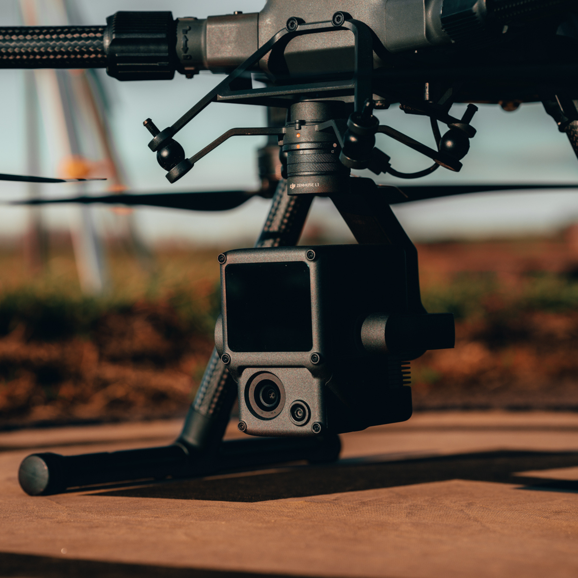
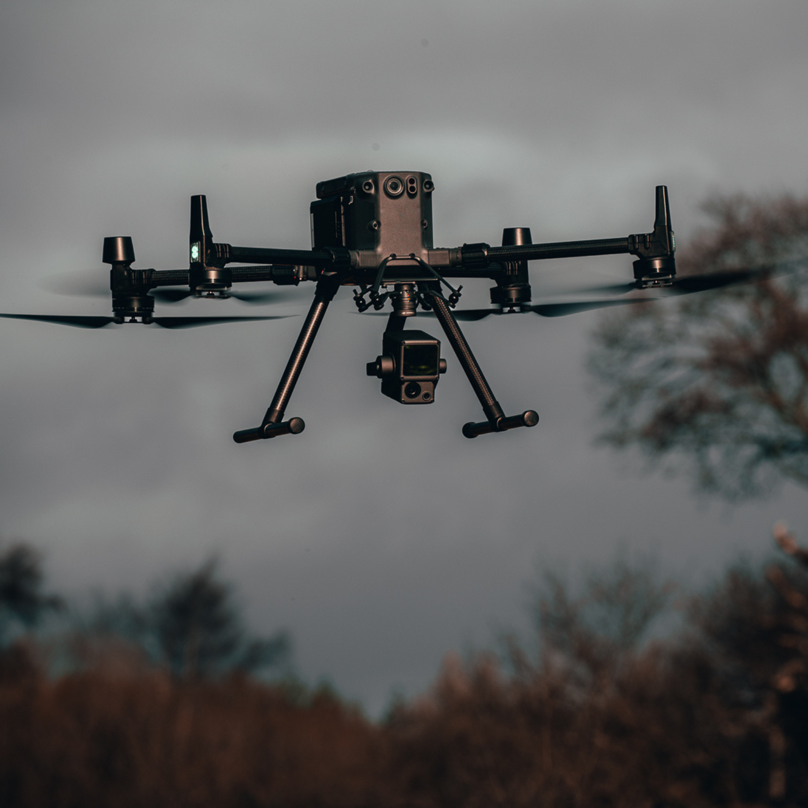
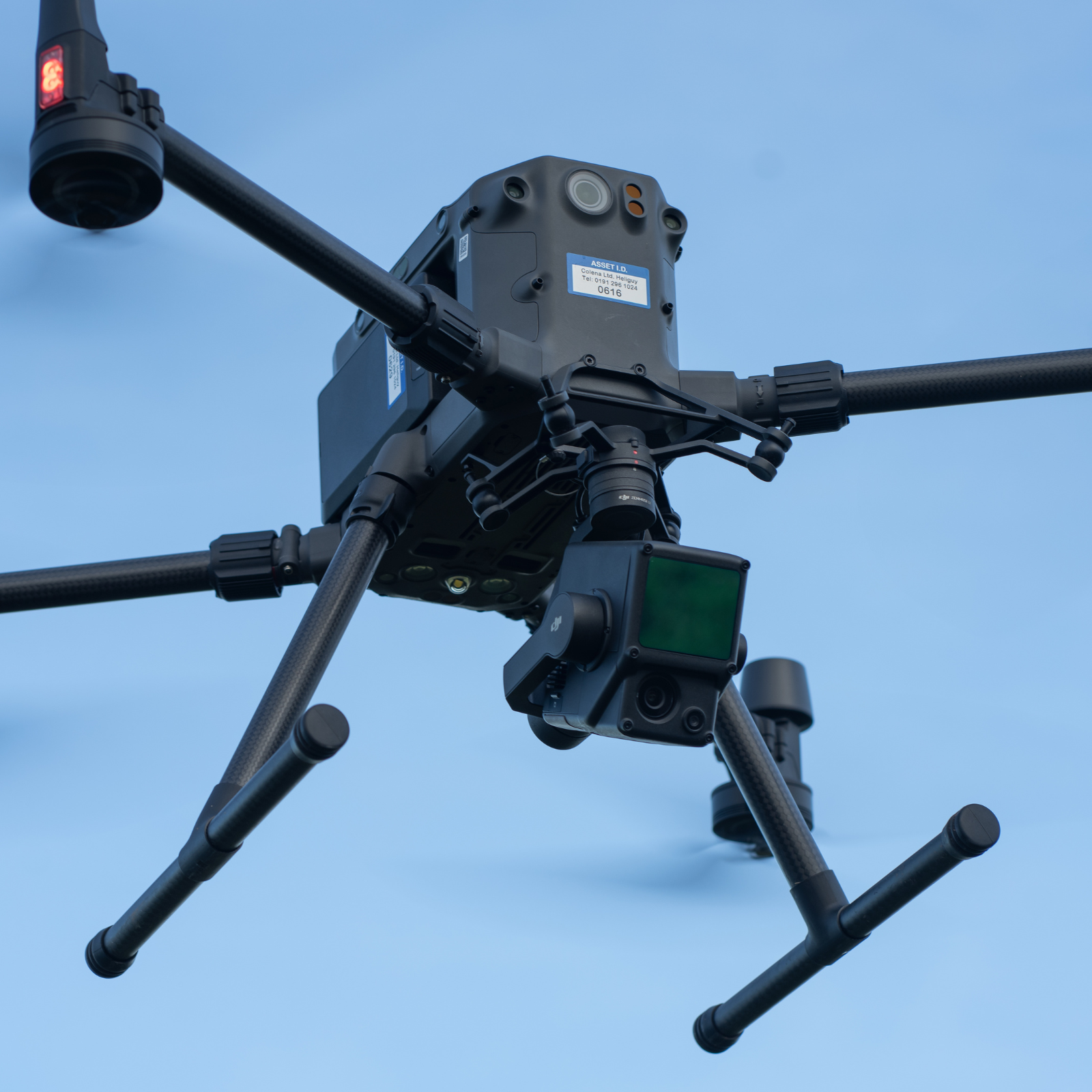
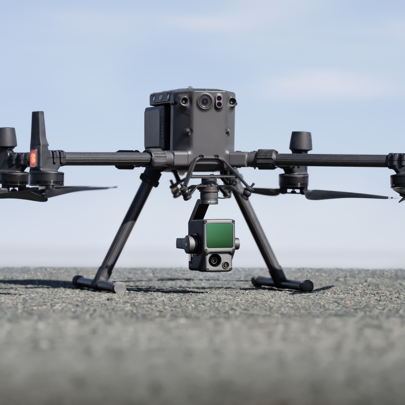
The DJI Zenmuse L1 is a cost-efficient and easy to use enterprise aerial LiDAR payload, engineered for DJI's flagship commercial drone, the M300 RTK.

The L1 integrates a Livox sensor, high-precision IMU, a one-inch 20MP CMOS visual camera with mechanical shutter, and 3-axis stabilised gimbal system.

Combine it with the M300 RTK and the mapping software DJI Terra for a highly-efficient all-in-one aerial LiDAR solution to obtain 3D point clouds for high accuracy and detailed reconstruction. 

The L1 can be used across a range of industry verticals, such as energy, AEC, forestry, public safety, and more.

The highlights of the L1 are:

  • All-in-one Solution: Integrates a Lidar module, an RGB camera, and a high-accuracy IMU.
  • High Accuracy: Vertical - 5cm; Horizontal - 10cm (with 50m flight height).
  • Efficient: Cover 2km² in a single flight (flight velocity 10 m/s, flight height 100m, side overlap ratio 20%).  
  • High Density Point Cloud: 240,000 effective points/s.
  • Multiple Returns: Support three returns (Dual and Triple returns to increase the point cloud density to up to 480,000 pts/sec). 
  • Measurement Range: 450m maximum (80% reflectivity 0 klx). 
  • Real-time Point Cloud View: Able to display and measure point clouds in real time. 
  • Weather Resistant: IP54 rating, enabling operators to collect data in rainy or foggy environments. 
  • DJI Ecosystem: Use DJI Terra for post-processing data. 

L1 Workflow Course - Your Guide To Best Results

Online end-to-end workflow training course for the L1, presented by the heliguy™ in-house GIS specialists.
More than two hours of video content featuring set-up, data collection, post-processing, and point cloud cleaning and classification. Course e-book also available.


DJI ZENMUSE L1 And M300 RTK Case Study

Sample Data Sets.

Dense LiDAR Point Cloud Generation

Exclusive data sets collected by heliguy™ show the quality of the DJI Zenmuse L1 for LiDAR drone surveying, and the power of DJI Terra as a data-processing tool.

Our key findings included:

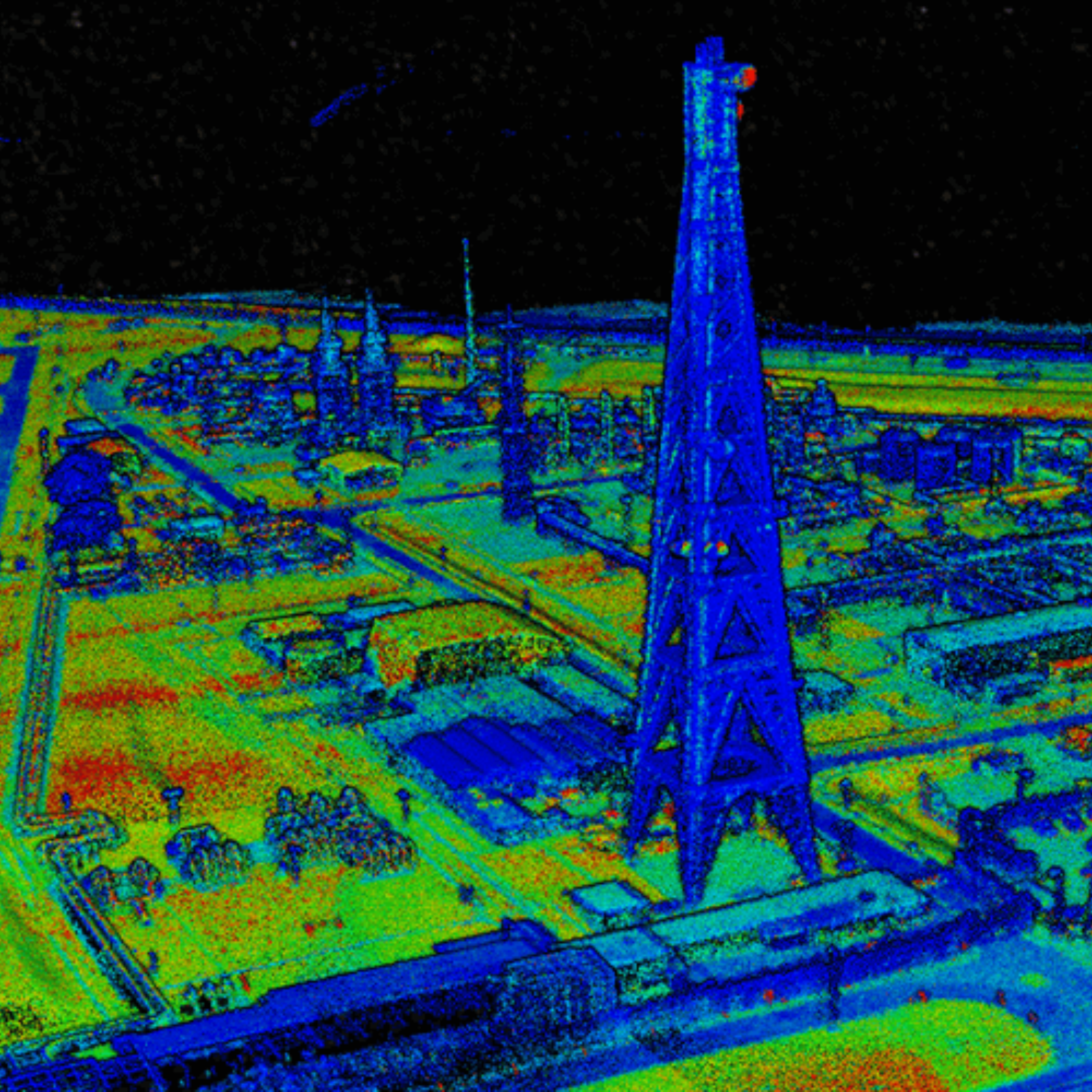
    • Quality Point Clouds:  The L1 is capable of creating dense point clouds, like the one pictured. The gimbal was fixed at 90° during the flight. The sides of buildings, for instance, would be more fleshed out by reorienting the gimbal. 
    • Rapid Processing: Rapid data processing through DJI Terra: Three minutes to process flight data from a 30-minute mission.
    • Easy To Use: Autonomous data collection makes the L1 an accessible and simple plug-and-play LiDAR solution.
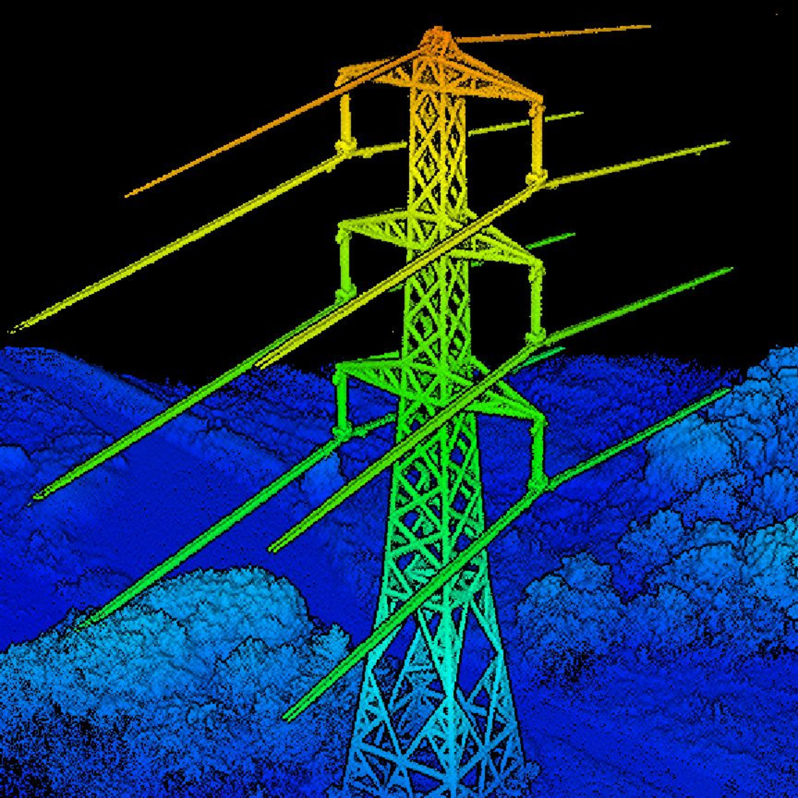
    • Detect Intricate Details: The L1 helped to identify intricate details on our point clouds, such as powerlines; features which were not visible in a 2D orthomosaic. 
    • Dual Camera Solution: The L1 features a LiDAR sensor and an RGB camera. This enables the L1 to output true colour point clouds and reality models. The 20MP RGB camera can be used for photogrammetry, with a ground sample distance (GSD) of 2.74cm at 100 metres of flight height.   

Maximise DATA COLLECTION

Generate point clouds in real-time.

Streamline LiDAR Missions

The Zenmuse L1 integrates a powerful and ultra-lightweight Livox Lidar module with a 70° FOV, a high-accuracy IMU, and a 20-megapixel camera with a 1-inch CMOS sensor which can be used for photogrammetry missions.

The Zenmuse L1 can generate true-color point cloud models in real-time, or acquire a vast area (up to 2km²) of point cloud data in a single flight.

With a Point Rate of 240,000 points per second and a detection range of 450 meters, the ease and speed of capturing quality Lidar data is unprecedented. Thanks to the L1's ability to support 3 returns, the point rate can be increased to 480,000 pts/sec.  

The module supports both Line Scan Mode and Non-repetitive Scanning Mode, a unique technology developed by Livox. This will provide full coverage of the area of interest in a very short amount of time, and allows the sensor to capture data in any direction, instead of along a defined plane. 

The Zenmuse L1 Lidar solution can easily penetrate vegetation canopies and foliage. 

With an IP54 rating, the L1 can be used in tricky weather conditions, providing more opportunities to collect data. 

When the aircraft unexpectedly loses GNSS signal, the DJI L1 can continually use the visual assistant camera to receive orientation data and maintain system accuracy within a short period of time.

High Accuracy IMU

Reliable Data Output

The L1's high-accuracy IMU is essential for quality LiDAR data collection. 

IMU Accuracy

Positioning Accuracy (Vertical)

RTK: 5 cm
PPK: 5 cm

Positioning Accuracy (Horizontal)

RTK: 5 cm

PPK: 2 cm

IMU Accuracy (Yaw)

RTK: 0.18°

PPK: 0.08°

IMU Accuracy (Pitch/Roll)

RTK: 0.03°

PPK: 0.025°

System Accuracy - System Performance Index

Recommended Flight Height

50-150m

Point Cloud Density

100-300pts/m^2

DJI L1 Additional Features

Payload Health Management System: Built into the DJI Pilot app, the Payload Health Management System records the total use time of the DJI L1, as well as the number of rotation times, error logs, and product maintenance suggestions.

Real-time Awareness Flight: The LiDAR sensor can obtain the aircraft's height above the ground in real-time and perform a terrain awareness flight to ensure data quality and flight safety. 

Accuracy Report: After the flight, DJI Pilot will generate an inspection report, view the quality of the point-cloud data, the photo position, number of photos, and the RTK status, so the pilot can confirm the quality of the data on-site.

DJI L1 - Empowering aerial surveys

LiDAR sensor has a range of uses.

Generate Accurate Models And Reconstructions

The DJI L1 is aimed at commercial drone users who are seeking high-accuracy aerial surveying solutions.

The LiDAR sensor can empower clients in energy, AEC, public safety, architecture/heritage, and forestry management.

The L1 is ideal for the following scenarios:

  • Topographic Survey: Collect elevation data in a dense vegetation field. The L1 is able to extract Digital Elevation Models (DEM) and Digital Surface Models (DSM).
  • Infrastructure Reconstruction: Reconstruct highly-detailed structures such as power lines, and oil and gas pipelines to reduce manned operations - improving efficiency and increasing safety.
  • Forestry: Due to the multi-echo capability of the DJI L1, the elevation data in dense forest fields can be easily generated and extracted into DEM and DSM. 
  • Emergency Mapping Survey: The DJI L1 is capable of capturing real-time, true colour point-cloud models. This provides up to date information for emergency response teams. The IP54-rated L1 can also operate in rainy/foggy conditions, as well as low-light scenarios. 

DJI L1 Aerial Surveying Workflow

Harness The Power Of The DJI Ecosystem

Operators can use the DJI ecosystem for an end-to-end LiDAR surveying workflow. This involves the M300 RTK, the L1 sensor, DJI Terra, and the DJI Pilot app. 

  • UAS Platform: DJI M300 RTK drone and L1 payload.
  • Ground Control App: DJI Pilot (able to generate point clouds in real-time).
  • Post-processing Software: DJI Terra (professional version or above).
  • Data Output: 3D point cloud in .LAS format.

Data Acquisition: Plan mission using DJI Pilot app, with a range of mission options available. Make sure the M300 RTK is connected to RTK network, otherwise DJI Terra will not post-process the captured data.

Data Process: In DJI Terra 'Aerial Photography' task, select the mapping scene as 'LiDAR post-processing', and then select the source folder containing LiDAR IMU and Inertial Navigation Data to start data processing. If the selected folder contains visible light photos, the generated point-cloud file is a visible light point cloud. 

DJI L1 Versus DJI Photogrammetry Solutions

How The LiDAR Sensor Compares to the P1 Camera and DJI Phantom 4 RTK

Solutions

Pros

Cons

M300 RTK + DJI Zenmuse L1

 • Highly adaptable: Does not rely on lighting conditions or target texture.

 • Collect elevation data in dense vegetation field. Able to extract DEM and DSM.

 • High-density modelling on detailed subjects, such as power lines and bridges. Output highly-detailed point-cloud data.

 • Efficient: Two square miles of ground coverage during a single flight.

 • Not suitable for 2D reconstruction use.

 • Rely on initial POS state.

M300 RTK + DJI Zenmuse P1

 • Multiple Operation Modes: 2D orthomosaic, 3D oblique, corridor, and others.

 • Efficient: One square mile of 2D orthomosaic coverage during a single flight.

 • High Accuracy: 1:500 surveying-level accuracy data sets without using ground control points.

 • High Resolution: 45MP full-frame CMOS. 

 • Unable to conduct DEM reconstruction.

 • Relatively low reconstruction efficiency compared with DJI L1.

 • Unable to operate at night time and unable to reconstruct areas with no visual texture. 

Phantom 4 RTK

 • Low entry barrier, cost-efficient.

 • Multiple Operation Modes: The GSR app integrates multiple intuitive mission planning modes for different applications and generates waypoints and flight routes automatically with few parameters determined.

 • Highly-integrated all-in-one form factor, with camera fixed to drone. It is also highly portable.

 • Relatively low operating efficiency compared to the P1.

 • Lower resolution payload (20MP compared to 45MP on the P1).

 • Not ideal for large-area operations.

 • Unable to operate at night time and is unable to reconstruct an area with no visual texture.

Product Specification

Spec

Value

General


Dimensions

152 × 110 × 169 mm

Weight

930±10 g

Power

Typical: 30 W; Max: 60 W

IP Rating

IP54

Supported Aircraft

DJI M300 RTK

Operating Temperature Range


-20° to 50° C (-4° to 122° F);
0° to 50° C (32° to 122° F) when using RGB mapping camera

Storage Temperature Range

-20° to 60° C (-4° to 140° F)

System Performance


Detection Range


450 m @ 80% reflectivity, 0 klx;
190 m @ 10% reflectivity, 100 klx


Point Rate


Single return: max. 240,000 pts/s;
Multiple return: max. 480,000 pts/s

System Accuracy (RMS 1σ)


Horizontal: 10 cm @ 50 m;
Vertical: 5 cm @ 50 m

This was achieved at 50 m flight altitude; flight speed 10 m/s; gimbal pitch -90°; and each straight segment of the flight route was less than 1,000 m.

Real-time Point Cloud Coloring Modes

Reflectivity, Height, Distance, RGB

LiDAR


Ranging Accuracy (RMS 1σ)

3 cm @ 100 m*


*Measured in an environment of 25℃ with a target (80% reflectivity) 100 metres away. The result may vary under different test conditions.

Maximum Returns Supported

3

Scan Modes


Non-repetitive scanning pattern, Repetitive scanning pattern

FOV


Non-repetitive scanning pattern: 70.4° (horizontal) × 77.2° (vertical);
Repetitive scanning pattern: 70.4° (horizontal) × 4.5° (vertical)

Laser Safety


Class 1 (IEC 60825-1:2014) (Eye Safety)

Inertial Navigation System


IMU Update Frequency

200 Hz


Accelerometer Range


±8 g

Angular Velocity Meter Range

±2000 dps

Yaw Accuracy (RMS 1σ)

Real-time: 0.3°, Post-processing: 0.15°*

*50 m flight altitude; flight speed 10 m/s; gimbal pitch -90°; and each straight segment of the flight route was less than 1,000 m; DJI Terra was used for post-processing.

Pitch / Roll Accuracy (RMS 1σ)

Real-time: 0.05°, Post-processing: 0.025°*

*50 m flight altitude; flight speed 10 m/s; gimbal pitch -90°; and each straight segment of the flight route was less than 1,000 m; DJI Terra was used for post-processing.

Auxiliary Positioning Vision Sensor


Resolution


1280 × 960


FOV


95°

RGB Mapping Camera


Sensor Size


1 inch

Effective Pixels


20 MP

Photo Size


5472 × 3078 (16:9);
4864 × 3648 (4:3);
5472 × 3648 (3:2)

Focal Length


8.8 mm / 24 mm (Equivalent)

Shutter Speed


Mechanical Shutter Speed: 1/2000 - 8 s
Electronic Shutter Speed: 1/8000 - 8 s

ISO


Video: 100 – 3200 (Auto), 100 – 6400 (Manual)
Photo: 100 - 3200 (Auto), 100 - 12800 (Manual)

Aperture Range


f/2.8 - f/11

Supported File System


FAT (≤32 GB); exFAT (>32 GB)

Photo Format

JPEG

Video Format


MOV, MP4

Video Resolution


H.264, 4K: 3840×2160 30p

Gimbal


Stabilised System


3-axis (tilt, roll, pan)

Angular Vibration Range


0.01°

Mount


Detachable DJI SKYPORT

Mechanical Range


Tilt: -120° to +30°; Pan: ±320°

Operation Modes


Follow/Free/Re-centre

Data Storage


Raw Data Storage


Photo/IMU/Point cloud data storage/GNSS/Calibration files

Supported microSD Cards


microSD: Sequential writing speed 50 MB/s or above and UHS-I Speed Grade 3 rating or above; Max capacity: 256 GB

Recommended microSD Cards


SanDisk Extreme 128GB UHS-I Speed Grade 3
SanDisk Extreme 64GB UHS-I Speed Grade 3
SanDisk Extreme 32GB UHS-I Speed Grade 3
SanDisk Extreme 16GB UHS-I Speed Grade 3
Lexar 1066x 128GB U3
Samsung EVO Plus 128GB

The recommended microSD cards may be updated in future.

Post-processing Software


Supported Software


DJI Terra

Data Format


DJI Terra supports exporting standard format point cloud models:
Point cloud format: PNTS/LAS/PLY/PCD/S3MB format

Frequently Asked Questions

What is the protection level of the Zenmuse L1?
The L1 has an IP54 rating according to the IEC60529 standard. This means that it is protected against solid objects over 1mm in size and against water splashed from all directions. The protection level is not permanent however and will decrease over time due to device wear.
 
To ensure the highest levels of protection:
 
• Before installing, make sure that the interface and surface of the gimbal are dry;
• Before use, make sure that the gimbal is firmly installed on the drone and the SD card protective cap is clean, free of foreign objects, and closed;
• Before opening the SD card protective cap, wipe the surface of the drone clean.
What aircraft is the L1 compatible with?

The L1 is compatible with the M300 RTK. Before using, please upgrade the firmware of the drone and remote controller to the latest version.

Which apps are compatible with the L1?
The L1 currently supports only the Android version of the DJI Pilot App.
Does the camera require an SD card?

The camera requires a MicroSD card with Class 10 or higher transmission speed or rated UHS-1, with up to 256 GB supported.

What is the Field of View (FOV) of the L1's Lidar?
In Non-repetitive Scanning mode, the FOV is 70.4°x77.2°.
In Repetitive Scanning mode, the FOV is 70.4°x4.5°.
What is the maximum measuring range of the L1?
The maximum measuring range of the L1 is 190m@10%, 100klx; 450m@80%, 0klx.
The recommended typical working height is 50m-150m.
What is the scanning frequency of the L1?

The L1 provides three scanning frequencies: one/two returns: 80K/s, 160K/s, and 240K/s; three returns: 80K/s, 240K/s.

How many scanning modes does the L1 have?

The L1 has two scanning modes: Non-repetitive Scanning mode and Repetitive Scanning mode.

How many returns does the L1 support?
The L1 supports 4 types of returns:
 
One return: highest intensity;
One return: first return;
Two returns;
Three returns.[TR2]
What does the L1's Point Cloud LiveView do?

The L1 collects point cloud models based on RTK and displays the collected models on Pilot in real-time.

 
The following features are supported:
 
• Rotating, dragging, zooming, quick switching of perspectives, and centering;
• Multiple colouring modes including RGB, reflectivity, and elevation;
• Basic measurement functions including distance, angle, and plane area;
• Importing data into DJI Terra to display directly.
How does the L1 perform high-accuracy post-processed modelling?

For high-accuracy post-processed modelling, you can import the data from the SD card into DJI Terra with one click. This will generate a colourised point cloud model with high-accuracy PPK-IMU position and orientation calculation supported.

Which model reconstruction formats does the L1 support?

The L1 supports the following model reconstruction formats:

 
• Point cloud formats: PNTS, LAS, PLY, PCD and S3MB;
• Model formats: B3DM, OSGB, PLY, OBJ and S3MB.
Which types of flight missions does the L1 support?

The L1 currently supports Aerial photography and Corridor mapping flight.

Does the L1 support ground-based data collection?
The L1 supports ground-based stationary 360° model data collection*.
 
*Support coming soon.
What is the IMU accuracy of the L1?

In typical operating scenarios, the IMU accuracy of the L1 is 0.025°(roll/pitch)/0.08°(yaw).

What is the L1's auxiliary vision sensor used for?
The vision sensor provides altitude data. This means that if the GNSS signal temporarily fails, the aircraft's accuracy will not be affected for up to 60 seconds.
What is the L1's RGB camera used for?
The RGB camera of the L1 provides basic functions for taking photos and recording videos and provides real-time colour information for the point cloud data during the scanning process. This allows the L1 to output true colour point clouds and reality models.
 
Note that Lidar scanning and video recording cannot work simultaneously.
Which measurement operations can be performed during real-time point cloud rendering?

During real-time point cloud in the Pilot, the point, line and plane measurements can be performed.

What is the surveying and mapping accuracy of the L1?

At a flight height of 50 m, the vertical accuracy of the L1 can reach 5 cm and the horizontal accuracy can reach 10 cm.

Can the L1 work at night?

The Lidar module of the L1 has active detection capability which can scan terrain to collect point clouds during nighttime or other low light conditions.

Which scanning mode does the L1's Lidar module adopt?

The Lidar module of the L1 adopts an Advanced Frame Scanning mode. This ensures that all point clouds collected are valid point cloud data.

How efficient is the surveying and mapping operation of the L1?

At a flight height of 100 m and a velocity of 10 m/s, a single flight with the M300 RTK and the L1 can collect data covering an area of 2 km2.

On which gimbal of the M300 RTK can the L1 be mounted?

The L1 can be mounted on the right downward gimbal port (when facing the drone) or the upward gimbal on top of the M300 RTK.

What are the recommended parameters for operating DJI L1?

Select mapping or corridor mission mode to plan the mission, relative altitude (50m), velocity (5m/s), side overlaps ratio (50%) and enable 'calibrated flight'.

What is the FOV on the L1 LiDAR sensor?

Circular: FOV 70.4° (Horizontal) x 77.2° (Vertical); Non-repetitive Linear: FOV 70.4° (Horizontal) x 4.5° (Vertical). 

What is the difference between the repetitive scanning pattern and non-repetitive scanning pattern?

Livox's non-repetitive scanning patterns differ from the repetitive linear scanning offered by traditional LiDAR sensors. The areas scanned inside the FOV of a Horizon sensor grow the longer the integration time, increasing the likelihood of objects and other details within the FOV being detected.

What is the visual assistant camera built into the L1 for?

When the aircraft loses GNSS signal unexpectedly, the DJI L1 can continually use the visual assistant camera to receive orientation data and maintain system accuracy within a short period of time (60 seconds).

Is PPK supported when using the DJI L1 with the M300 RTK?

Yes. The mission folder generated would include point-cloud data, photos, GNSS observation data, and exposure log for the PPK process.

What are the application scenarios of the Zenmuse L1?
The L1 can be widely used in multiple scenarios including:
 
• Topographic surveying and mapping
• Power transmission line corridor modelling
• Emergency response surveying and mapping
• Detailed modelling
• Agriculture & forestry investigation

Customer Reviews

Based on 1 review Write a review

You may also like