

- In-depth guide to cleaning and classifying LiDAR data;
- What is LiDAR noise and how removing it improves your data set;
- Why classification is an important post-processing step;
- heliguy™ has developed a geospatial workflow course for the L1, which will include LiDAR post-processing best practices.
Drone LiDAR is a highly accurate and extremely efficient aerial surveying method which can be used to build georeferenced point clouds.
However, before you settle on your completed data set, it is important to modify the raw point cloud to ensure the final product is as accurate and as clean as it can be.
This is done through additional processing to remove excessive noise and classify specific details in the point cloud, and is an integral component of the quality control stage.

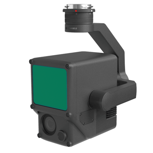
This guide will explain the importance of cleaning and classifying your LiDAR data set, using examples collected by heliguy™ via the L1 LiDAR sensor (for the M300 RTK) and using DJI Terra for initial processing, followed by Terrasolid for post-processing.
heliguy™ has developed a geospatial workflow course for the L1, which will include L1 data collection, as well as best practices and post-processing using DJI Terra and Terrasolid.
LiDAR Data Set Cleaning - Removing Noise
Noise is present - to some degree - in all LiDAR collections, and can be caused by a variety of things, such as haze, water, and the high sensitivity of the detector.
Noise relates to erroneous points in the point cloud which interfere with the display, processing and accuracy of the data.
Taking our data set as an example, the point cloud had 1,362,928 noise points out of a total 46,726,641 points - as indicated in the statistics box in the image below. A selection of these noise points (red dots) are evident, as seen in the cross-section view.

Noise can reduced through point thinning and smoothing without losing much of the accuracy and detail. If there is any bad data in the data set, it can also be manually classified as low points as shown in the screenshot below. The pink dots show the low points.

One of the biggest contributors to noise is .LAS overlap, where erroneous points emerge across different parts of the flight route. The different coloured straight lines (ie white, purple, yellow, red, etc) in the image above show the different flight paths.
This happens when laser data is collected from multiple points along the flight route and/or where the LiDAR's returns overlap on the border of the flight lines.
This is demonstrated in the below image - which shows how the different flight paths contain a tapestry of colours, instead of numerous partitions, each with one defined colour.

To combat this, it is important to either classify overlap or remove it altogether to rid the redundant and low accuracy points from each flight path.
The image below shows the difference between a LiDAR data set with overlap (left) and one with the overlap removed (right).

In the left-hand image, there are no defined flight partitions, with each strip a splattering of various colour because of the overlap. In the right-hand image, each strip (flight path) has a clearly defined colour, with the erroneous points removed.
The difference between overlap vs removed overlap is seen in these two cross-sections below.

The top images show the data set with overlap. The cross-section - depicting the red flight corridor - is thick and mixed with various colours. But in the bottom images (the point cloud without overlap), the cross-section for the red flight pass is much more smooth, thinned and overwhelmingly red, as the erroneous colours (such as green) from neighbouring flight paths have been removed.
This means that the laser points have been distributed more evenly to ensure consistency, which in turns results in higher accuracy and therefore a better quality point cloud. This can then be used to produce a better quality digital model.
The cut overlap tool also helps remove any small height mismatches in the data.
It is also interesting to note how the removal of overlap dramatically reduces the number of points in the point cloud - taking the figure from 111,090,083 down to 46,726,641.
Not only does this make the point cloud more accurate, but the removal of 64,363,442 erroneous points speeds up the time it takes to build your digital asset.
LiDAR Data: Classifying And Feature Extraction
Once you have tidied up your data set, it is important to conduct classification. This is the process of referencing data points and assigning values within a point cloud.
It is essentially labelling or annotating your data set, and as such, the points can be classified into numerous categories, such as bare earth or ground, vegetation, rail, or water. This helps take the abstract out of a LiDAR data set.
The image below shows the data set, pre-and-post classification. The raw point cloud (left graphic) was initially processed through DJI Terra and then put into Terrasolid for post-processing and classification (right image).

Notice how the classified point cloud is coloured, with the various features matching the shade of their related classes.
This is further demonstrated in the image below, which shows a cross-section of part of the classified point cloud, with roof tops marked as red, the ground illustrated by green, and the tree having different shades of vegetation types.

Classifying LiDAR data sets is useful for numerous reasons. Benefits include:
- Once classified, all non-terrain data can be extracted to provide a Digital Terrain Model (DTM).
- Perform further analysis tools on individual classes, such as reidentifications or tidying up specific features in the data set.
- Extract specific classes. For example, you could pull out electricity line data to remove all unneeded data.
Such classification is important for various industry applications. Examples include:
- Construction: You could detect building components automatically from your scan and help track progress, assess material needs, and detect safety risks.
- Environmental Science: Monitor large scale geological trends and drill down even to tree species detection and density estimates.
Depending on the software, data sets can be classified automatically or manually. A combination of the two, ie manually cross-checking automatic classification, is a nice balance.
Manual classification is particularly useful if parts are missing from certain objects on the data set or if there are classification errors.
In this example, the left image shows a building which is missing a section of rooftop, as part of the automatic classification stage. But the right-hand picture demonstrates how this has been rectified - and completed - with a bit of manual work.

DTMs: Tidying Up Anomalies
LiDAR is an extremely useful surveying tool for creating Digital Terrain Models (DTMs).
You can find out why in our LiDAR vs Photogrammetry guide.
But sometimes, a data set throws up some anomalies when the point cloud is converted to a DTM.
Firstly, this image shows the data set as a DTM (right image): Notice how the natural features, such as vegetation and buildings, have been removed.

However, when zooming in on one section, you see part of the data set which is irregular, ie littered with black streaks, making it quite choppy, especially compared to the rest of the area.

In this instance, this has occurred because a building was previously there, but removed through the DTM creation.
As such, this error is not giving an accurate reflection of the terrain: Proven by the cross-section below, which has an irregular bump - giving the illusion of a slope or gradient increase, when there isn't one.

This can be corrected manually to provide a truer representation of the terrain - as illustrated by the left-hand graphic below - and look how it improves the accuracy, with a smoother cross-profile.

Cleaning And Classifying LiDAR Data - Summary
Building a robust LiDAR data set is a multi-step process which extends beyond the data collection.
Post-processing the raw point cloud is an important part of the workflow, to ensure the final product is accurate, clean and classified. Removing unnecessary points also shaves off the time it takes for future processing and building digital assets.
This blog has explained the importance of conducting cleaning and classifying. The heliguy™ geospatial workflow course will teach you how to conduct these important steps, utilsing DJI Terra and Terrasolid. For more information, contact us.


Leave a comment