Products
DJI Terra Update: Convert Drone Survey Data Into National Coordinate System
New firmware update for DJI Terra enables users to accurately convert their raw L1 and P1 LiDAR and photogrammetry drone survey data into a national coordinate system. For users in the UK, this will be OSGB36/British National Grid. This upd ... Read More

DJI Terra firmware update enables users to accurately convert raw L1 and P1 drone survey data into a national coordinate system;
For UK users, this will be OSGB36/British National Grid. Terra now also incorporates the OSTN15 (National Grid Transformation) and the OSGM15 (National Geoid Model) parameters to accurately georeference horizontal and elevation data to the British coordinate system;
This key upgrade streamlines this stage of the processing workflow, meaning users no longer have to switch to another software to accurately convert to a localised coordinate system;
heliguy™ test data shows that converting coordinates within DJI Terra is now as accurate as doing it through an alternative workflow, such as within Terrasolid from DJI Terra;
This upgrade is a major step forward for DJI Terra users, and is an update that heliguy™ has previously asked DJI to implement;
DJI Terra firmware update incudes a wealth of new features, including added functionality to refine water surfaces for 3D Reconstruction.
A new firmware update for DJI Terra enables users to accurately convert their raw L1 and P1 drone survey data into a national coordinate system.
For users in the UK, this will be OSGB36/British National Grid.
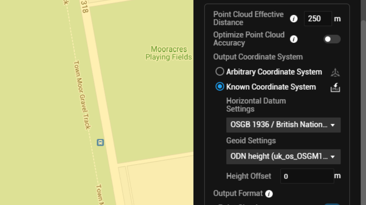
This key upgrade streamlines this stage of the processing workflow - meaning that DJI Terra can now be used to accurately transform data from the WGS 84 global coordinate system, rather than having to do this in an alternative software platform, like Terrasolid.
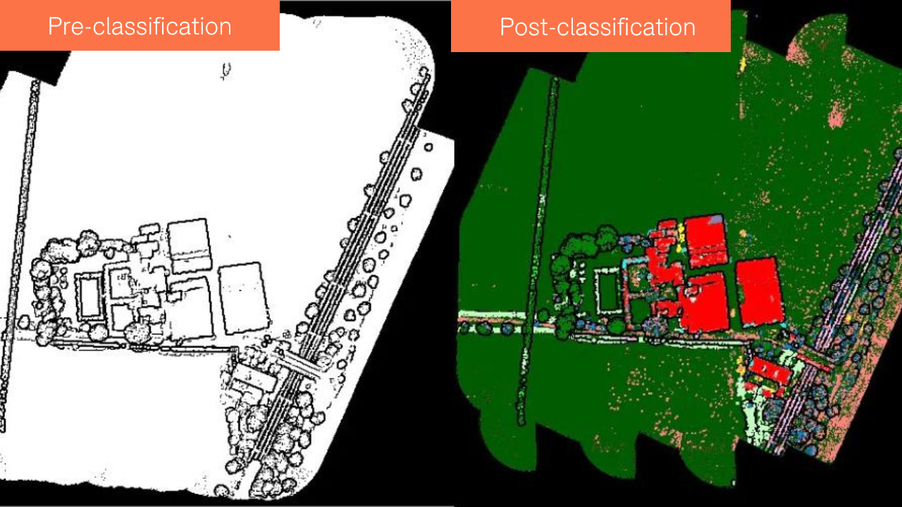
This provides a seamless end-to-end process inside DJI Terra for surveyors who want to generate a raw LiDAR or photogrammety point cloud in a localised coordinate system. However, additional cleaning and classification still needs to be done through a platform like Terrasolid, if required.
Test data from heliguy™ shows that DJI Terra's coordinate conversion is now just as accurate as doing this switch in Terrasolid.
The heliguy™ in-house surveying team - which has compiled a free online L1 LiDAR course, including data processing in DJI Terra/Terrasolid - has previously suggested to DJI that Terra be given national coordinate system functionality. We are pleased that this features in the latest round of updates.
Other key upgrades as part of the new firmware update (Version: 3.5.0) include added functionality to refine water surfaces for 3D Reconstruction; and added Merged Output option to merge output results in PLY, LAS, or PCD format for point cloud reconstruction.
Read our in-depth guide to drone mapping with DJI Terra for full firmware update details and more information on the drone data processing platform.
DJI Terra Coordinate Conversion Workflow
To put the new streamlined coordinate conversion feature into context, we'll outline the steps below and explain how they differ from the previous workflow. For this example, we'll use the British Coordinate System: OSGB36/BNG.
Previously, DJI Terra users would process their data relative to the global coordinate system WGS 84, under these settings:
Horizontal Datum Settings: WGS 84
Geoid Settings: Default
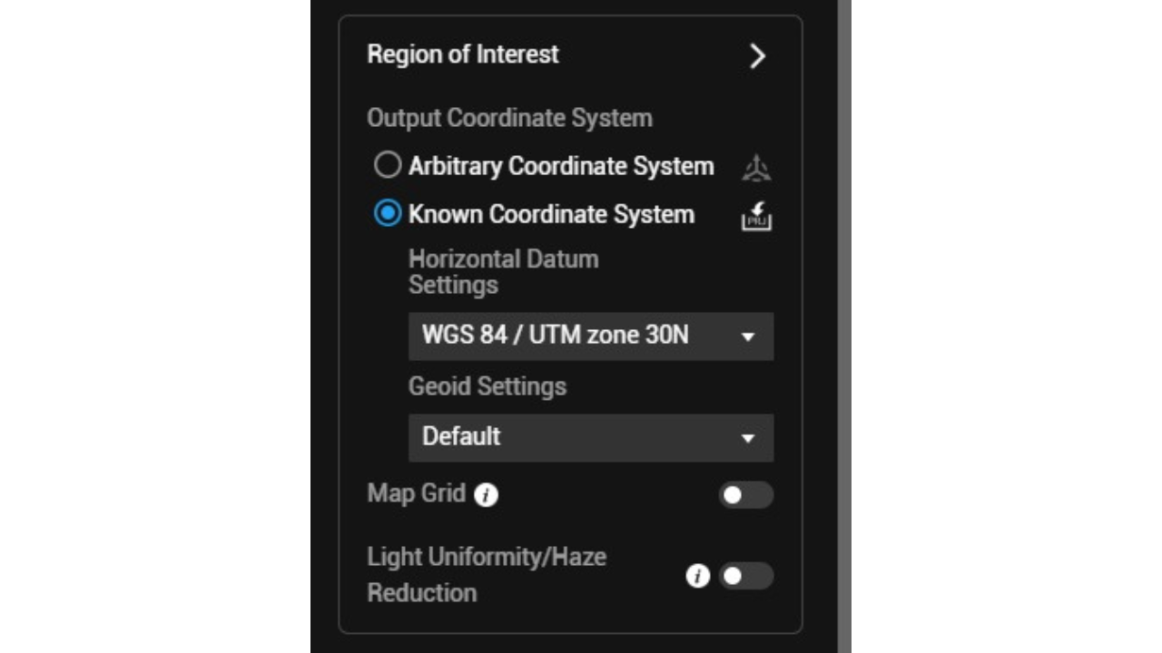
DJI Terra did provide an option to convert data to a national coordinate system, but this process lacked accuracy. Therefore, conversion via an alternative software was needed to provide accurate localised georeferencing.
However, after the firmware update, users can now do this precise transformation within DJI Terra.
In the case of UK users, the settings would be changed to the following:
Horizontal Datum Settings: OSGB 1936/British National Grid
Geoid Settings: ODN Height
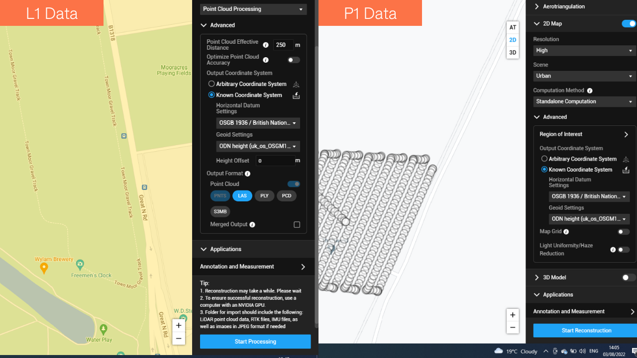
This is now possible because DJI Terra software incorporates the OSTN15 (National Grid Transformation) and the OSGM15 (National Geoid Model) parameters into the transformation, enabling UK users to accurately georeference both horizontal and elevation data to the British coordinate system.
As test data shows, the coordinate conversion through Terra is now as accurate as going through the Terra-Terrasolid workflow. The tables below show this accuracy comparison, based on some test data collected by heliguy™. In this case, the average magnitude is the figure we're after: Note how the average magnitude using the original Terra-Terrasolid workflow is 0.043, while the average magnitude using the new Terra workflow is 0.042.
Accuracy: DJI Terra & Terrasolid Coordinate Conversion Using L1 Data
Number | Easting | Northing | Known Z | Laser Z | Dz |
1 | 423582.814 | 607577.648 | 44.321 | 44.316 | -0.005 |
2 | 423601.237 | 607512.878 | 43.159 | 43.210 | +0.051 |
3 | 423578.697 | 607475.472 | 44.984 | 45.038 | +0.054 |
4 | 423600.445 | 607440.785 | 44.572 | 44.607 | +0.035 |
5 | 423496.381 | 607442.931 | 45.442 | 45.375 | -0.067 |
6 | 423539.056 | 607506.236 | 44.672 | 44.718 | +0.046 |
7 | 423539.056 | 607415.696 | 45.450 | 45.496 | +0.046 |
Average dz | +0.0229 | ||||
Minimum dz | -0.0670 | ||||
Maximum dz | +0.0540 | ||||
Average magnitude | 0.0434 | ||||
Root mean square | 0.0470 | ||||
Std deviation | 0.0444 |
Accuracy: New DJI Terra Coordinate Conversion Using L1 Data
Number | Easting | Northing | Known Z | Laser Z | Dz |
1 | 423582.810 | 607577.650 | 44.321 | 44.297 | -0.024 |
2 | 423601.240 | 607512.880 | 43.159 | 43.211 | +0.052 |
3 | 423578.700 | 607475.470 | 44.984 | 45.010 | +0.026 |
4 | 423600.450 | 607440.790 | 44.572 | 44.607 | +0.035 |
5 | 423496.380 | 607442.930 | 45.442 | 45.365 | -0.077 |
6 | 423539.060 | 607506.240 | 44.672 | 44.644 | -0.028 |
7 | 423660.200 | 607415.700 | 45.450 | 45.401 | -0.049 |
Average dz | -0.009 | ||||
Minimum dz | -0.077 | ||||
Maximum dz | +0.052 | ||||
Average magnitude | 0.042 | ||||
Root mean square | 0.045 | ||||
Std deviation | 0.048 |
The ability to convert data through Terra in this way is useful as most projects in the UK are georeferenced to the British National Grid coordinate system.
The fully georeferenced raw point cloud can then be directly exported from Terra. The data can also be put into a software platform like Terrasolid and the user can now bypass the coordinate conversion stage and go straight to point cloud cleaning and classification, if required.
To discuss this in more detail or to speak about bolstering your surveying workflows with drones, contact the heliguy in-house surveying team.
