
Products
Maximise Your Remote Drone Missions: Key Features of DJI FlightHub 2 and DJI Dock 2
Explore how DJI FlightHub 2 & DJI Dock 2 streamlines mission planning and generates better results.
In-depth guide to using DJI FlightHub 2 for automated deployments with DJI Dock 2;
Step-by-step guide to creating flights and collecting data remotely;
Key features include cloud mapping, 3D model import for optimised mission planning, and custom geofencing for enhanced flight safety;
DJI FlightHub 2 has robust data security protocols: Its cloud servers are operated by Amazon Web Services - compliant to ISO/IEC 27001 security certifications.
DJI FlightHub 2 empowers remote and automated drone deployments with DJI Dock 2.
Use the all-in-one cloud-based management platform to plan and schedule operations, create geofences to increase flight safety, and automatically upload and centralise data upon mission completion.
Key features include cloud mapping, one-tap live stream, and the ability to import 3D models for optimised route plotting - especially beneficial for complex missions.
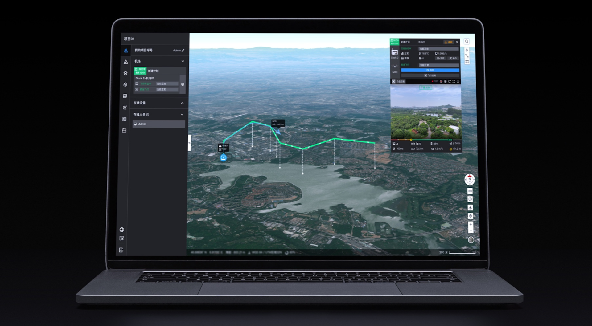
This in-depth blog explores the functionality of DJI FlightHub 2 for facilitating cloud-based operations, helping operators collect automated and repeatable drone data, on-demand, from afar.
Some of these features are illustrated using exclusive datasets and screenshots collected by heliguy™.
These tools can be used by organisations who initially deploy DJI Dock 2 in a VLOS capacity, before scaling to BVLOS operations.
Best Features Of DJI FlightHub 2 For DJI Dock 2 Operations
We've compiled a list of some of the most important FlightHub 2 features for DJI Dock 2 missions.
Before we delve into more detail, here's an overview of our top picks.
Remote Flight Planning and Scheduling: Create a route, time your mission, and watch the operation.
Flight Route Editor: Import 3D models for enhanced route plotting.
Preview Data Capture: Use maps and models to plan shots ahead of the flight.
AI Spot-check & FlyTo Tasks: Aids efficient and repeatable data collection.
Custom Flight Area And No-Return Points: Create geofenced areas and plan a safer return to home.
Live Flight Controls: Take control during flight to ensure you collect the insights you require.
One-tap Live Stream: Live stream from the drone, providing real-time situational awareness anywhere in the world.
Cloud Mapping: Automatically uploads maps and models to the cloud once the drone arrives back at Dock 2.
Model Comparison: Side-by-side imagery to chart progress over time.
DJI TerraAPI: Integrate DJI Terra into your own dock management systems.
Open Ecosystem: Use FlightHub 2 to control third-party payloads and link to third-party cloud platforms.
Data Security: DJI FlightHub 2 is built to protect user data.
1: Remote Mission Planning
DJI FlightHub 2 enables operators to remotely plan and schedule flights, and then watch the subsequent mission, from afar, in real time.
This functionality is the foundation for remote and automated drone deployments.
These series of images, collected by heliguy™ during DJI Dock 2 testing, provide a quick workflow guide to plan a flight.
In this case, we opted for a Waypoint Route...
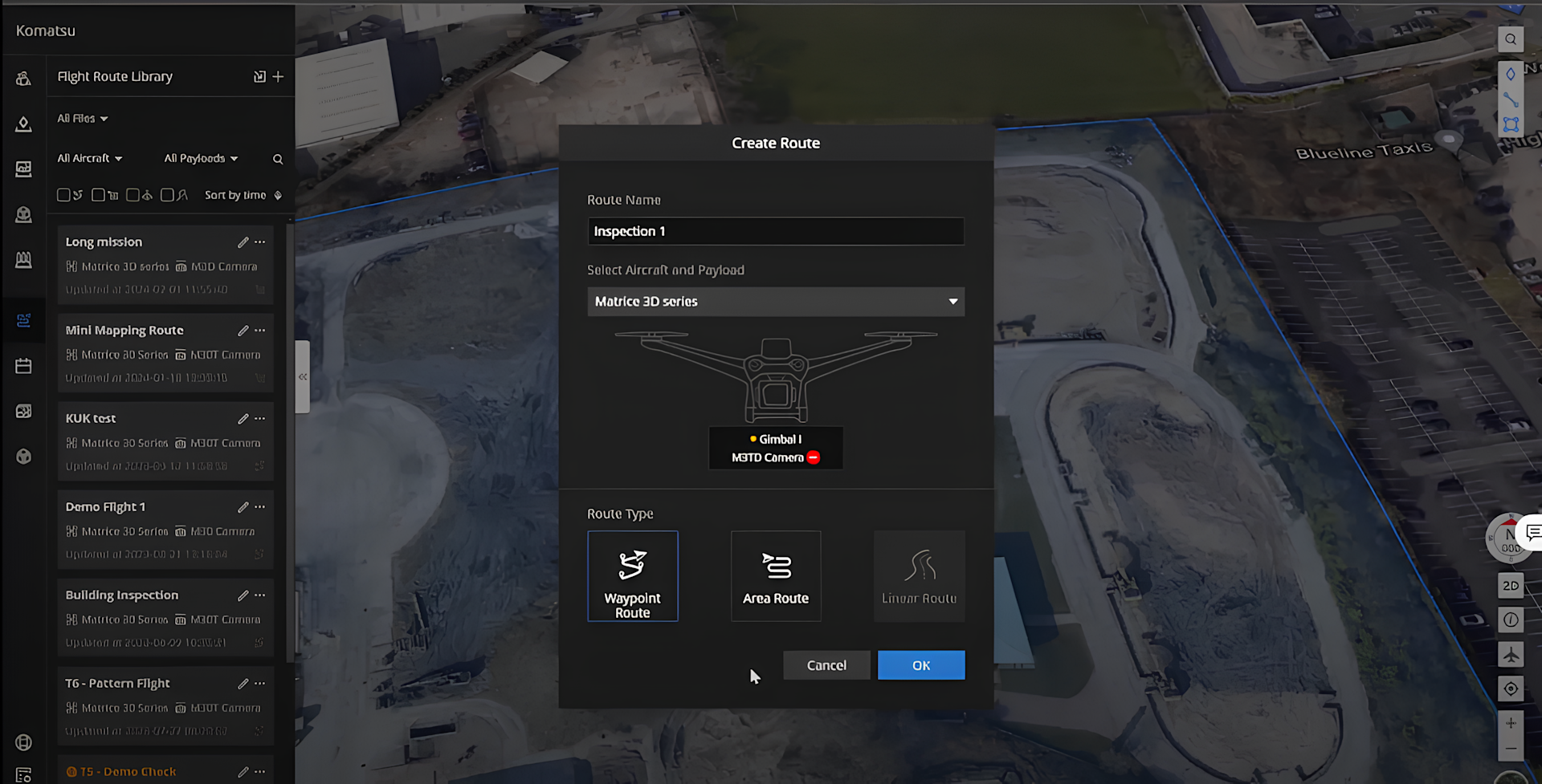
...and plotted waypoints for our drone to fly to across the survey site.
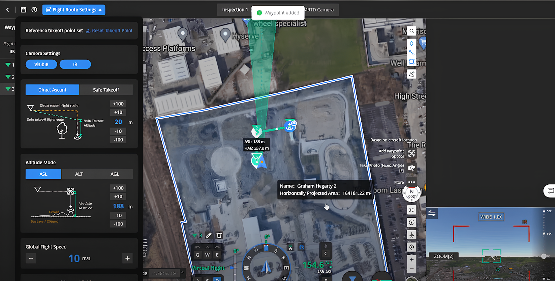
The images above and below show some of the parametres that can be changed, such as flight altitude (in this case, 55m), flight speed, and camera settings...
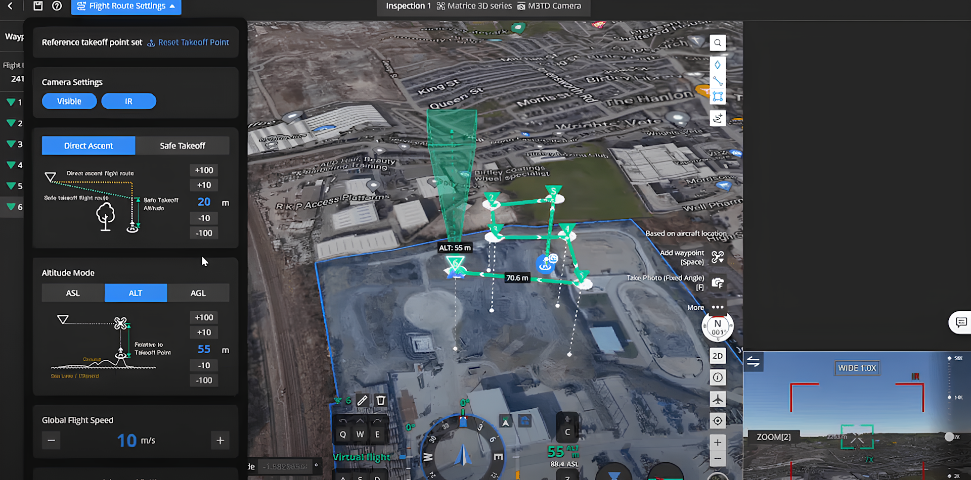
...while the image below shows how operators can remotely set the timing of the flight, determining whether it is flown:
Immediately;
At a specific time;
Recurring;
Continuous.
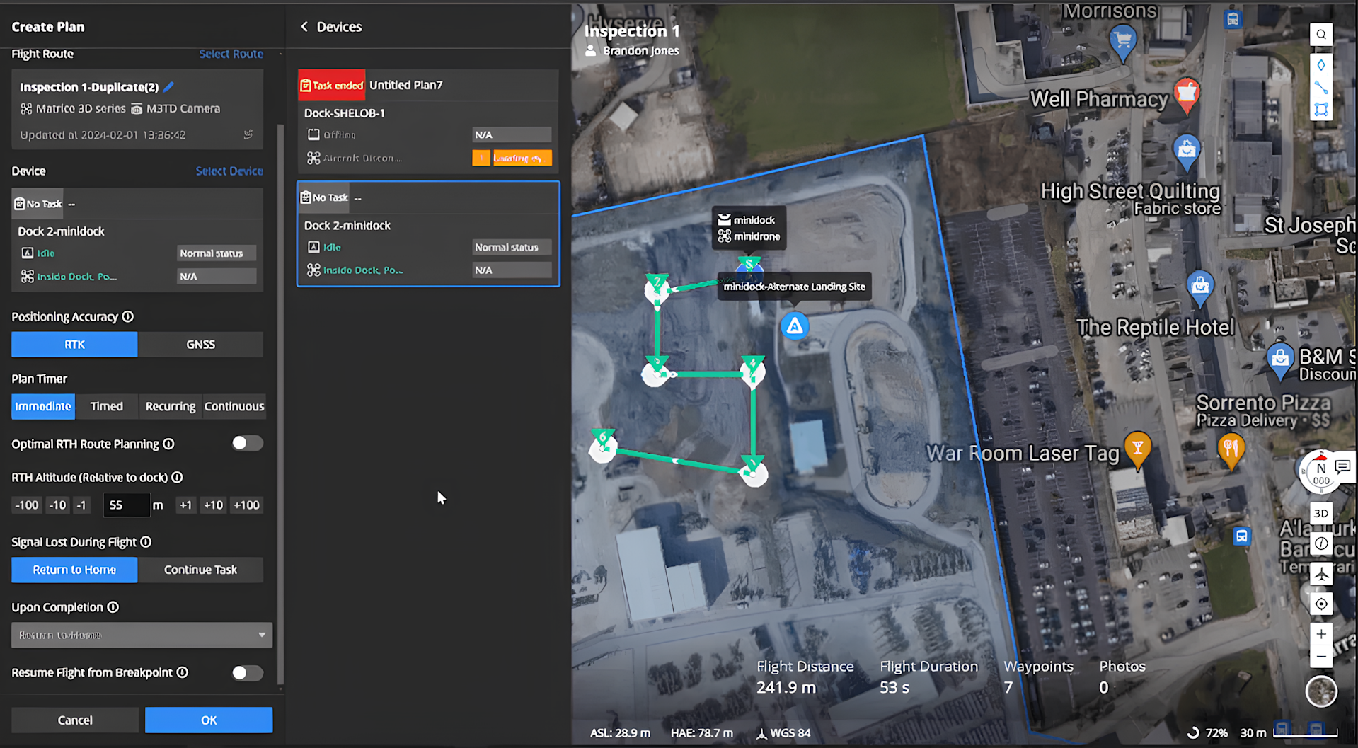
Once the flight parameters are set, the drone can be launched.
The flight can be monitored throughout the duration of the operation.
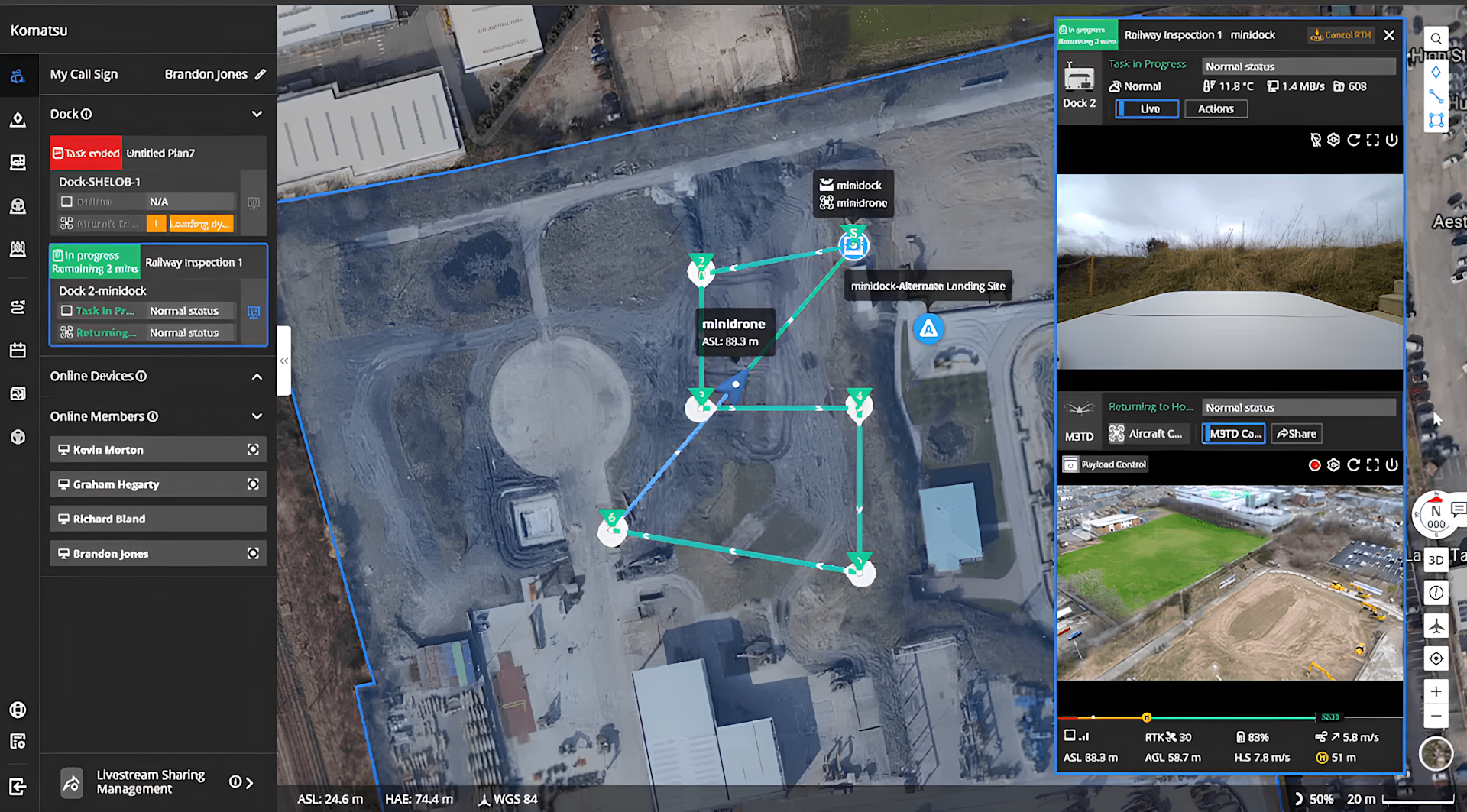
The screenshot below shows FlightHub 2's interface during flight.
You can see the flight path, as well as the camera feed from the Dock 2 (top window, right) powered by an internal fisheye camera, and the camera feed from the drone (bottom window, right).
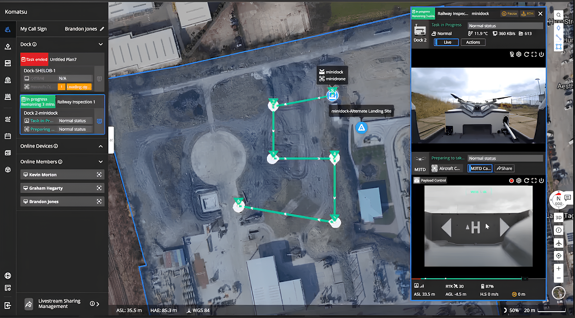
After taking off, the blue triangle shows the drone's flight path, while the bottom right image shows the view from the drone's camera...
...and the view of the Dock 2 can be seen as the drone comes in for landing (bottom right).
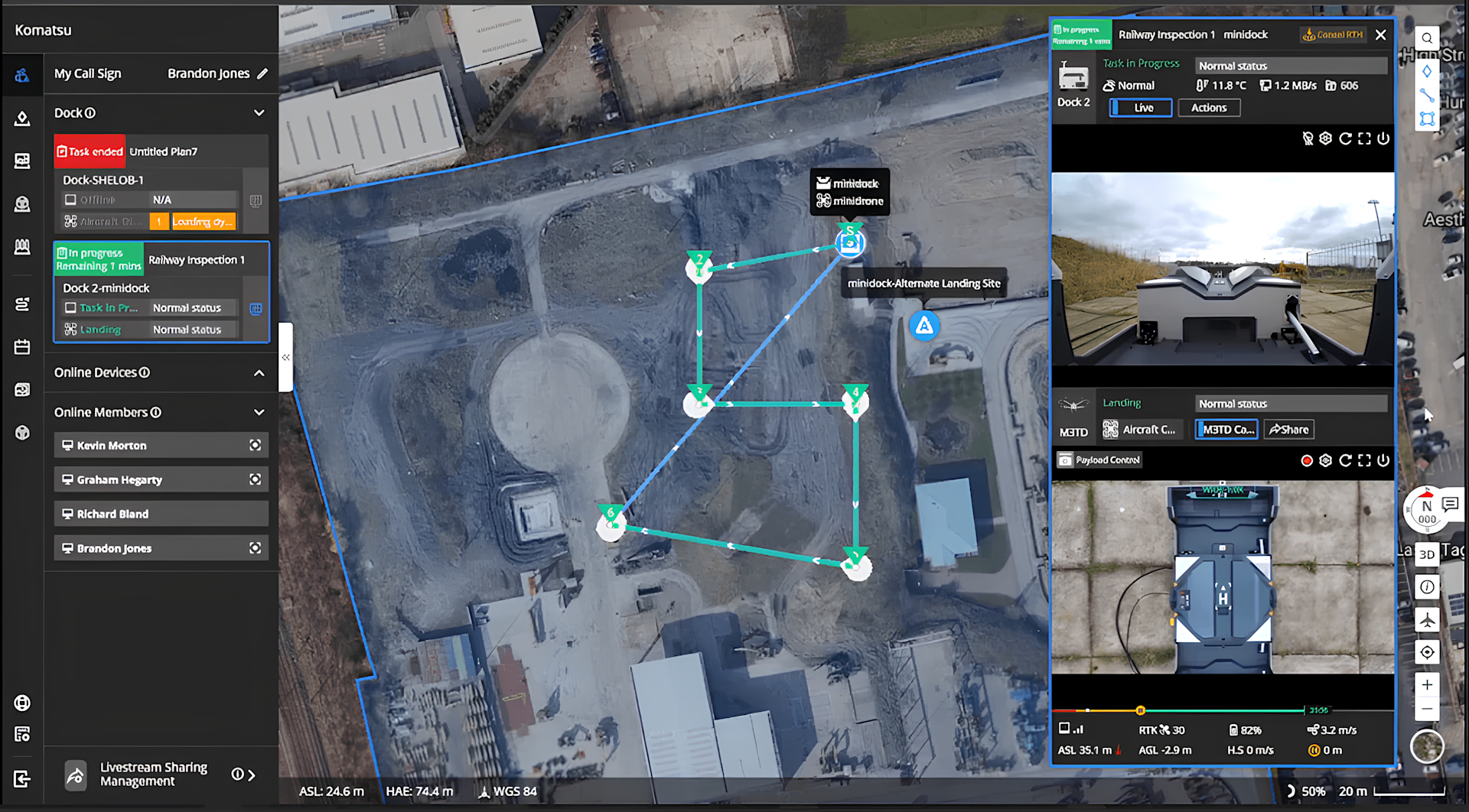
Upon returning, the data is uploaded to the cloud. We'll come to this later.
2: Flight Route Editor
So, that's a quick overview of planning a flight through FlightHub 2.
But, the platform features additional tools to enable more complex and precise mission preparation and data capture.
The first of these features is the Flight Route Editor, which facilitates intuitive and efficient operations and enhances flight route planning and accuracy.
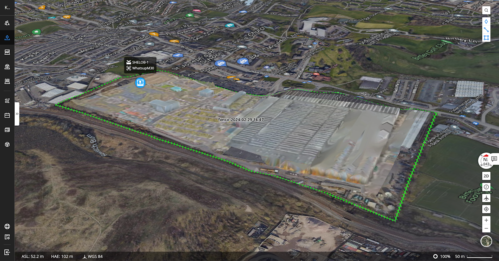
This allows users to import previously-collected 3D models into FlightHub 2 to use for flight planning.
This is ideal for more accurate flight planning, based on up-to-date terrain, elevation, and location data.
The image below shows how a 3D model has been overlaid onto our flight area. The green line around the model is a custom geofence - we'll come to this later.
3: Previewing Data Capture Before Flight
This feature is a by-product of the Flight Route Editor functionality.
It lets you see and plan, ahead of the mission, what imagery the drone will capture - based on the 3D model imported into FlightHub 2, or using Google data.
Take a roof inspection, for example.
The below image shows a preview of the section of roof that the drone's camera will capture, based on a 2D view of the site.
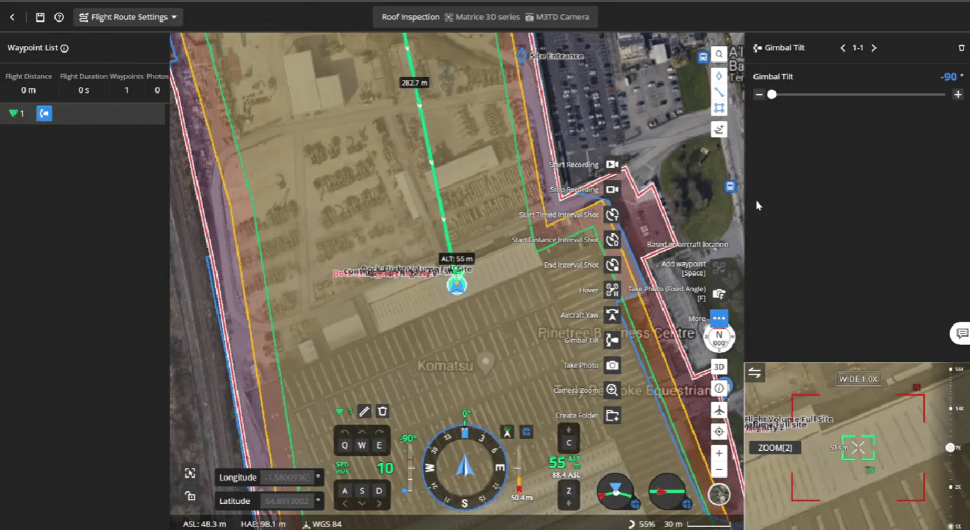
This enables operators to plan the perfect shot ahead of the mission.
And in this particular case, resulted in capturing this image - collected by the DJI M3TD drone, which has visual, thermal and zoom capabilities.

During the mission, we were able to use FlightHub 2 to remotely toggle between visual and thermal cameras.
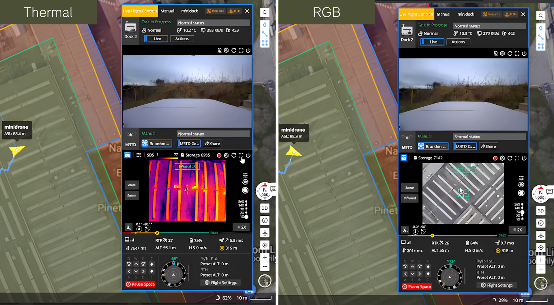
For reference, a pilot was onsite to keep the drone in VLOS and was ready to take over the controls if required.
4: AI Spot-check & FlyTo Tasks
Importing 3D models into FlightHub 2 can also be used for AI Spot-check and FlyTo Tasks.
Mode | Function |
AI Spot-check | Frame a specific area in the 3D model, and the aircraft will automatically compare the area to be captured with the framed area in subsequent automated operations. This actively adjusts the camera's angle to ensure accurate capture of the same area across multiple flights. |
FlyTo Tasks | Utilise high-precision 3D models to automatically plan the optimal flight route. Before an urgent task, the operator only needs to click on the subject, and the aircraft will fly to the destination via an efficient and safe route. |
5: Custom Flight Area And No-Return Points
Flight safety is paramount, especially when flying automated and remote operations.
Custom Flight Area
Through DJI FlightHub 2, create a Custom Flight Area to prevent the aircraft from flying from or into a designated zone.
For instance, this map shows how we created a safe zone (green) and a restricted zone (red).
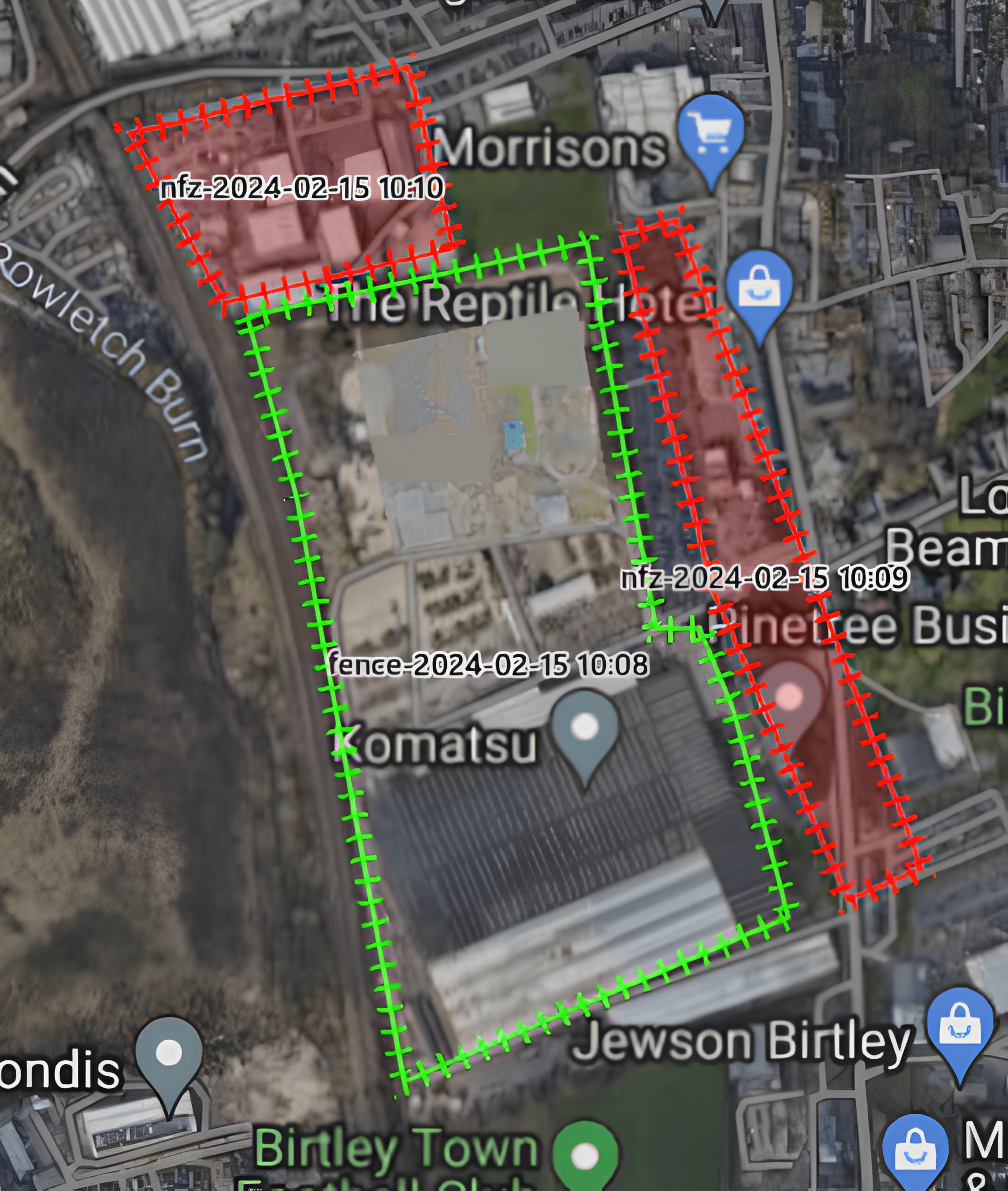
This feature ensures the aircraft stays within the safe zone and prevents it from flying out of the area.
Meanwhile, a restricted zone means that the drone is not allowed to fly into a particular area.
No-Return Point
When planning your waypoint missions, you can now tag waypoints as 'no return points', indicating areas where traditional RTH is not possible - either due to height risk or complex environments.


These No-Return Points inform the drone to discard the typical RTH route and return home following back the waypoint mission until it reaches the last safe waypoint and then calculates the RTH flight path.
This is useful for operations such as substation inspection.
6: Live Flight Control
Using DJI FlightHub 2 or a third-party cloud platform, operators can remotely control the drone's flight and gimbal angle via keyboard and mouse.
In this example, we took control of the drone to reorientate the gimbal and custom zoom on part of a railway line.
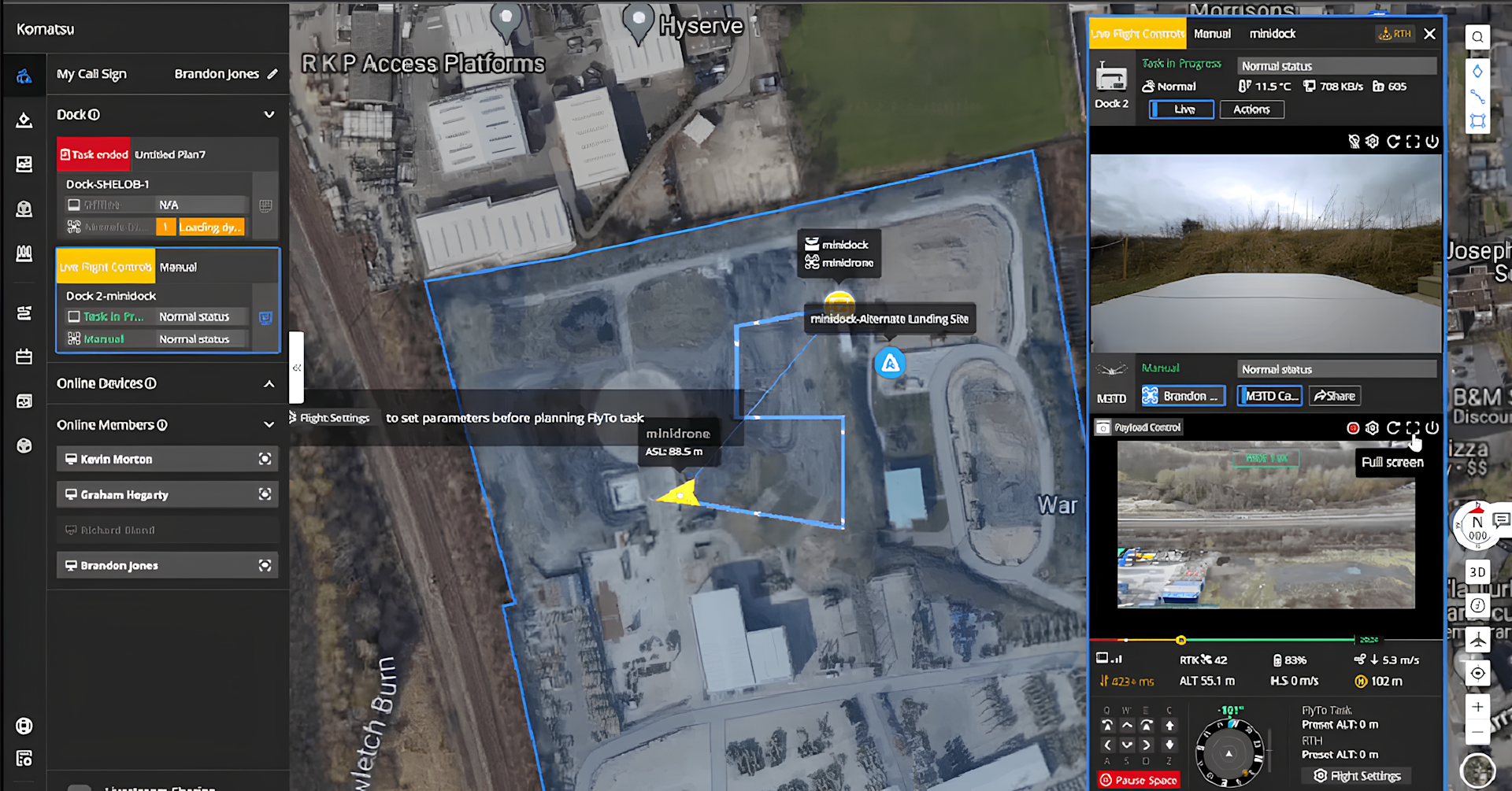
The view from the drone's camera can be viewed in full screen, or a split screen view can show the thermal and visual feeds when flying with the M3TD.
7: One-tap Live Stream
The one-tap live stream provides situational awareness to anyone in the world.
Control who sees the live stream by sharing a URL link.
8: Cloud Mapping
Planning flights and remotely conducting an operation is one thing. But uploading and centralising data is also crucial when it comes to remote missions.
This brings us to Cloud Mapping.
After the aircraft completes its flight task, DJI FlightHub 2 automatically generates high-precision 3D models based on the collected flight data, authentically restoring the operating environment, such as this example below.
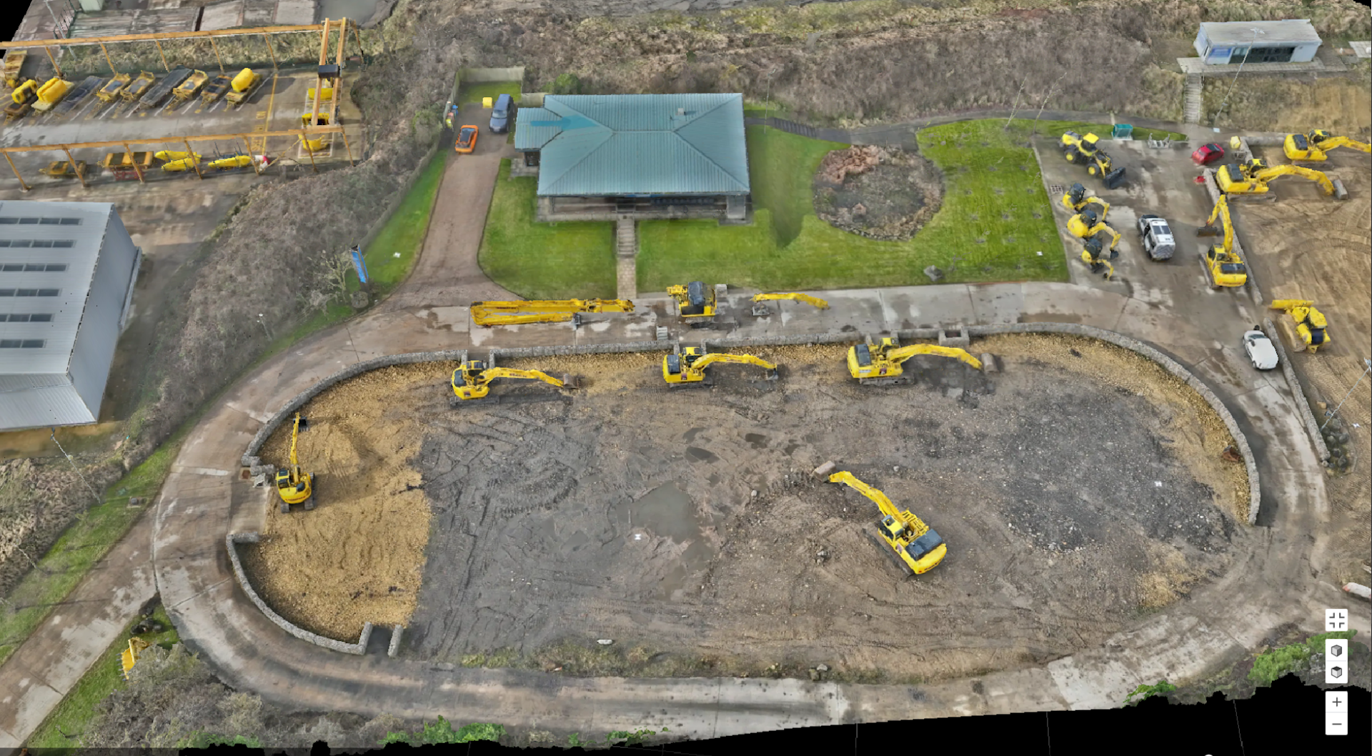
This means that models can be uploaded without having to attend the site.
Cloud Mapping is especially useful for operators mapping with the DJI Dock 2 and DJI M3D drone, which is designed as a high-precision surveying platform.
Furthermore, these models can be annotated, measured, downloaded, and imported into additional software for deeper calculations and analysis.
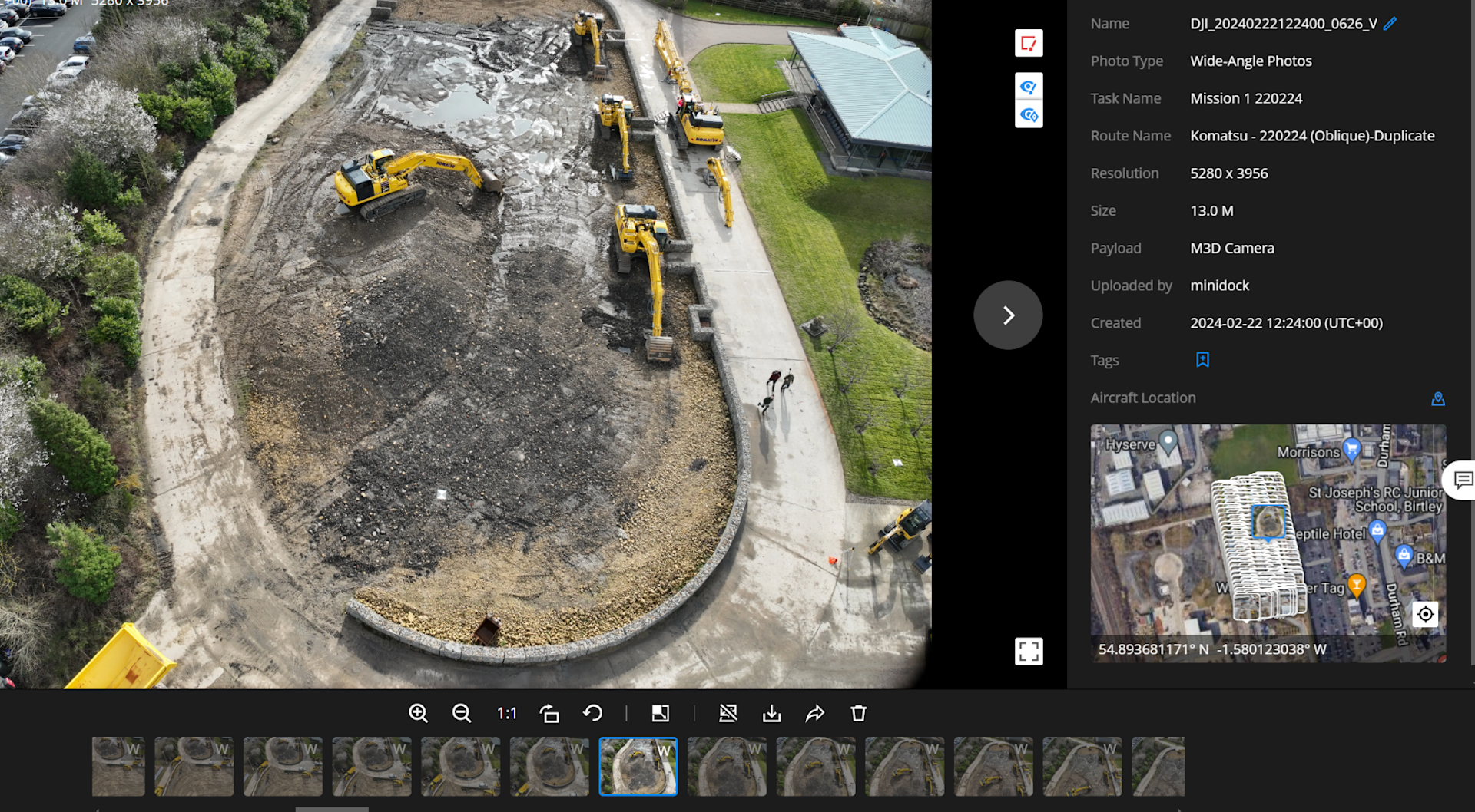
Individual images can also be viewed in the cloud, via the Media File library.
9: Model Comparison
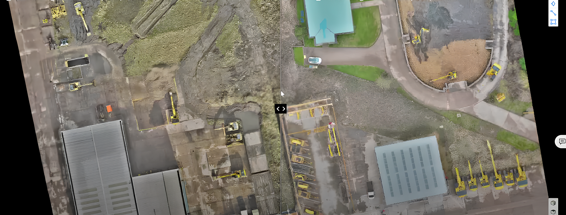
The Model Comparison feature is ideal for applications such as progress monitoring or earthworks movements.
View two models side-by-side to make changes on your survey site easier to visualise.
10: DJI TerraAPI
With DJI TerraAPI, users can integrate the powerful mapping capabilities of DJI Terra into their own dock management systems.
This enables automated 2D/3D reconstruction and customised photo mapping workflows, allowing the operation results of DJI Dock 2 to better meet the needs of a wide variety of industry applications.
DJI TerraAPI is currently available for a free trial. For more information, click here.
11: Open Ecosystem
DJI FlightHub 2 supports the capabilities of the DJI Dock 2 and DJI Matrice 3D drone series to be deployed with a non-DJI ecosystem.
For instance, the DJI Matrice 3D Series integrate with loudspeakers, spotlights and other modules (via the aircraft's E-Port), and these can be remotely controlled via FlightHub 2.
An example is the Sniffer4D: The M3D Series can be integrated with either a multi-gas detection unit or a dedicated methane module.
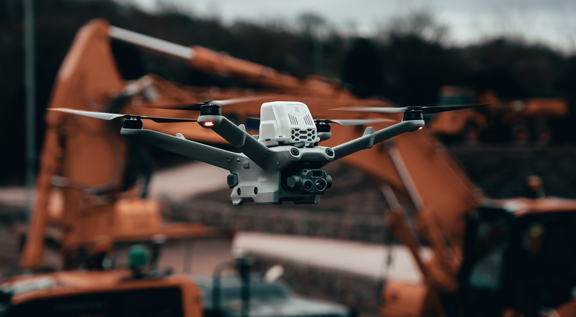
Incidentally, the aircrafts' E-Port Lite supports connection to a parachute (available separately).
FlightHub 2 also supports Cloud-to-Cloud Coordination. Through the FlightHub Sync function, users can link it to a third-party cloud platform for flexible management of operation data.
12: Data Security
DJI FlightHub 2 is built to maintain integrity across multiple levels of the drone and data management process - from device connection and maintenance, to data upload and transmission, to cloud service storage and operational security.
DJI FlightHub 2 uploads, stores and manages data on cloud servers operated by Amazon Web Services, which are compliant to ISO/IEC 27001 security certifications.
Summary
DJI FlightHub 2 is an all-in-one cloud-based platform to empower remote and automated drone deployments with the DJI Dock 2.
It is packed with powerful features, from flight planning to automatic data upload to the cloud, to facilitate scheduled and on-demand data collection.
While BVLOS operations in the UK are not yet standardised, operators can use FlightHub 2 and deploy the Dock 2 drones in VLOS to build a use case ahead of scaling to BVLOS flights.
heliguy™ is a DJI Dock 2 partner and can help you integrate it into your workflows. This includes site planning, maintenance, survey support, training, and OSC consultancy for BVLOS operations. Contact us to find out more.
