News
heliguy™ partners with Terrasolid as end of free trial looms
Drone surveying specialist heliguy™ partners with Terrasolid to offer the industry-leading point-cloud processing software. Terrasolid's free trial of the UAV bundle finishes this year, so current users are encouraged to upgrade now through ... Read More

Drone surveying specialist heliguy****™ partners with Terrasolid to continue to offer the industry-leading point-cloud processing software;
Terrasolid's free trial of the UAV bundle finishes this year, so current users are encouraged to upgrade now;
Terrasolid can be used in conjunction with DJI Terra, but it has additional processing capabilities and a greater suite of features for in-depth analysis;
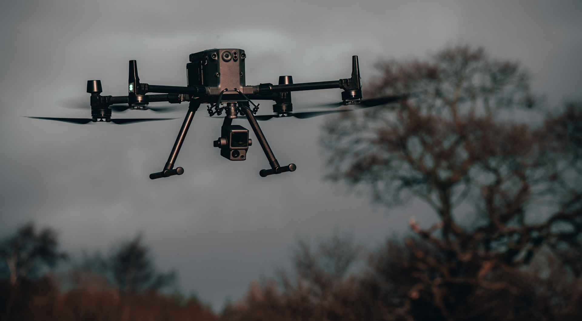
Terrasolid is particularly effective for processing data collected with the DJI Zenmmuse L1;
Purchasing Terrasolid though heliguy™ has several advantages: Our in-house surveying division has used the L1-Terrasolid workflow for project-based data collection and processing and developed a specialist training course which was subsequently distributed by DJI to a global audience.
Drone surveying specialist heliguy™ has partnered with industry-leading software developer Terrasolid to provide an end-to-end workflow for high-quality UAS point-cloud processing.
The partnership offers continuity to heliguy™ clients who have utilised the free trial of the Terrasolid UAV bundle - which finishes at the end of the year and is tailored to DJI Zenmuse L1 data.
Users are now encouraged to upgrade before 2023, to access Terrasolid’s product ecosystem at a discounted price.
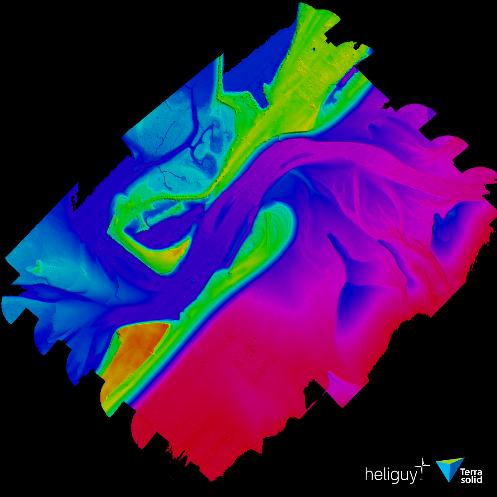
Purchasing the software through heliguy™ has numerous advantages: We are experts in the L1 and Terrasolid platforms - providing supply and support for each; our in-house surveying division has used the L1-Terrasolid workflow for project-based data collection and processing; and produced an L1 LiDAR workflow course - including point-cloud optimisation in Terrasolid - which DJI subsequently distributed for global roll out.
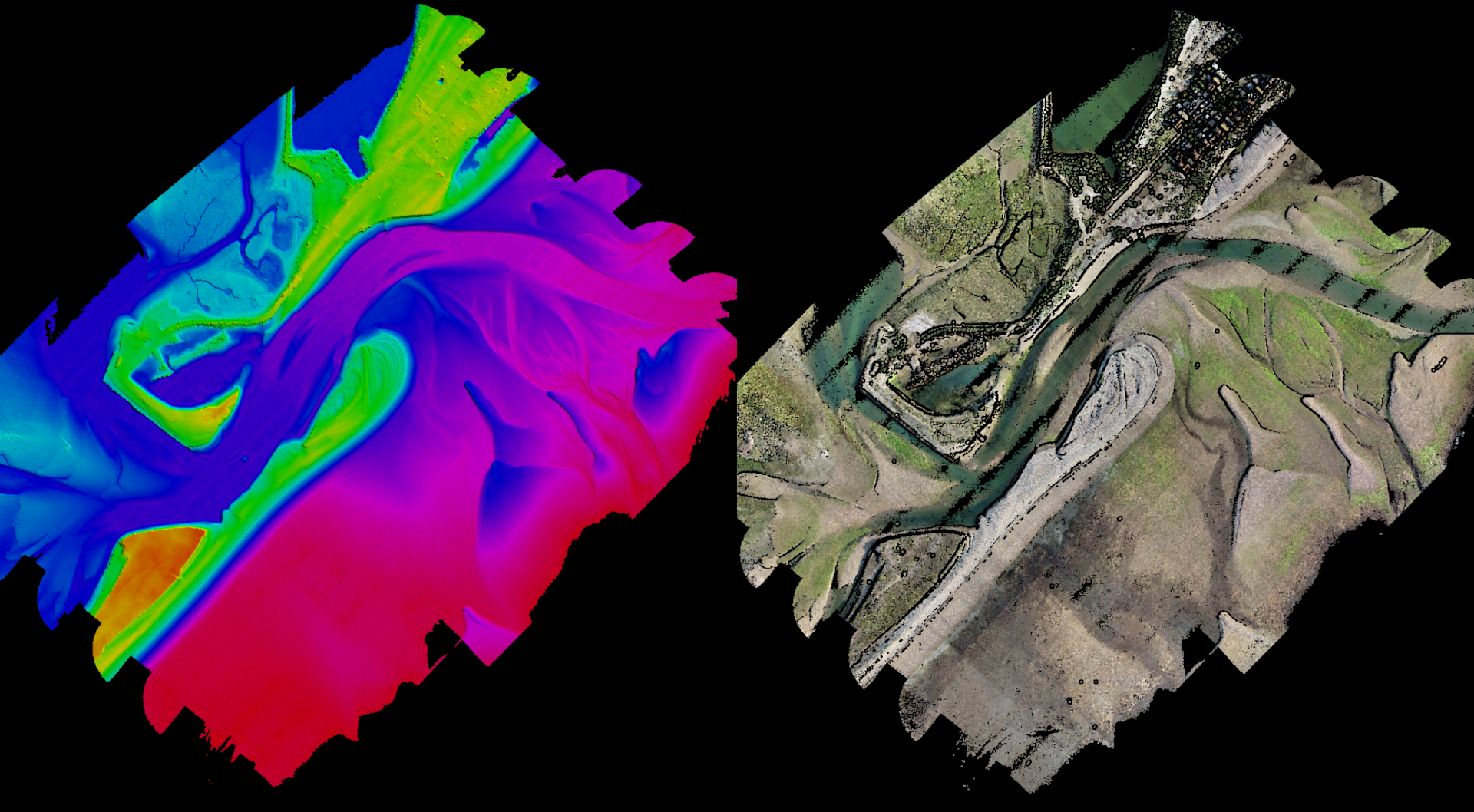
Terrasolid can be used in conjunction with DJI Terra, as a next-step processing tool. However, compared to DJI Terra, Terrasolid offers additional processing capabilities and provides a greater suite of features for in-depth analysis, such as object classification and cleaning.
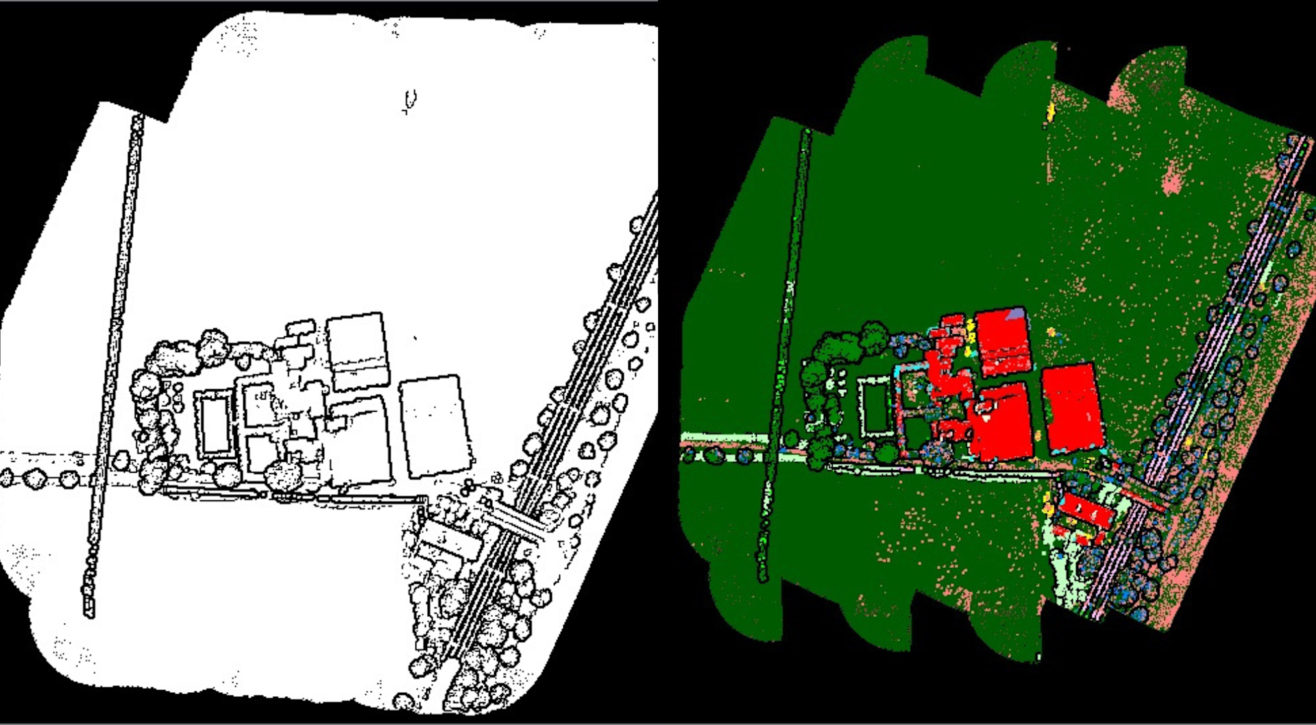
Terrasolid simplifies LiDAR data processing with an automated wizard and the software can enable feature extraction, volumetric calculations, terrain representations, and 3D vector creation.
Multiple licences are available across Terrasolid’s software suite, but heliguy™ encourages users to purchase the TerraScan UAV + TerraModeler UAV bundle - important for mapping missions and replicating the functionality of the free Terrasolid UAV bundle, which includes a highly-automated Wizard for processing L1 aerial survey data.
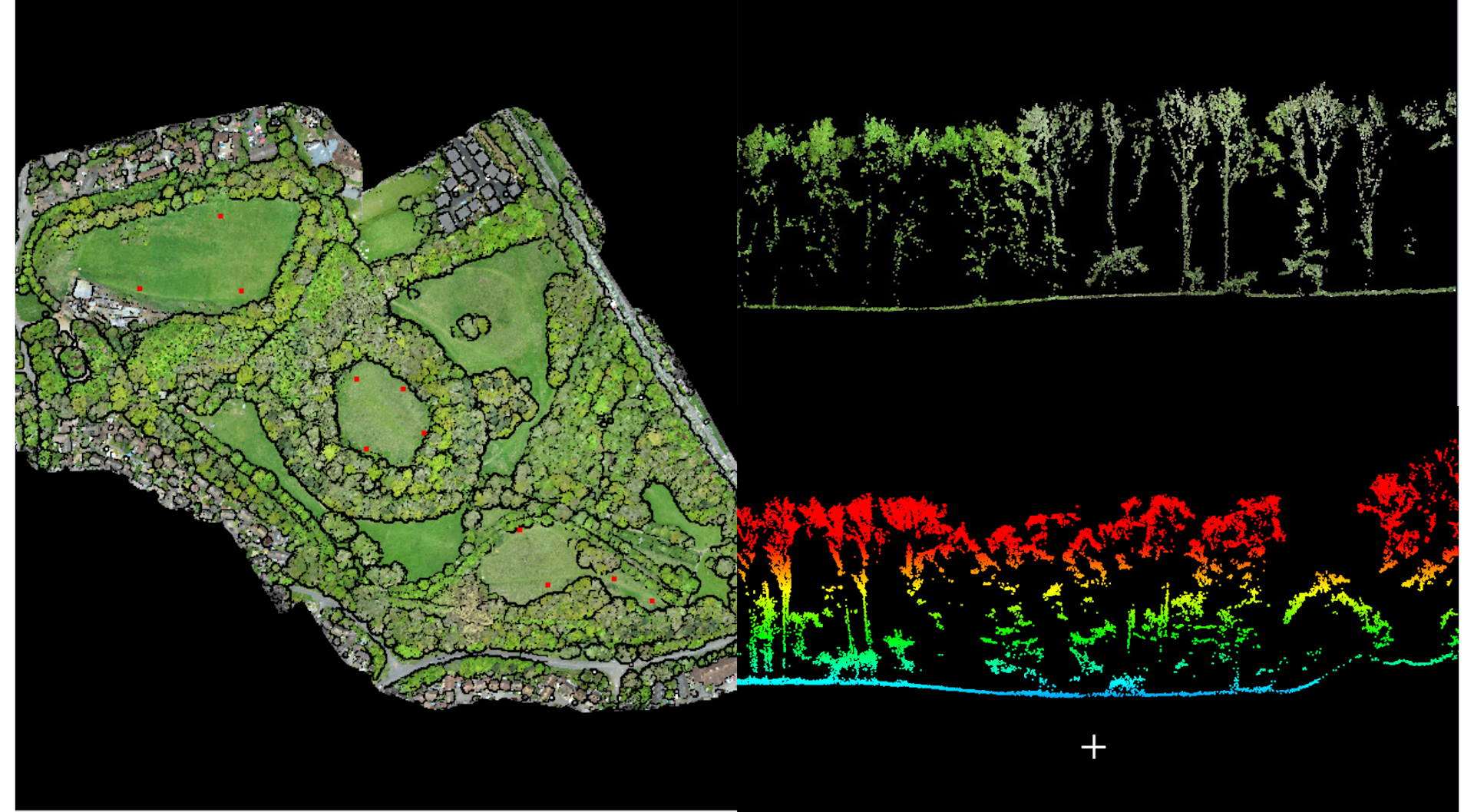
TerraScan UAV: Deliverables include high-quality classified point cloud data or vector data to be used in various engineering and maintenance applications; run corridor analysis; and use classification tools.
TerraModeler UAV: Create, edit, and visualise surface models (TIN). TerraModeler creates surface models from points in TerraScan UAV. The software offers versatile visualisation options including colored shaded surfaces, contour lines, grids, colored triangle nets, elevation texts, slope directions and textured surfaces (in combination with TerraPhoto UAV).
More recently, Terrasolid has added TerraMatch to the automated wizard. TerraMatch - which can be purchased individually, or in a combo with TerraModeler UAV and/or TerraScan UAV - improves the accuracy and quality of the raw laser point cloud.
Ben Sangster, Geospatial Solutions Manager at heliguy™, said: “We are delighted to partner with Terrasolid.
“Through its comprehensive suite of LiDAR data processing and image processing - developed specifically for the demanding requirements of geospatial, engineering, operations and environmental professionals - Terrasolid is the industry-standard software for points clouds and modelling and is used by thousands of people worldwide.
“It has become a key tool for surveyors utilising L1 data, enabling them to process point clouds automatically and seamlessly. Terrasolid is used in conjunction with DJI Terra, and so becomes a key component of DJI's end-to-end drone surveying workflow.
“Terrasolid brings multiple benefits to drone LiDAR data processing, especially with data captured by the L1, and heliguy™ will offer comprehensive support to all of our Terrasolid users.”
Terrasolid makes it easier for users to process L1 data, using a .LAS file written by DJI Terra software, as well as a trajectory solution output from DJI Terra.It can take less than 10 minutes for Terrasolid to read the point cloud, then users can begin to gain deep insights.
This can be done through the specialised drone processing wizard, which not only simplifies DJI L1 data import, but also simplifies typical processing and classification steps which are common for many end products.
Combining DJI Terra with Terrasolid enables surveyors to gain even deeper and more meaningful results, driving more effective decision-making.
