News
Hurricane Dorian: Why Drones Are The Go-To Tool After Freak Weather Events
As Hurricane Dorian threatens the USA after devastating the Bahamas, we take a look at how DJI enterprise drones can play a crucial role in helping safety agencies mitigate the damage and after-effects of freak weather events. ... Read More

As Hurricane Dorian threatens the USA after devastating the Bahamas, we take a look at how drones can play a crucial role in helping safety agencies mitigate the damage and after-effects of freak weather events.
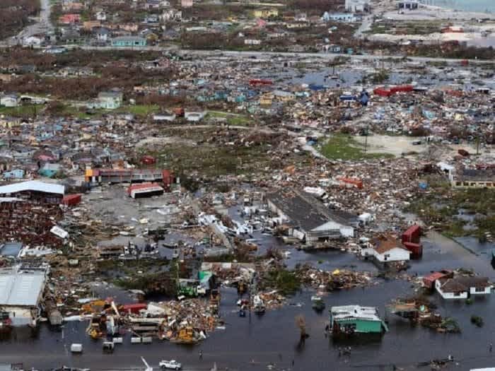
Extreme weather has been increasing in America over the last 50 years, including more heavy downpours and hurricanes. In fact, some of the costliest hurricanes on record have occurred in the last decade; namely hurricanes Sandy (2012), Harvey (2017), Maria (2017), and Irma (2017). And now the raging Hurricane Dorian has left a trail of devastation in its wake, claiming the lives of at least 20 people in the Bahamas.
First responders and utility companies today rely on drones to help people during emergencies, and DJI expects our products will play a critical – even lifesaving – role in responding to this looming disaster (Hurricane Dorian).
Mario Rebello, DJI vice president and North America regional manager,
With severe hurricanes seemingly on the rise, drones have emerged as the go-to tool for the emergency services to bolster their recovery plans and aid their rescue efforts - offering useful aerial perspectives which provide key decision-makers with vital situational awareness quickly, effectively, cheaply and safely.
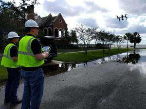
DJI enterprise drones - as sold by DJI Gold Partner Heliguy - are ideal for such rescue efforts, including the M200 Series which can carry a host of payloads - such as the Z30 zoom camera and XT2 thermal sensor - and the Mavic 2 Enterprise, which is a lightweight aircraft for quick deployment.
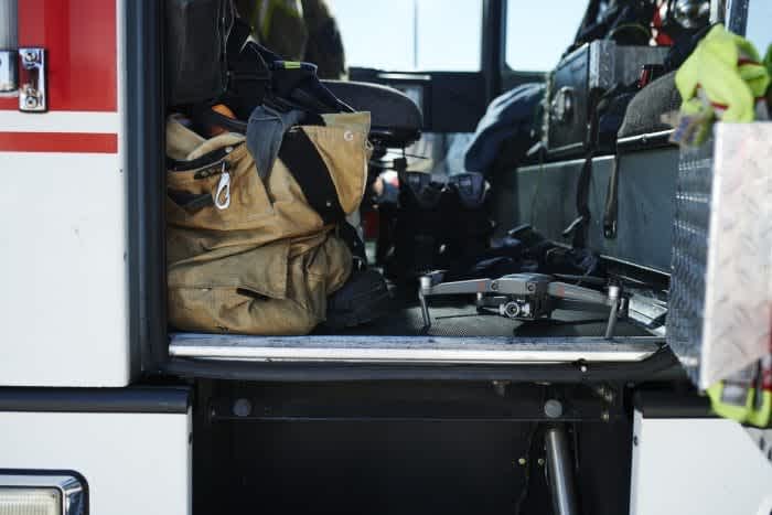
The DJI Mavic 2 Enterprise.
In this Heliguy Insider blog post, we take a look at the advantages of using drones for post-disaster response and real-life examples of when drones were used following some of the most devastating hurricanes in recent memory.
Drones Versus Traditional Methods
Drones are transforming the way that emergency services and key agencies act after a hurricane, quickly replacing traditional response methods. After all, relying on helicopters or grounds crews comes with its challenges.
Yes, helicopters offer aerial views, but technicians might miss issues as they fly by at 40 miles per hour.
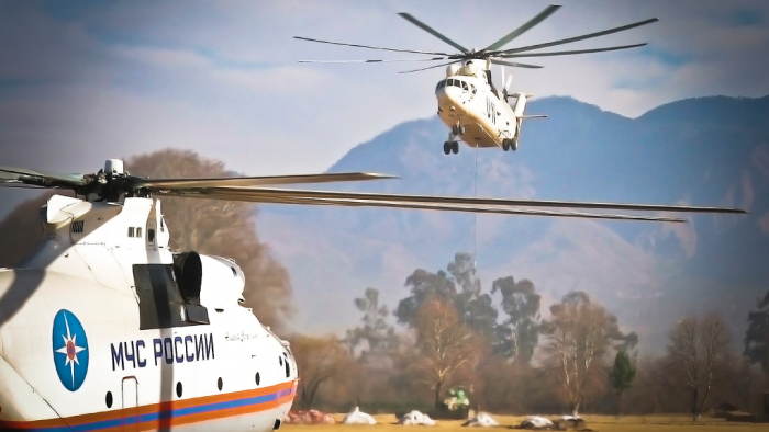
This method can also be expensive, not to mention dangerous, with missions impacted by lingering bad weather or cloud cover, while pilots might be required to manoeuvre their helicopters without colliding with hard-to-see lines or transmission towers.
Meanwhile, ground crews often have trouble accessing the areas they need to inspect due to downed trees and impassable roads, and face dangerous conditions like swampy areas and downed electric lines. It is also a time-consuming process.
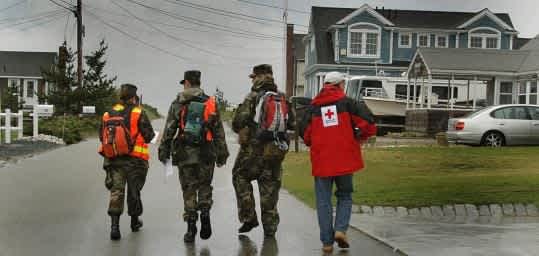
To overcome the challenges associated with traditional hurricane response methods, drones have flown into the mix, offering a cost-effective solution which is quicker and safer than ground patrols and cheaper and less dangerous than helicopter missions.
Having a rugged platform like the DJI M200 Series that can fly in adverse weather conditions was ideal following Hurricane Irma
Thanks to drones, damage of critical infrastructure can be assessed far easier and more efficiently than traditional methods, providing the most up to date and near real-time experience for the incident commanders. Drones can also cover large expanses of land, be deployed fast and access hard to reach areas - all while keeping operators out of harm's way.

Hurricane Dorian - Drones Set To Play Their Part
With Hurricane Dorian bearing down on America's East Coast, there are already reports of the emergency services readying their drones for action.
North Carolina Department of Transportation (NCDOT), for instance, has gone on the record to say that it is assembling teams of people who can fly unmanned aircraft after the storm has passed to collect video and photo images of the damage.
James Pearce, spokesman for the Division of Aviationm said: "As much as possible, we try to get them in position so they’re close to the impacted areas. We want to be ready to go as soon as the storm passes.”
NCDOT first used drones to get a bird’s-eye view of storm damage after Hurricane Florence last autumn. The department deployed 15 teams of two to four people to capture thousands of images at dozens of places where roads were impassable (see image below).
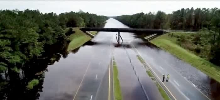
Meanwhile, a few days ago, DJI urged authorised drone users in the southeast United States to prepare their equipment and their operating procedures for the impending arrival of Hurricane Dorian.
The manufacturer said public safety agencies, utility operators, media outlets and other drone users with FAA authorisation to fly DJI drones should prepare now to ensure they can fly in a chaotic post-storm environment without electricity or internet service.
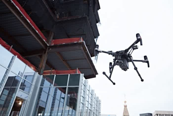
DJI has unlocked its geofencing restrictions for drones operated by Florida Power & Light Company, which serves more than 10 million people across the state of Florida, and is working with other utilities which may be called in to assist recovery efforts.
It was also announced that DJI was working with Florida emergency management agencies and with DJI Enterprise dealers who serve first responders to quickly unlock geofencing for public safety drones in Florida.
Mario Rebello, DJI vice president and North America regional manager, said: “First responders and utility companies today rely on drones to help people during emergencies, and DJI expects our products will play a critical – even lifesaving – role in responding to this looming disaster."
In the Bahamas, drone teams have been tasked with documenting the widespread devastation and damage and offer situational awareness to local Bahamian government officials.
Members of the Airborne International Response Team (AIRT), which provides drone capabilities for disaster response, have teamed up with members of the Southeast Florida Region 7 All-Hazards Incident Management Team (SEFL-R7 AHIMT), to form a joint-reconnaissance team.
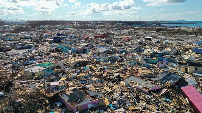
Christopher Todd, Executive Director at AIRT, said: "The debris field at Marsh Harbor was unlike anything I have ever seen. By combining the drone with the latest rapid mapping technology, we were able to produce a highly accurate and incredibly detailed digital map of the hardest-hit areas of Marsh Harbor and the other towns.
“Beyond just search and rescue and damage assessment missions, these types of systems will help us provide a better understanding of what exactly happened, why it happened, and how it might be prevented from happening again in the future."
Case Studies: Drones A Key Player Amid Hurricane Chaos
So, drones have been used in the aftermath of Hurricane Dorian, but it isn't the first time UAVs have been deployed to bolster recovery efforts.
In 2016, with Hurricane Matthew, insurance and telecom companies such as Allstate and Verizon, relied upon drones to assess the damage of critical infrastructure.
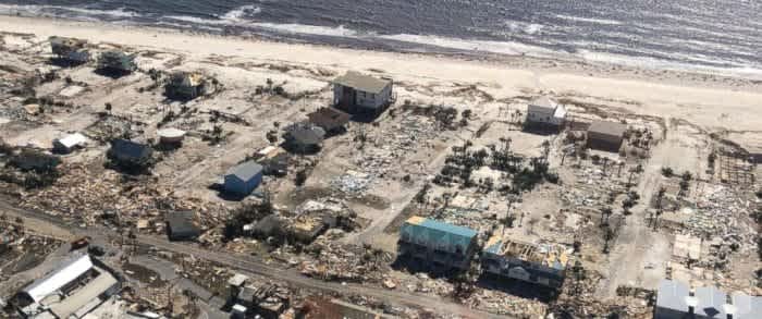
In order to determine connectivity and damage, the telecom company, Verizon, used a drone throughout parts of North Carolina that experienced severe flooding to inspect cell towers.
In Savannah, Georgia, Allstate relied on drones to survey property damage caused by the hurricane.
In 2017, hurricanes Harvey and Irma presented another scenario where drones were utilised to serve in disaster recovery efforts as useful recovery tools.
En route to Florida, Hurricane Irma left thousands of people homeless, and in some cases, similar to the earlier incident with Harvey and Texas-based chemical plant, Arkema, others have been exposed to harmful chemical substances from large refineries wiped out by the hurricane.
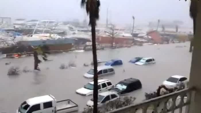
Determined to restore order on the ground, emergency management teams and first responders were hard at work, utilising drones to give them an aerial perspective and assessing the damage of critical infrastrucuture, enabling key decision-makers to take action.
Drone teams conducted more than a thousand missions, covering in excess of 300 miles of hurricane-damaged terrain, to try to limit the effects of Hurricane Irma.
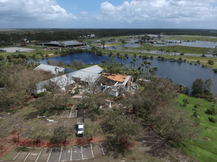
This imagery provided the most up to date and near real-time experience for incident commanders and the pictures were able to be catalogued.
Cameras, especially with long-range zoom and thermal imaging capabilities, were utilised extensively during these operations, with the rugged DJI M200 Series - which can carry payloads such as the Z30 zoom and XT2 thermal - proving its worth.
Meanwhile, drones helped insurance inspectors improve safety, gather better data and jumpstart efforts to rebuild the Caribbean island of St Martin following Hurricane Irma - which took a good brunt of the storm and saw the vast majority of its buildings damaged.
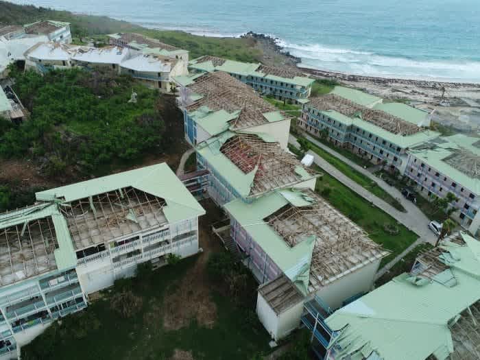
It meant that claim adjusters needed to inspect each structure and estimate the cost of repairs before insurance companies could begin to help the island’s residents get back on their feet.
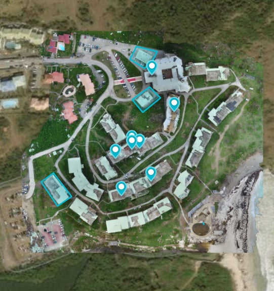
From the ground, this would take months. But, by using drone maps to assess the structural damage caused by the hurricane, insurance inspectors shortened that process to days – all while improving safety, data collection and turnaround time for the claims process.
The drone maps helped to create a common set of data and a clear record of the damage, helping everyone involved stay organised and on the same page throughout the process. Each map could also be geotagged, with a clear record of the exact time, date and location.
Conclusion
The ever-increasing use of drones for disaster response mirrors the rise of drones across the larger world of enterprise, from construction to public safety.
And it's no coincidence either. Drones yield numerous benefits for the emergency services in the wake of a freak weather event, like a hurricane, compared to more traditional methods.
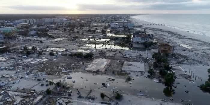
They can be deployed quickly, easily and cheaply, providing real-time information and unique views which are vital to decision-makers – all while keeping crews away from danger.
Drone technology has certainly been something of a game-changer when it comes to reacting to a major disaster.
To discuss how Heliguy can launch, support or scale your enterprise drone programme, contact us by email or phone.
