

- A guide to ground control points: What they are and how to place them;
- GCPs are noticeable spots with known coordinates on the ground. They help with high-precision drone mapping;
- A GCP must be visible from the ground and evenly located throughout the survey area;
- After placing a GCP, you need to measure its position. Do this using an RTK or PPK-capable GNSS receiver;
- A drone with PPK or RTK reduces the number of required ground control points, but we recommend laying them, as our accuracy report suggests.
If you are planning to do precise drone mapping, you will need to prepare ground control points for your project.
This blog will explain what ground control points are and how to place them.
What Is A Ground Control Point?
Ground Control Points (GCPs) are well noticeable spots with known coordinates on the ground in your area of interest.
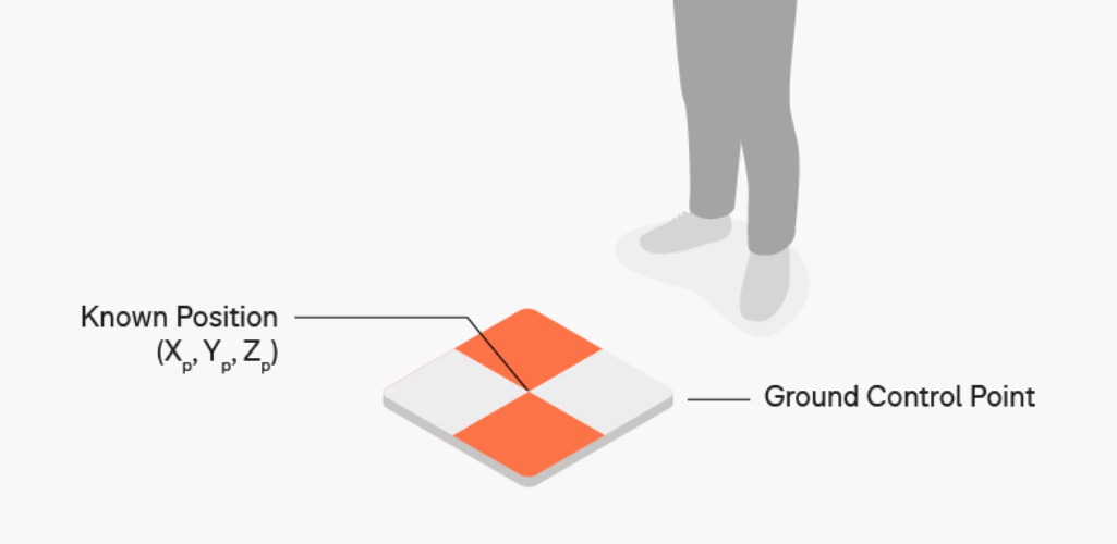
They are used as reference points to establish an accurate position of photogrammetric or LiDAR data to a coordinate system you’re working in.
Ground control points help deliver as accurate an aerial map as possible. These points are important to surveyors because they are set with absolute accuracy. This means that a point correlates to a true value, such as a GPS coordinate.
If you conduct a drone survey and you need to achieve a high accurate positioning result there is no work around than using GCPs.
Even if you use PPK or RTK on a drone, it is still recommended to use a few GCPs to ensure the accuracy of your project.
Having flown the DJI Phantom 4 RTK, Terra Drone Europe believes that in some cases the accuracy that can be achieved without any GCPs is less than 3-4cm. Read the accuracy report here.
For instance, test results indicate that in a 1:500 aerial surveying operation without GCPs, the drone can achieve a horizontal accuracy of 3cm and a vertical accuracy of 5cm - meeting the requirements of aerial surveying without GCPs.

However, when in need of greater accuracy, it is advisable to use a number of ground control points (three or four, depending on the size of your site, as pictured above, with GCPs being the red dots) - but it is still a reduction compared to traditional surveying methods.
Ground Control Points: Main Requirements
There are a number of requirements for ground control points.
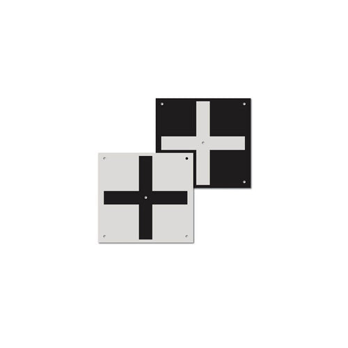
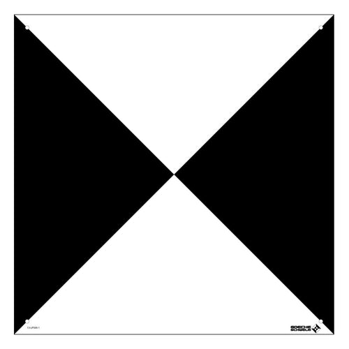
The main requirement for a ground control point is good visibility so you can find it on your photos - as this image demonstrates.

Typically, a GCP should be around half a metre by half a metre - 2ft x 2ft - and painted in highly contrasting colours to differ from the surroundings. Its centre point should also be easily identified.

You can create GCPs yourself, or buy them. heliguy™ stocks a range of Ground Control Points, such as the RSL512 Ground Control Target or the Goecke Ground Control Point.
Basic Rules Of Placing GCPs for Surveying Accuracy
The number of GCPs you require depends on the size and topology of your survey site. However, we suggest using at least three GCPs.
It is important that all GCPs are evenly allocated through your survey area.
So, if you use five points, set one in each corner of your site, and the last one in the centre of the survey area.

If your working area has noticeable elevation changes, try to place GCPs at the highest and lowest points on site.
Ensure the GCPs are securely placed so their position remains stable and cannot be easily moved.
Make sure GCPs are clearly seen from the air and not covered by vegetation and other obstructions.

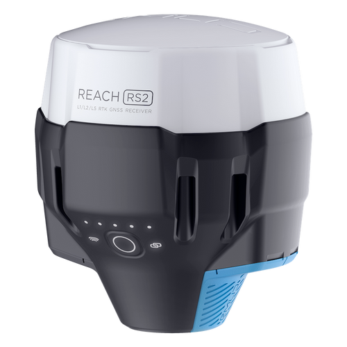
After you place a GCP, you need to measure its position.
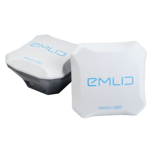
To do it, use an RTK or PPK capable GNSS receiver, such as the Emlid Rerach RS2 or Reach RS+.

Go to your ground control point and put your pole in the centre of the target to measure the position of the GCP.
As part of this process, it is important that your pole is level and you know the height of your pole.

Ground Sample Distance
When it comes to drone surveying, ground sample distance - or GSD - is another important factor.
GSD is a calculation used to explain how the real world scale established by GCPs translates to a map.
The GSD describes the distance between the centre point of two consecutive pixels on a digital image.
So, if a drone achieves a GSD of 5 cm/px, that equates to one pixel on your digital map corresponding to 5 cm in reality.

Without an accurate GSD, it’s impossible for surveyors to turn all the drone data they collected into usable maps.
Find out more in our guide to Ground Sample Distance.
GCPs vs Manual Tie Points
Notably, GCPs are different from manual tie points, another real world placement that surveyors use.
A manual tie point is a feature that can be seen in multiple aerial photographs. Surveyors identify these points in aerial mapping software like DJI Terra, which uses them to stitch the images together and make a complete photogrammetric map.

While ground control points and manual tie-in points are both essential in surveying, only GCPs match up to real coordinate points.
For this reason, manual tie points can help improve the relative accuracy of a project, but don’t help with absolute accuracy, as their location in space has not been defined.
Ground Control Points - Summary
When it comes to surveying, accuracy is king and can make or break a project.
A drone is a great tool for surveying, but not at the sacrifice of precision and accuracy.
GCPs help in this process, and advancements in UAS technology mean that fewer need to be laid.
Placing them can be time-consuming, but this practice is better and quicker than having to re-do a whole survey which has been hindered by low accuracy.
Contact the heliguy™ in-house surveying team to discuss adding drones to your mapping workflows.

Leave a comment