
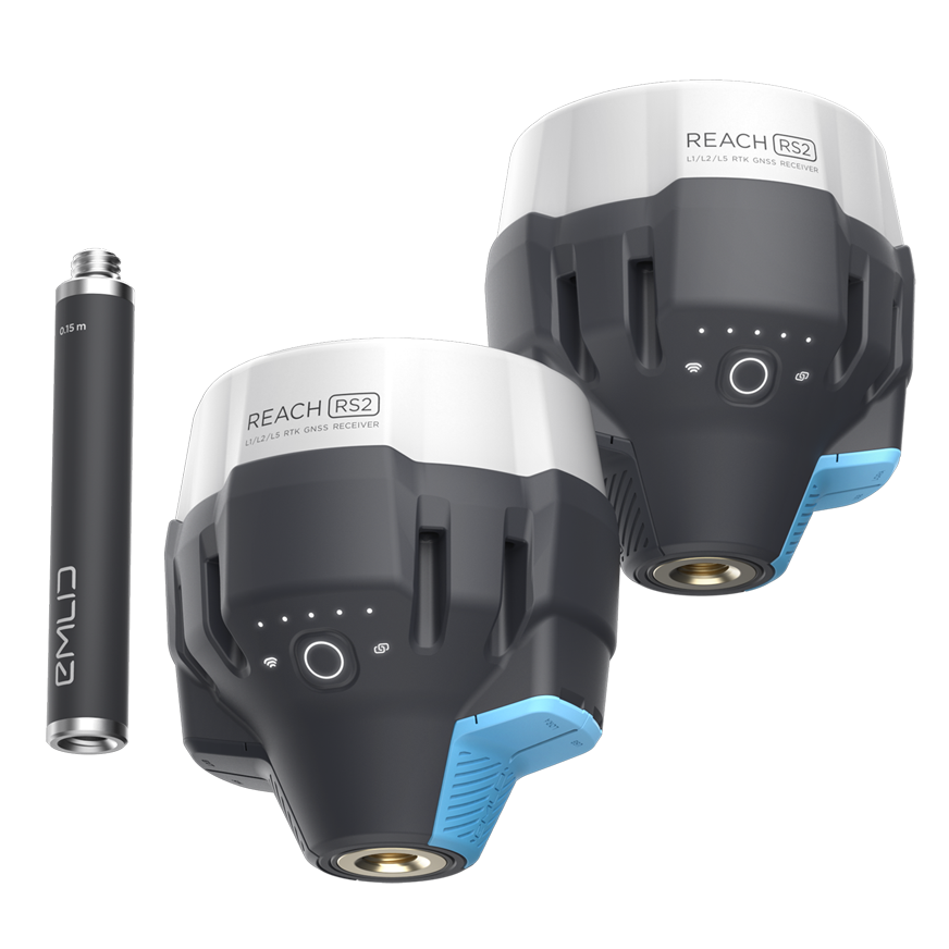


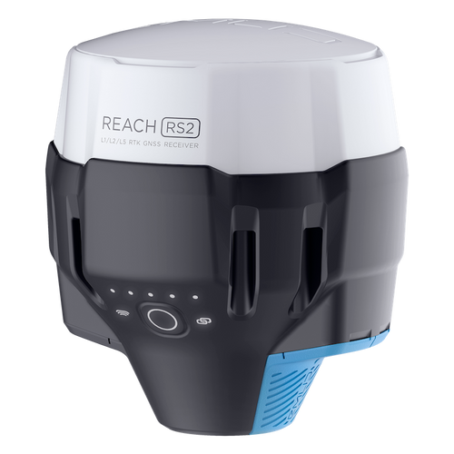
Emlid Reach RS2 GNSS Receiver
Emlid Reach RS2 GNSS Receiver
Multi-band, centimetre-accurate GNSS receiver
The Emlid Reach RS2 is a multi-band GNSS receiver which allows you to collect data with centimetre accuracy.
The receiver gets a fixed position within seconds and is designed to work in RTK (up to 60km) and PPK modes (up to 100km).
With Reach's RINEX logs, obtain accurate coordinates on any point on earth.
Reach RS2 has a built-in cellular modem for hassle-free NTRIP connections in the field.
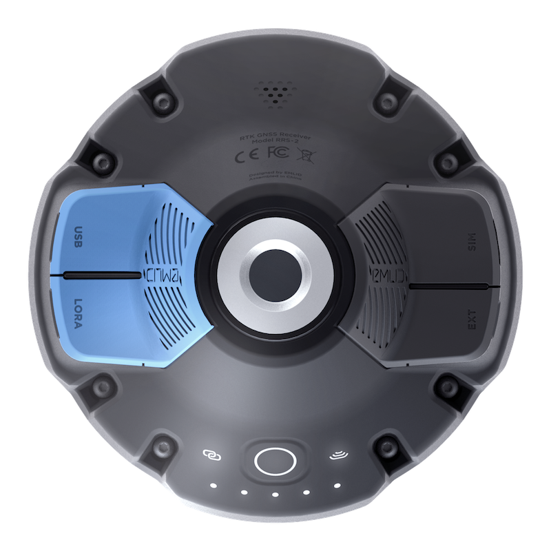
All receivers go with internal LoRa radio working on up to 8km distance. LoRa radio is used to connect rover to base when internet-delivered corrections are not available.
Reach RS2 is engineered to work in the most challenging environments. It has an IP67 rating and is made of polycarbonate.
The battery lasts for 16 hours when working in RTK and for up to 22 hours when logging (in PPK mode).
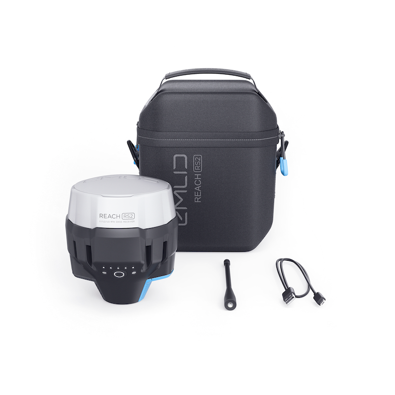
The Reach RS2 can be used with the Emlid Flow app - a user-friendly data collection software.
Deploy the Reach RS2 for surveying, mapping and navigation. It can be used with a drone.
The Reach RS2 is a powerful yet cost-effective solution, compared to other receivers on the market.
Accurate Data Collection
Key features for high-precision surveying
Achieve quality survey results with the Emlid Reach RS2. Key features include:
Gets Fix In Seconds: Reach RS2 gets fixed solution in just seconds and maintains robust performance even in challenging conditions. Centimetre accuracy can be achieved on distances over 60 km in RTK, and 100 km in PPK mode.
Built-in 3.5G Modem: Reach RS2 features a power-efficient 3.5G HSPA modem with 2G fallback and global coverage. Now corrections can be accessed or broadcasted over NTRIP independently, without relying on an internet connection on your phone.
PPP Support: RINEX raw data logs are compatible with OPUS, CSRS-PPP, AUSPOS, and other PPP services so now you can get centimetre-precise results in any place on Earth. Process RINEX files in an online service and get position with absolute accuracy.
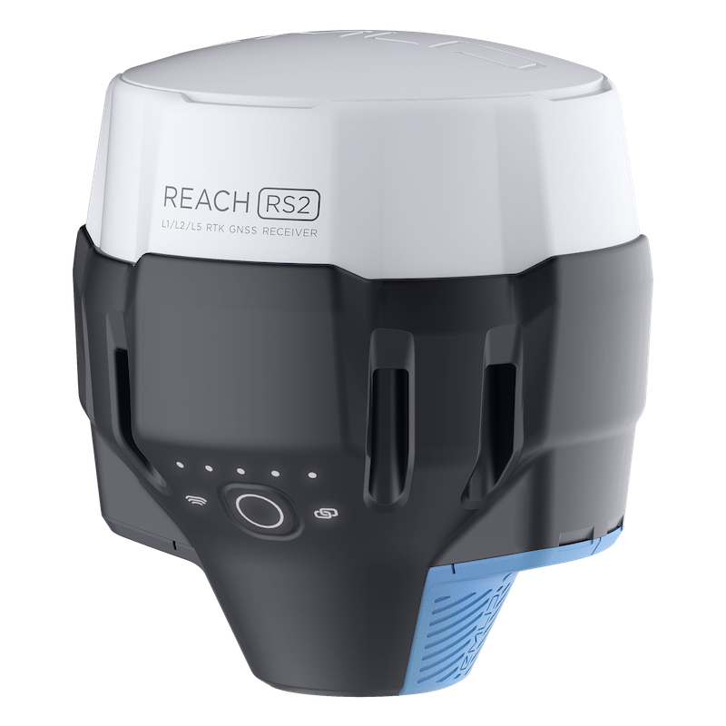
Tough And Robust Design
Collect data - no matter the weather
Engineered to be tough, compact and lightweight, the Emlid Reach RS2 is designed to work in the most challenging environments.
Compact and Lightweight: Measuring 126 x 142 mm, the Reach RS2 has a compact design, enabling it to be carried in a small bag. At 950g, it weighs less than a typical survey pole.
Rugged and Robust: Reach RS2 has an IP67 rating. All of its connectors are completely sealed and protected from water and dust with silicone plugs. It also has a working temperature of -20°С to 65°С, making it a reliable solution in hot or cold conditions.
Long Life: Up to 22 hours of autonomous work when logging data and up to 16 hours as a 3G rover, even in cold weather. Reach RS2 can charge from a USB wall charger or on-the-go via a power bank over USB-C.
Polycarbonate Body: Reach RS2 is impact-resistant. Its body is made of polycarbonate, an extremely durable material that is used in bulletproof glass.
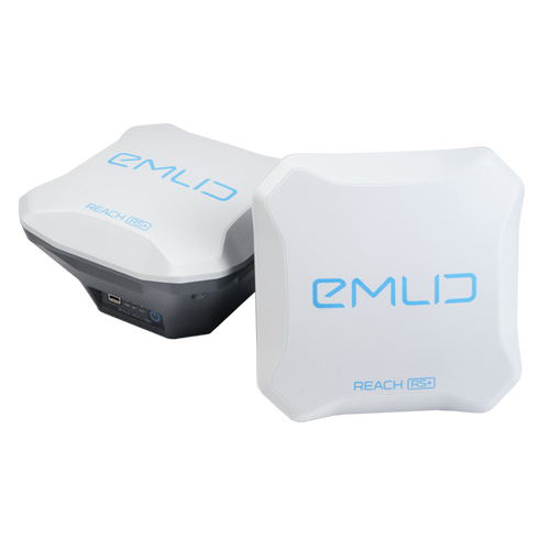
Base And Rover for RTK and PPK
Base Station and Data Collection Module
The Emlid Reach RS2 offers seamless connectivity:
Real-time Navigation: The Reach RS2 can send precise coordinates over Bluetooth or Wi-Fi to your tablet with a lightbar navigation app. The RS-232 interface allows the direct connection of the Reach RS2 to an autosteer system. Solution formats: NMEA, ERB, LLH/XYZ
Base Station Mode: Use the RS2 to set up your own base station. Stream corrections over the network via NTRIP/TCP or LoRa radio (used to connect rover to base when internet-delivered corrections are not available), record base logs for post-processing.
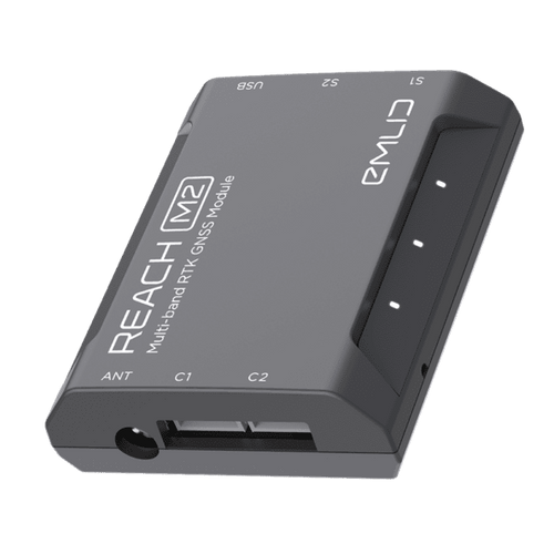
The RS2 works with any number of rovers, and is compatible with the Reach RS+ as well as the M2/M+ RTK GNSS modules for drone mapping.
The RS2 is compatible with any receiver that supports RTCM3 and NTRIP. External radios are supported over RS-232.
UAV Mapping Kits
Both solutions are available as stand alone modules or as part of dedicated UAV mapping kits.
The Reach M2 UAV mapping kit features: Reach M2, Reach RS2, GNSS antenna and accessories.
The Reach M+ UAV mapping kit features: Reach M+, Reach RS+, GNSS antenna and accessories.


Emlid Flow
Emlid Flow is a mobile app for land surveying, which can be used in conjunction with Emlid’s ecosystem of GNSS receivers.
It is an upgraded version of the ReachView 3 app, with new features and the Flow 360 cloud service.
Key features include:
- Linework and coding
- Geoids, grid shifts, custom coordinate systems
- Stake out points and lines
- Base and rover configuration
- Reach receiver monitoring for information on satellite reception, solution status, corrections stream state and battery charge level
- Manage NTRIP profiles
- Raw data logging (RINEX files for PPK workflows)
The app is synchronised with the cloud-based Emlid Flow 360. It allows you to access and manage your survey data from the browser at flow360.emlid.com.
With Emlid Flow 360, you can prepare for the fieldwork from the comfort of your office: Create a project, configure the coordinate system, choose a code library or upload a new one, or just import all the necessary data.


