Products
New Emlid Flow Mobile App For Land Surveying
Emlid has launched Emlid Flow, a mobile app for land surveying featuring new professional survey tools. It is an upgraded version of Emlid's ReachView 3 app, with enhanced features, and the new Emlid Flow 360 brings a cloud-based service to ... Read More

New Emlid Flow app for land surveying;
Enhanced features include linework and coding, while Emlid Flow 360 offers cloud-based functionality for remote survey data management;
Other features include point collection, intuitive stakeout tool, raw data logging, NTRIP profile management, and base and rover configuration;
Emlid Flow is an upgraded version of and replacement for Emlid's popular ReachView 3 app. It can be used with Emlid's range of industry-leading GNSS receivers;
heliguy™ has partnered with Emlid to add their products to our surveying ecosystem to help streamline and bolster end-to-end mapping workflows.
Emlid has launched Emlid Flow - a mobile app for land surveying featuring new professional survey tools.
Emlid Flow is an upgraded version of Emlid's ReachView 3 app, with enhanced features.
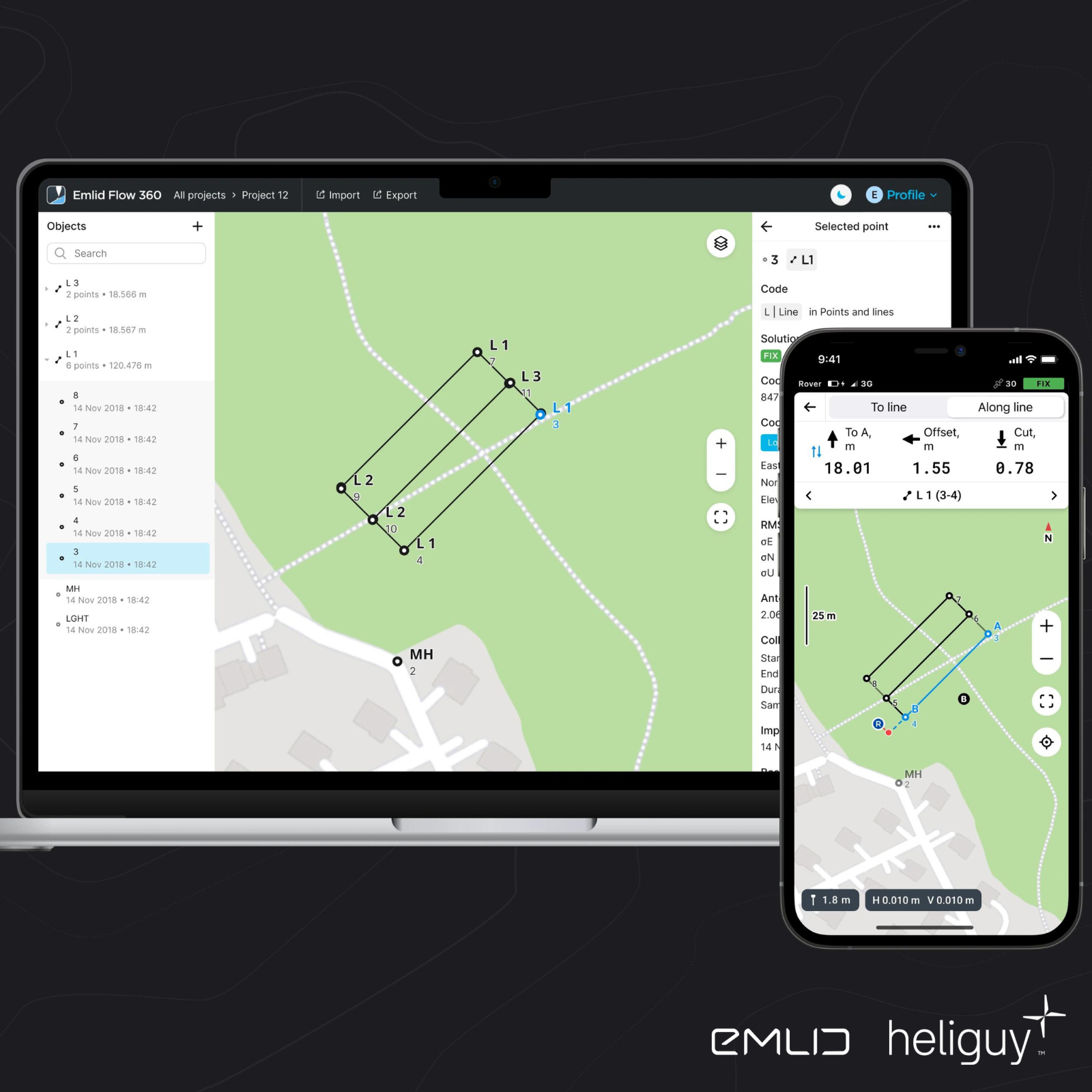
The app has enhanced functionality for fieldwork with easy-to-use linework and coding, while the new Emlid Flow 360 brings a cloud-based service to enable the remote management of survey data.
Emlid Flow and Emlid Flow 360 simplify workflows in the field and the office. A free standard version is available, or take out a paid-for subscription to access the Survey package, which has more features.
heliguy™ has partnered with Emlid to add the company's range of industry-leading GNSS receivers, such as the Reach RS2+, to our surveying product ecosystem to help professionals streamline and bolster their end-to-end surveying workflows. The new Emlid Flow can be used in conjunction with Emlid receivers.
Emlid Flow: Key Features
The updated app brings new options for geospatial professionals, featuring long-awaited features to increase productivity.
Linework
With Emlid Flow, you can now create linework on the go. Measure and move ahead with just a few taps. Make data collection a breeze using predefined geometry types or a full-blown code library. The linework is displayed immediately, so you can always see how your project is progressing.
While staking a line using Emlid Flow visual guides, you can easily navigate to a line, and stake out a line with an offset and with a chainage.
Coding
Emlid Flow supports the coding of points and lines during collection in the field. This enables you to measure and describe objects seamlessly.
Upload your custom code library or use a standard one built into Emlid Flow, which has more than a hundred codes available from the start.
There's no need to type the description for each point and line, just choose a code from a library at your fingertips. You can quickly switch between different object codes, start or continue collecting the lines, and create new codes on the go right in your survey project.
Satellite Map View
One more new feature brings several map layers. Now you can switch between a standard map and satellite imagery.
**Please note that the Linework, Coding, and Satellite Map View are only available with the paid-for Survey package.
Efficient Data Collection And Stakeout
These next set of features are available with the Standard and Survey packages.
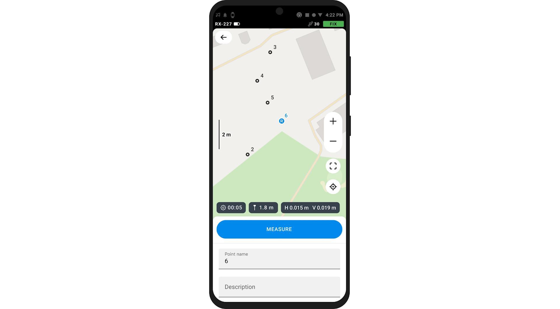
Point Collection
Collect points, write detailed descriptions, and perform quality control using the responsive interface. The app has built-in support for projections, grids, and geoids and a library with hundreds of verified coordinate systems.
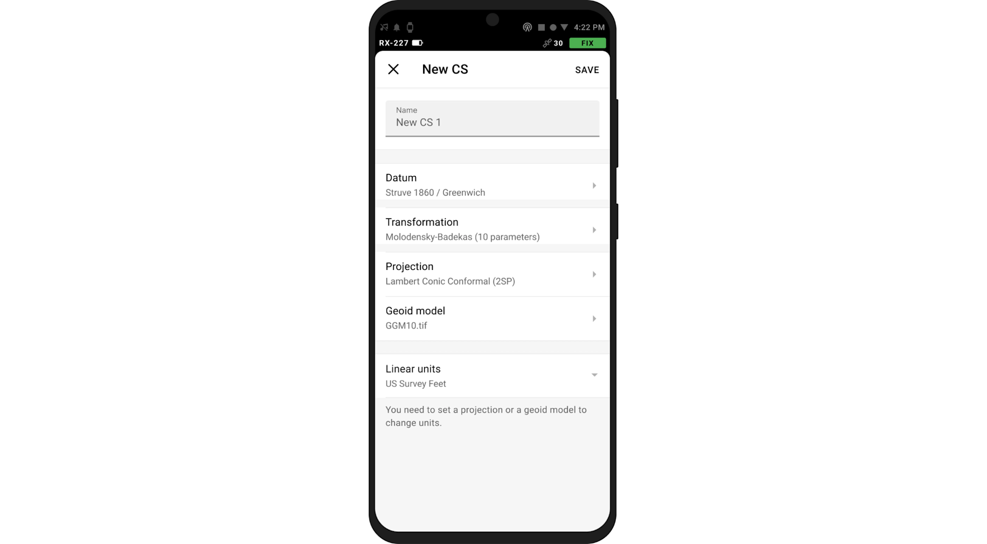
Coordinate Systems Wizard
Emlid Flow has a wizard for manual coordinate system creation for areas without a predefined coordinate system. To start your survey, you just need to specify the datum, enter transformation parameters or projection, and choose your geoid.
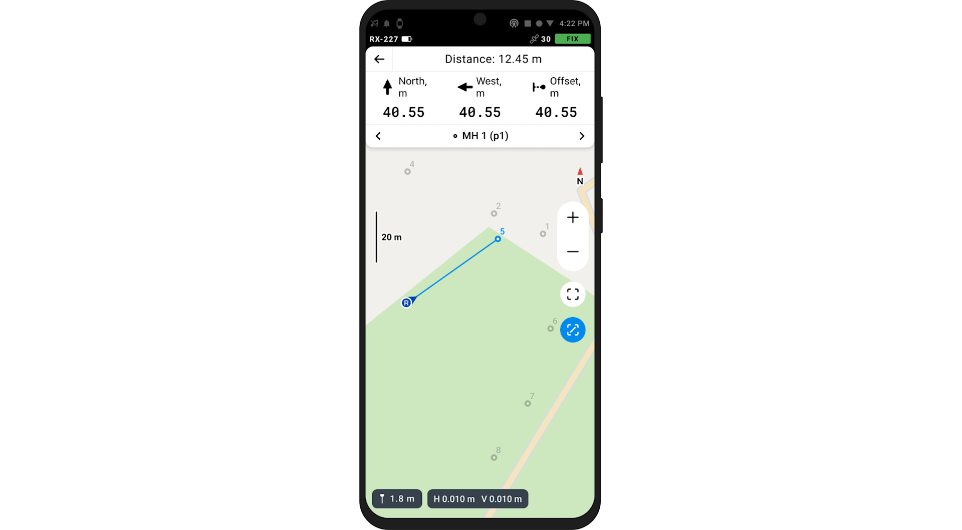
Intuitive Stakeout Tool
Emlid Flow displays East-North and straight-to-line distances and supports cut and fill indication. When you get close to a point, the indication switches to a close-up alignment mode helping you to centre exactly above the point.
Additionally, the app comes with a close-up alignment tool for when you need to be precise.
Emlid Flow With Reach Receivers
Use Emlid Flow to configure and control your Reach receivers: Available with the Standard and Survey licences.
Monitor Reach Receivers
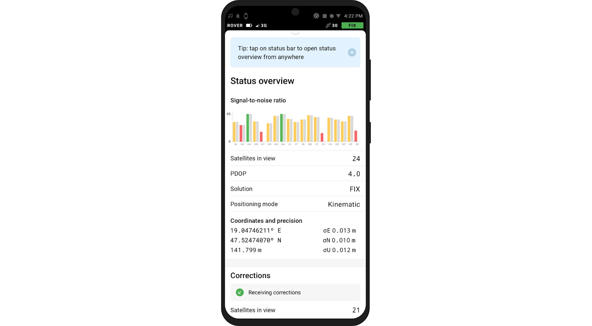
All the necessary status information is available at your fingertips: Satellite reception, solution status, modem reception, corrections stream state, and battery charge level.
Configure Your Base And Rover
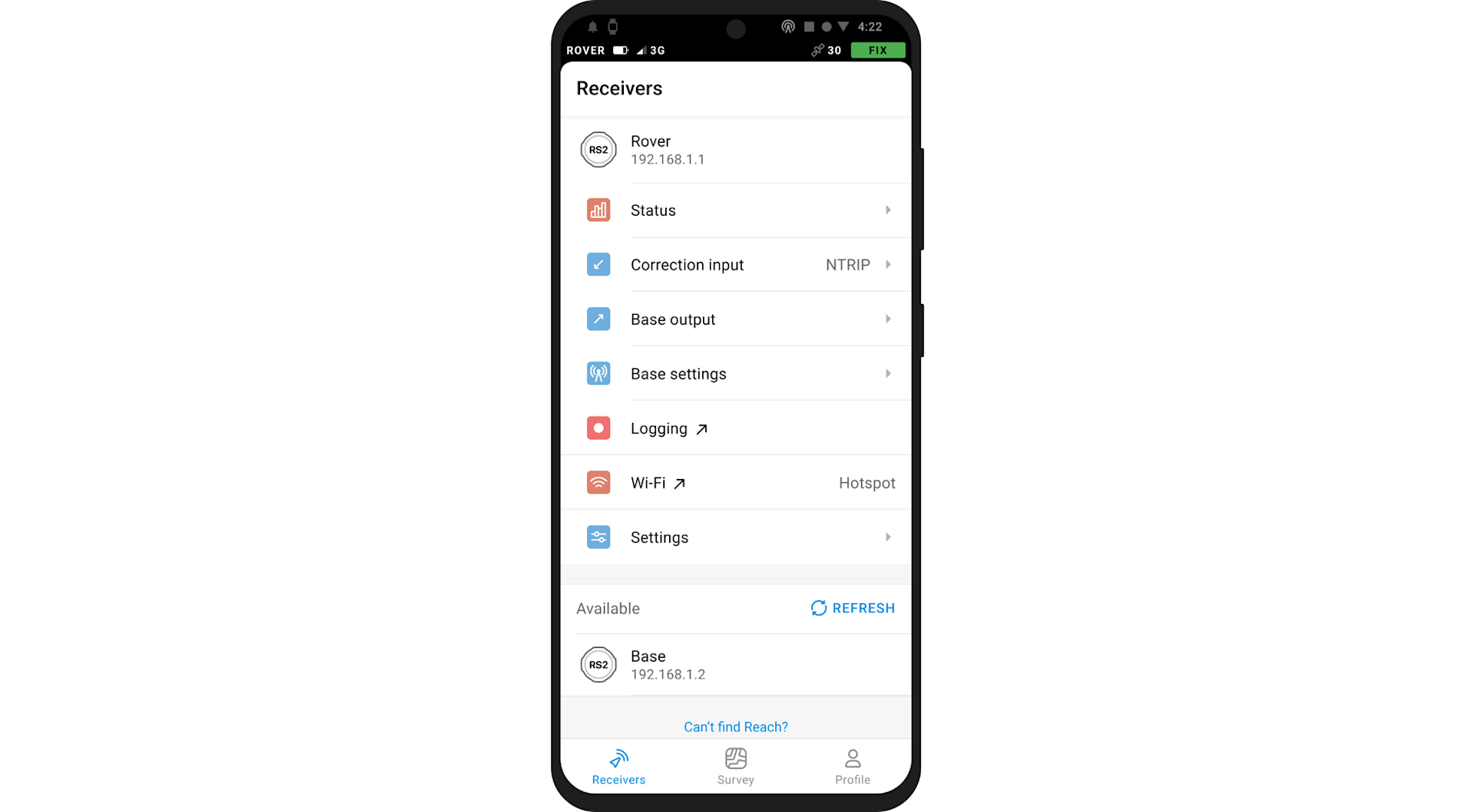
Emlid Flow allows you to set up your Reach receivers for any scenario. Pick correction sources, set up your base station, and fine-tune settings, all within a few clicks.
Manage NTRIP Profiles
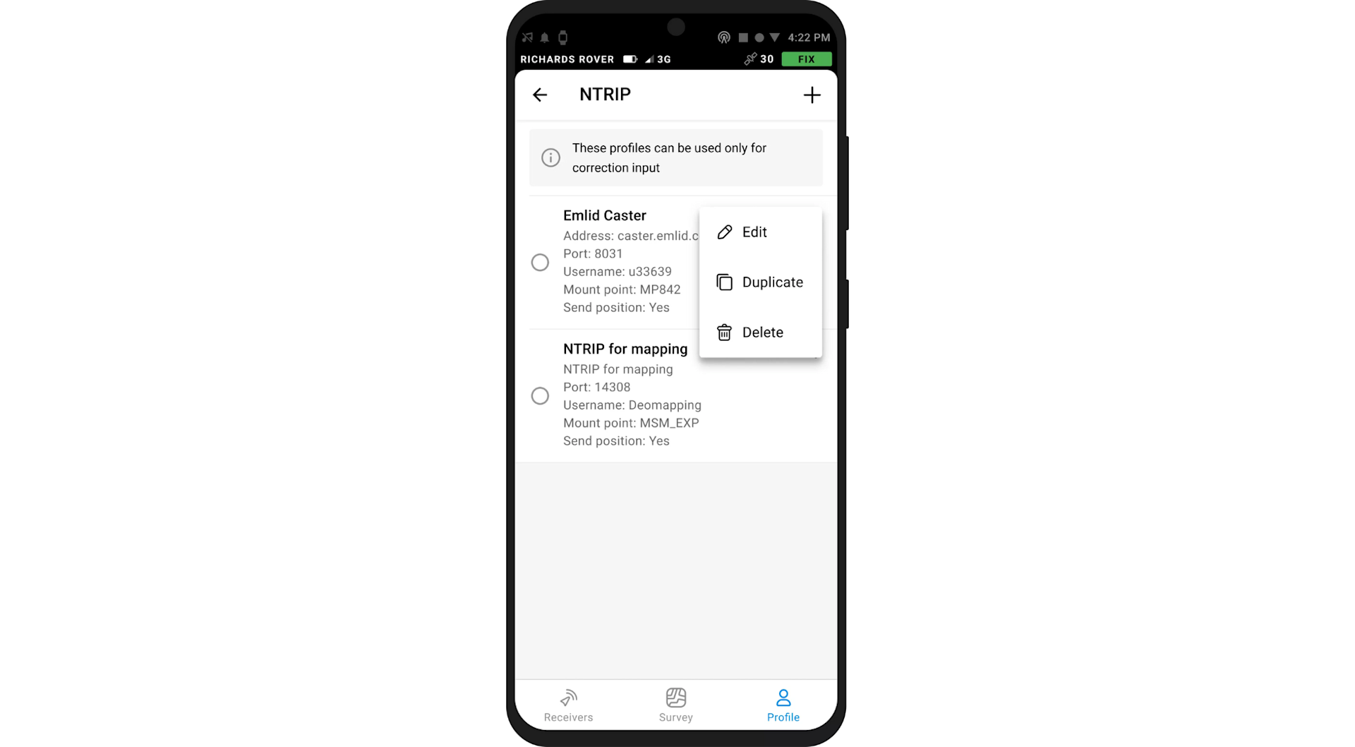
Store all accounts for NTRIP services in one place. You can use the same correction input settings for several Reach units after only entering the credentials once.
Raw Data Logging
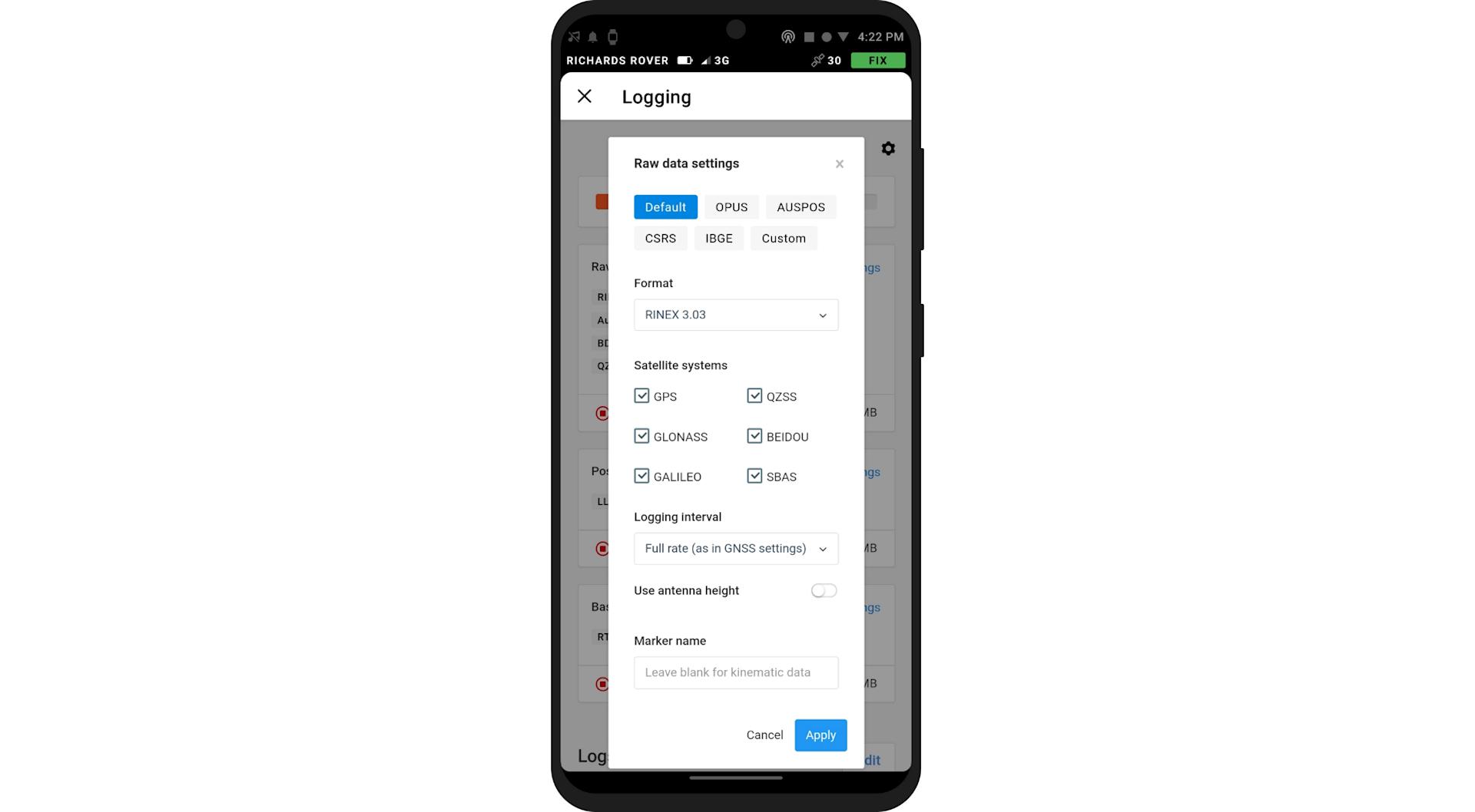
All Reach receivers of the RS- and M-series log industry-standard RINEX files for PPK workflows. Reach-produced RINEX logs from multi-band Reach receivers are compatible with popular PPP services, so that you can get centimetre-precise results anywhere on Earth.
Emlid Flow 360
Your app is synchronised with a cloud-based service, Emlid Flow 360. It allows you to access and manage your survey data from the browser at flow360.emlid.com.
With Emlid Flow 360, you can prepare for the fieldwork remotely: Create a project, configure the coordinate system, choose a code library or upload a new one, or just import all the necessary data.
It is immediately available inside the Emlid Flow app. No need to check if the latest version is on the collector because it syncs automatically for each linked project.
When the fieldwork is done, there is no need to manually transfer files from controllers: Just log in at Emlid Flow 360, and all your field data will be safely backed up here.
The app can work offline and synchronise data to Emlid Flow 360 as soon as your phone is back online. From the cloud service, you can export or import projects in DXFs, Shapefiles, and flexible CSVs just like in Emlid Flow.
Emlid Flow Subscriptions And Features
All the features previously available in the ReachView 3 app moved to Emlid Flow and remain free with the Standard subscription plan.
As before, Emlid Flow enables you to configure Reach receivers, collect and stake out points, export and import data in CSV, DXF, and Shapefile formats. The free Standard plan also includes the core features of Emlid Flow 360: Sync with the app, create projects, and export and import data.
Emlid will continue delivering updates available for free to enable users to easily handle the fieldwork with the Emlid Flow app and keep data in sync with Emlid Flow 360.
To access new features, subscribe to the Survey plan - bringing features such as linework and coding, and with more innovations on the horizon.
A single subscription works across both Emlid Flow and Emlid Flow 360, and can be purchased by paying monthly or annually. The annual subscription Survey plan is available with an annual subscription that you can buy in Emlid Flow 360. Or a monthly package - offering more flexibility for users to pay for just those months when they need it - is available for purchase in Emlid Flow 360, App Store, and Google Play. Local taxes may apply.
Standard | Survey | |
Emlid Flow | ||
Collect and stake out points | ✓ | ✓ |
Choose coordinate systems, geoids, and grid shifts | ✓ | ✓ |
Add custom coordinate system | ✓ | ✓ |
Export and import in CSV, DXF, SHP | ✓ | ✓ |
Control your Reach receivers | ✓ | ✓ |
Use a built-in NTRIP client | ✓ | ✓ |
Collect and stake out lines | X | ✓ |
Add codes on the go | X | ✓ |
Switch to a satellite map | X | ✓ |
Emlid Flow 360 | ||
Manage projects with the app | ✓ | ✓ |
Export and import in CSV, DXF, SHP | ✓ | ✓ |
Add custom code libraries | X | ✓ |
Price | Free forever | Pay monthly or annually. Prices vary depending on where you purchase from. Prices via flow360.emlid.com are: £20, per month, paid monthly; or £20, per month, £240 paid annually. |
How To Subscribe | No account is needed: Sign up for free | Free Emlid account is needed: Free 14-day trial available |
Existing installations of ReachView 3 will automatically update to Emlid Flow with the Standard subscription plan. In case you disabled automatic updates on your device, you can manually update the app in Google Play or App Store.
If you want to try the new Emlid Flow features, subscribe and get the free 2-week trial of the Survey plan. You can cancel your subscription anytime and get back to a Standard plan free of charge.
To find out more about Emlid's Flow and Emlid's range of GNSS receivers, contact the heliguy™ GIS team.
