Products
GeoSLAM Updates Connect Software
GeoSLAM has updated its Connect LiDAR data processing software. GeoSLAM Connect 2.3 features improvements to the Stop and Go Georeferencing workflow, and new ways to automatically georeference a point cloud. ... Read More
GeoSLAM has updated its GeoSLAM Connect software to further improve surveying workflows;
Developments to georeferencing workflows are the primary focus of Connect 2.3;
The release includes improvements to the Stop and Go Georeferencing workflow, and new ways to automatically georeference a point cloud;
heliguy™ has partnered with GeoSLAM to offer its range of handheld and drone-mounted LiDAR scanners, and associated software solutions.
GeoSLAM has updated its GeoSLAM Connect software - with new and improved features to aid LiDAR surveying workflows.
The release includes improvements to the Stop and Go Georeferencing workflow, and new ways to automatically georeference a point cloud.
Key upgrades within Connect 2.3 include:
Adjust to Control updates;
Reflective target georeferencing and alignment;
ZEB Vision calibration tool;
My GeoSLAM access from within Connect.
heliguy™ has partnered with GeoSLAM to offer its range of handheld and drone-mounted LiDAR scanners, and associated software solutions.
This blog explores the new features of Connect 2.3.
GeoSLAM Connect 2.3: Key Features
GeoSLAM Connect 2.3 delivers intuitive workflows for the users of GeoSLAM hardware.
GeoSLAM Connect is a software platform that allows for 3D visualisation of data and workflow automation. With the push of a button, data can be automatically processed, saved in a predesignated folder of choice, and prepared for the next step of a user’s workflow, such as taking it into GeoSLAM Draw or third-party software.
The key upgrades within Connect 2.3 are detailed below.
GeoSLAM Connect 2.3: Adjust To Control
Connect 2.3 provides improvements and incorporations to Adjust to Control, that complement the already existing Stop and Go Georeferencing workflow.
This provides users with more control over the way their data is georeferenced.
The new tool visualises control points and gives users more options when matching stationary points in their scan data to measured positions.
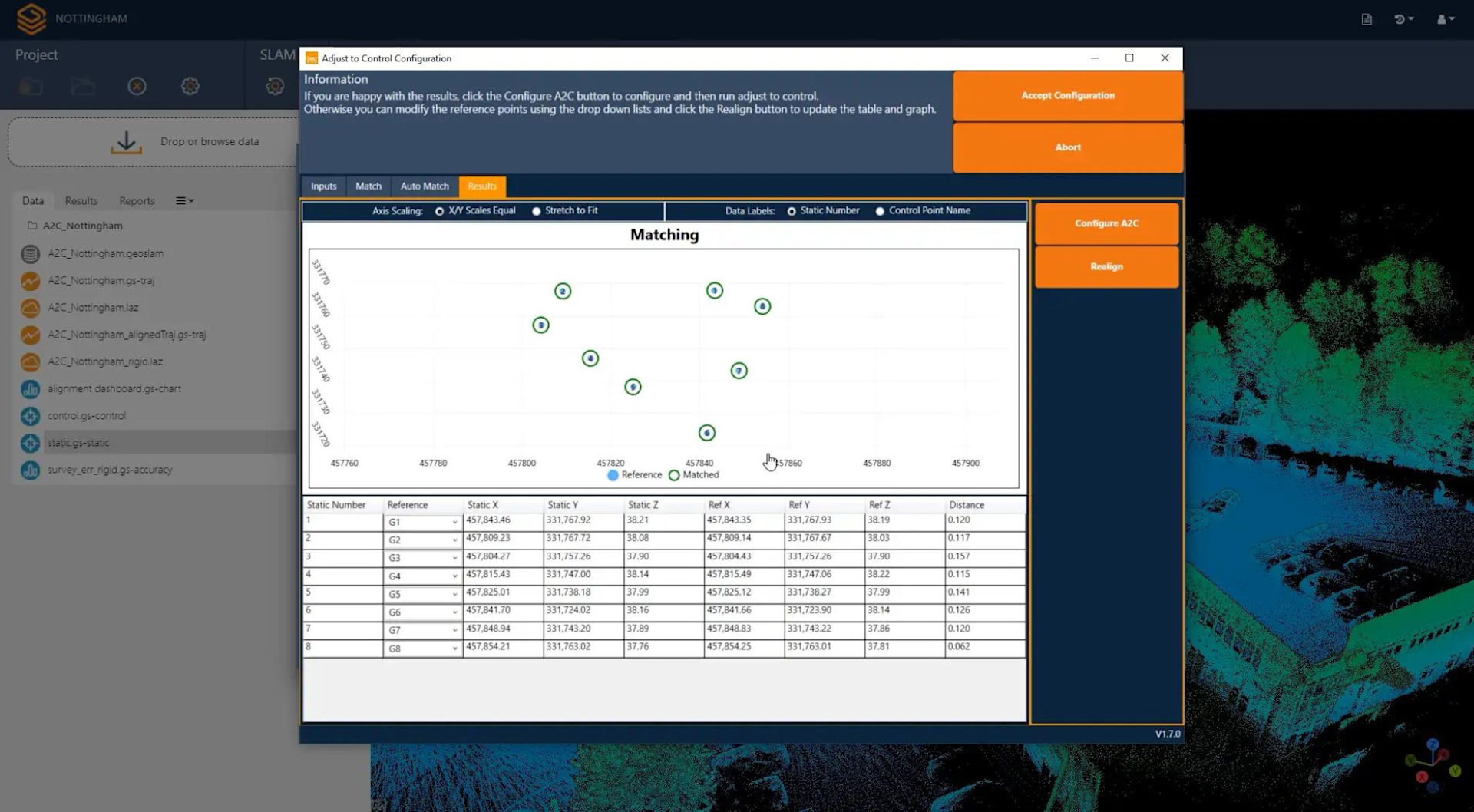
Users can select the auto-matching option, or to have more control over the process, manual matching is also available.
The new interface provides insights about the distribution of control points and how they relate to the static periods in the scan.
New charts and graphs show the outputs in finer detail than before, to help with understanding the distance error when georeferencing.
The user has access to change parameters which can ensure a better match and a more accurate result, along with improvements to existing tools such as non-rigid method of matching.
Georeferencing Data Using Reflective Targets
Further additions to Connect 2.3 include the ability to georeference data using reflective targets in the scanned environment. Data can now be georeferenced automatically within Connect, without the need to stop on a control point during the capturing process.
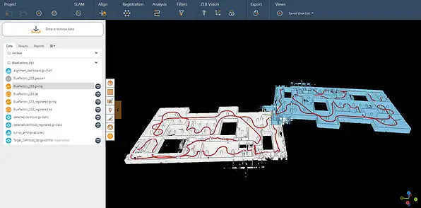
The capability to georeference data using reflective targets is particularly beneficial for UAV users, who cannot stop their systems mid-flight.
Aligning Data Using Reflective Targets
Aligning and merging data using the same reflective targets in multiple scans is another key feature of Connect 2.3.
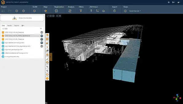
This feature benefits those who want to automatically align numerous datasets over a large site. This includes capturing repeat scans of the same environment, for example, when stockpile monitoring.
ZEB Vision Calibration
Aside from the georeferencing workflows, GeoSLAM has expanded other features in Connect 2.3.
One of these relates to the ZEB Vision, which attaches quickly to the ZEB Horizon LiDAR scanner to capture colourised data and 360° panoramic images in minutes.
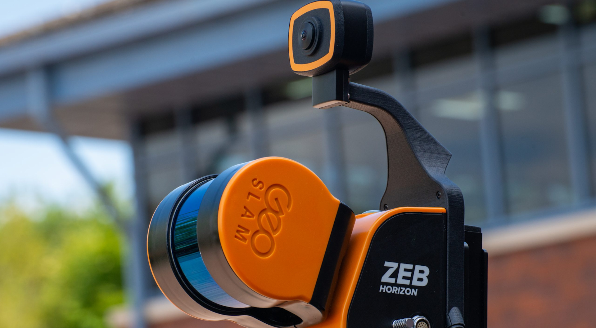
Following the release of Connect 2.3, calibrating the ZEB Vision has become easier, as it is now accessible from within the Connect interface, meaning users can complete the entire Vision workflow using the software.
Also, if users have disconnected the ZEB Vision system from the ZEB Horizon, they can re-calibrate it themselves rather than requiring assistance from GeoSLAM.
This allows more control over the scanning process and less disruption to data capture.
Additionally, the amount of storage space available for image data per scan has increased. This allows users to have the option to store ZEB Vision images directly to the ZEB Horizon datalogger. Packaging the images in the datafile, alongside the data, makes accessing the information a simpler process.
My GeoSLAM
My GeoSLAM accounts are now available from within the Connect interface. This gives greater access to resources such as GeoSLAM Academy and Knowledge Base. Using the new Licence Manager Tool, registration for a My GeoSLAM account is accessible when activating a licence.
Manual Alignment
The latest software update brings improvements to the Manual Alignment tool, previously released with Connect 2.2. These include interface and usability updates that make the overall workflows more user-friendly.
Summary
With this latest software release, GeoSLAM Connect further benefits users and increases productivity for data processing and workflows.
The new features of Connect 2.3 provide more control over the whole data gathering process.
GeoSLAM Care customers can upgrade to Connect 2.3 and any ZEB scanner purchases from the 2nd of March will include the latest version of the software.
GeoSLAM Connect comes as standard with every ZEB Horizon, ZEB Go or ZEB Revo RT laser scanner purchase. Read our GeoSLAM ZEB Go vs ZEB Revo RT Vs ZEB Horizon blog to compare the solutions.
heliguy™ has added GeoSLAM's hardware and software solutions - including drone-mounted laser scanners - to our product portfolio for end-to-end land surveying. To find out more and to discuss adding GeoSLAM products to your surveying programme, contact us.
