Picture the scene. Freezing temperatures, a thick blanket of snow, tricky terrain and a vast area of open space to cover. It’s a daunting prospect for the volunteers of
Lochaber Mountain Rescue, but it is a scenario which they face on an all-too-frequent basis. Often, the team’s missions are high-pressure call-outs, with time of the essence and every minute crucial to finding a missing or injured person in the unforgiving environment of Scotland’s Ben Nevis, which peaks at 4,411ft. Over the years, the dedicated and brave volunteers have used a combination of techniques and experience to aid stricken walkers who get lost or need medical assistance in the hills. But recently, Scotland's busiest mountain-rescue team has turned to another method to bolster its vital work. And the heroes at Lochaber have found that utilising drone technology has proved to be a life-saver - in some cases, literally! As team member Mike Smith said: “The drone is becoming an invaluable tool for our mountain rescue.”
The drone can track the position of members of the rescue team.
THE BENEFITS OF USING DRONE TECHNOLOGY
Lochaber Mountain Rescue has two Mavic drones in its fleet, having purchased them from North East England UAV expert
heliguy™. Embracing this modern technology has been beneficial to the crew for a number of reasons - helping it to scale and search large areas quickly, especially those which are remote and difficult to access by foot, and allowing the volunteers to do this without placing team members into unknowing danger. This is crucial. After all, Lochaber Mountain Rescue covers a staggeringly-huge area. While the majority of rescues take place on Ben Nevis, the crew is actually responsible for an area which exceeds 5,000 sq km, from Creag Mheagaidh in the east to Rum and the Small Isles in the west. On average, the team carries out more than 100 mountain rescues each year. The Lochaber crew is also part of independent Scottish Mountain Rescue (iSMR), which includes other units at Glencoe, Tayside and Cairngorm. While Lochaber was the first of this quartet to use drones, all four iSMR teams now utilise UAVs (unmanned aerial vehicle), having shared resources for the last two years. And drones are proving to be a vital addition to their important work.
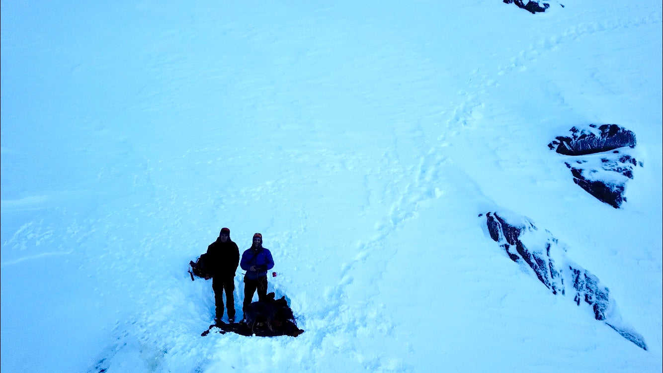
A drone launch point at Observatory Gully, Ben Nevis. The temperature is -10 degrees. Mike said: “Everywhere we operate is dangerous and the main problem in the mountains is that travelling even small distances can take a long time. But using the drone and its high-quality zoom camera allows us to scale difficult terrain much quicker and get the information a lot safer. “I would say that using a drone makes it 50% quicker than traditional methods to do a search. It widens the search area for us, allowing us to get an overview of the area - how big it is and inspect areas of concern, such as cornices (an overhanging ledge of snow), which can be 40ft long. "This is vital, especially when we are inspecting avalanche sites - which is our highest-risk activity - and allows us to make decisions about deployment. It means we can check out the area without having to climb up - it really does increase our situational awareness. “Once we send our crew out, the drone allows us to see where they are and what the conditions are around them. “We also use it for 3D mapping, to take photographs and create a 3D image of the area, which is great if we are not familiar with an area.”
DRONES ARE VITAL TO THE WORK OF THE TEAM
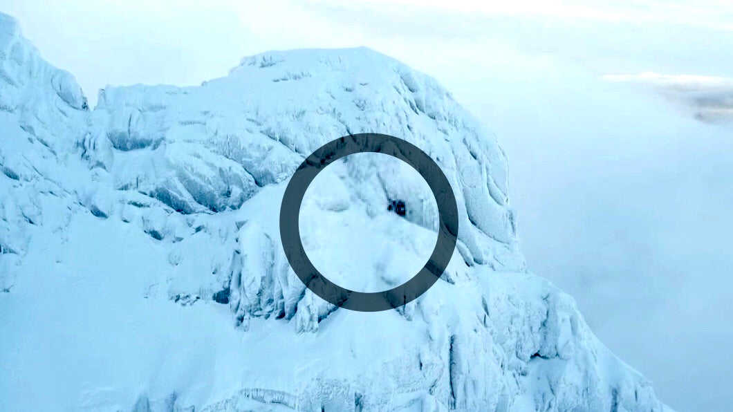
The rescue team utilised drone technology at the start of the year when searching for a hillwalker who plunged 1,600ft to his death on Ben Nevis. Polish hiker Marcin Bialas, 36, fell in an area close to Observatory Gully and Gardyloo Gully on January 21. He fell through a cornice and was buried deep below the surface. At the time of the fall - near to the summit - the search area was more than 30ft deep with snow. Due to this hostile environment, it took five months to find his body. While the rescue teams couldn’t save Mr Bialas’ life, using a drone made the search for his body a lot easier and a lot safer. Mike said: “There had been so much snow at this point. We knew the gully which he had fallen into - it is steep and treacherous, which meant that searching for him would be really difficult. As time went on, we couldn’t find him, and more snow had fallen. “Traditionally, we would need at least eight team members to deploy and go up to the gully, look around and search for signs of debris and we would send people into the gully itself - and this would be done numerous times a week. “But thanks to the drone, myself and the other drone pilot flew two or three times a week, recording as much footage as we could. We did this for five months and eventually we managed to locate him and recover his body. “It was a sad tale, but using a drone to search this area required two team members instead of eight - which is a big difference when you are all volunteers and have normal jobs too - and was much safer.” The story of Mr Bialas was tragic, but there are many examples of how the mountain-rescue team has used its drones to create happy endings. One such incident happened with two cragfast climbers, who were stranded approximately 3,600ft up Ben Nevis. Thankfully, they were rescued by helicopter 40 minutes later, after their location was confirmed by an image captured by the drone (see picture below).
The black circle indicates the location of the walkers. This image was captured by using the drone. Recently, the crew used the UAV to search for a walker, following a report of what looked like a parasail on the west slope of An Gearanach. Using the drone saved a lot of time and energy, in what turned out to be a false alarm. Mike said: “With light disappearing fast we decided to deploy one of our drones to recce the whole area. Nothing was found, so it was a false alarm with good intent. The drone saved a lot of legwork and is becoming an invaluable tool for our mountain rescue.” It is clear to see that drones are a useful tool in the team’s arsenal and the volunteers are maximising the benefits of the DJI Mavic series - known for being small, foldable and powerful.
A team member flying one of the drones. Mike said: “We really like them. We carry a lot of kit, so the fact that the drones are light, foldable and easy to carry is a big advantage. They are easily deployable and we can operate them with gloves on.” They are also durable. One of the team’s drones was lost last winter, but was recovered more than five months later - in working condition. Mike said: “The drone we lost last winter was found and returned after about five months under snow and after a change of battery and a new set of rotor blades and a bit of rest and recuperation, it has returned to the squadron on an operational basis.” It was a timely find for the team. Mike said: “We appear to be heading to our busiest year ever by far with still two months to go and with a wee nip in the air, winter just seems to be around the corner.”
Controlling the drone. Looking to the future, Lochaber Mountain Rescue Team is keen to make even more use of drone technology and has its eyes on DJI’s latest addition to the Mavic series - the Mavic 2 Enterprise. Designed with search and rescue, public safety and law enforcement in mind, this new release is something of a game-changer for the emergency services. Among the drone’s key features are its three accessories – a strong dual spotlight, which enhances vision in low-light areas and can pinpoint the exact location of a missing person; a beacon, featuring a bright flashing strobe visible from three miles away to enhance visibility during night-time flights; and a speaker, which is capable of a projection of 100 decibels and can be used for real-time voice transmission, as well as storing voice recordings for future use. Other perks of this impressive newbie include the 31 minutes of flight time, its 72kph maximum speed and the self-heating battery which works in temperatures as low as 14°F (-10°C); a crucial factor as accidents and incidents can happen at any time of the year. Just like its predecessors, the Mavic 2 Enterprise is small, light, compact and foldable, meaning that it can be carried with ease and is ready to go within minutes, while its omnidirectional obstacle sensing system keeps the drone at a safe distance away from obstacles, such as cliffs, vegetation and buildings. A big plus for emergency-service personnel is the password-protect system which is needed to take off or to access the 24 GB on-board storage, ensuring that the data stays safe, even if the drone falls into the wrong hands. Mike caught up with heliguy™ at the company’s recent
Emergency Services Roadshow, in Lincoln, and admitted that he was ‘absolutely impressed’ with the Mavic 2 Enterprise and would like to add it to the team's fleet for dynamic deployment on the mountain. The
Mavic 2 Enterprise Universal Edition (featuring the spotlight/speaker/beacon accessories) is available at heliguy.com for £2,069.
The Mavic 2 Enterprise with its speaker accessory. The mountain-rescue team also has its eye on the
DJI Matrice 210, with a thermal camera and 30x zoom, which the volunteers would use for extended searches and night capability. Mike said: "A nighttime capability is crucial for us and the M210 has everything we want for bigger area searches."
Leave a comment