
Technical
DJI Terra LiDAR Ground Classification Workflow
New firmware update enables DJI Terra to conduct LiDAR point cloud ground classification. In-depth workflow guide to ground classification, using sample data collected with the DJI Zenmuse L1. ... Read More
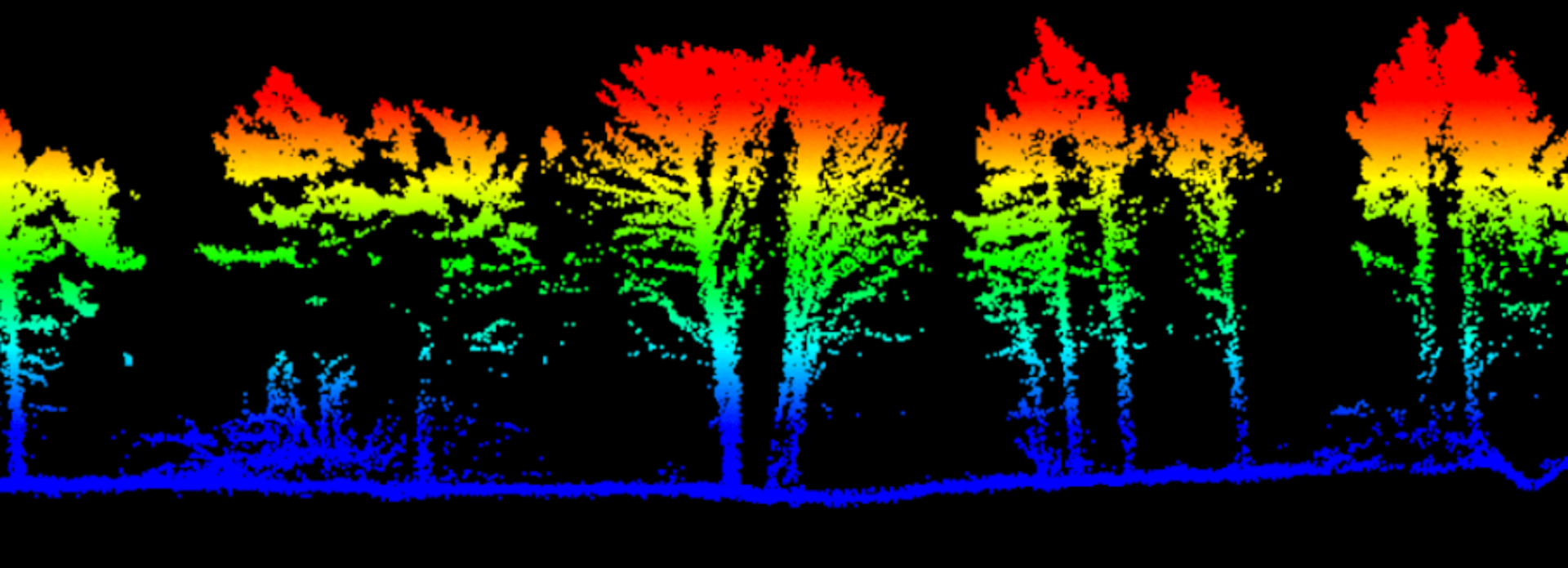
New firmware update now enables DJI Terra to conduct LiDAR point cloud ground classification;
Classify ground/bare earth ready for upload into a third-party software for DEM generation;
In-depth guide to conducting LiDAR point cloud ground classification in DJI Terra, using sample data collected with the DJI Zenmuse L1.
A new firmware update enables DJI Terra to conduct ground classification with LiDAR data.
This enables the classification of the ground/bare earth ready for upload into third-party software for DEM generation. Read our DEM vs DTM vs DSM blog for more details about tis type of model.
Classifying ground in a point cloud is essential for creating a robust DEM, helping to provide an accurate representation of the terrain and removes non-ground features.
DJI Terra: LiDAR Ground Classification - Workflow
In this example, the point cloud data has been captured with the DJI Zenmuse L1 LiDAR sensor, which can be used with the DJI M300 Series.
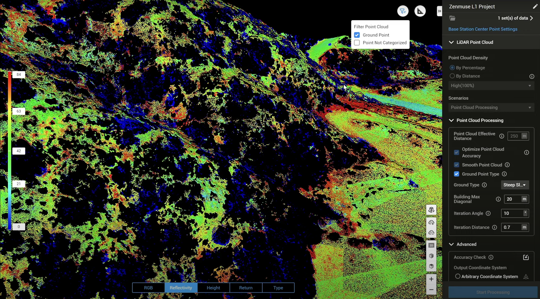
Thanks to the firmware update, the Point Cloud Processing section now contains Ground Point Type, as the image shows, right middle.
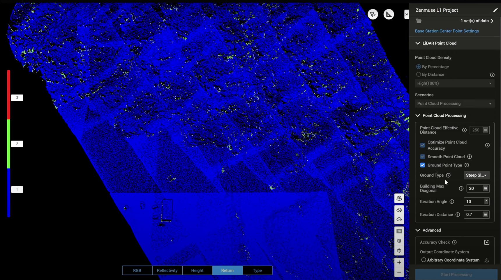
Enable Ground Point Type, which has four parameter settings: Ground Type; Building Max Diagonal; Iteration Angle; and Iteration Distance.
Ground Type
Choose between Flat Ground, Gentle Slope, or Steep Slope.
Flat Ground: Suitable for aeras with dense building or plain.
Gentle Slope: Suitable for areas such as common mountains and hills.
Steep Slope: Suitable for areas with great elevation changes, such as high mountains or river valleys.
Changing the ground type would also have Terra adjust the following iteration angle and iteration distance settings.
Building Max Diagonal
Max diagonal length of a building in the top view. The default value is 20m and the value range should be within 1-1,000m. It can be measured using Terra's measurement tool. This helps Terra better identify artificial structure and speeds up the classification process.
Iteration Angle & Iteration Distance
Normally, you don't have to change the iteration angle and iteration distance settings, but adjusting these will help you fine tune the ground classification result and provide you more freedom on the ground classification.
Iteration Angle: Parameter used to determine ground point. When the angle between the point and the triangular surface is within the configured value, the point is regarded as a ground point. The default value for Flat Ground is 3°, Flat Slope is 6°, and Steep Slope is 10°. Value range should be within 0.1° to 60°.
Iteration Distance: Parameter used to determine ground point. When the distance between the point and the triangular surface is within the configured value, the point is regarded as a ground point. The default value for Flat Ground is 0.3m, Flat Slope is 0.5m, and Steep Slope is 0.7m. Value range should be within 0.01-10m.
After setting up the Ground Point Type settings, press Start Processing to process the LiDAR point cloud data.
Click on the Type button at the bottom of the screen, which changes the point cloud to this view, which displays the points which have been categorised as ground (yellow shading) versus the non-categorised points.
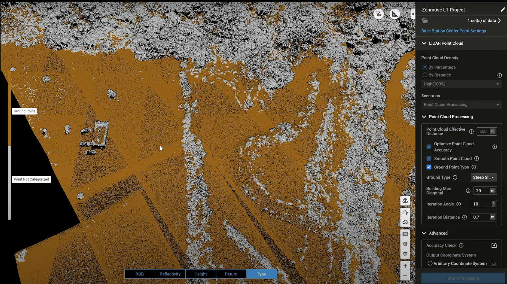
In the upper right corner, choose the Filter icon, and hide or unhide certain categorised points.
So this graphic below shows both the ground points and the points which have not been categorised, as displayed based on Reflectivity (provides insights into the characteristics of the scanned objects or surfaces)...
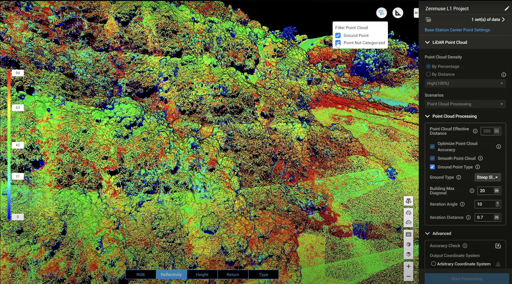
...while this image shows the ground points only, as displayed via the reflectivity setting.
After this, select the relevant LAS files which contain the categorised ground point layer...
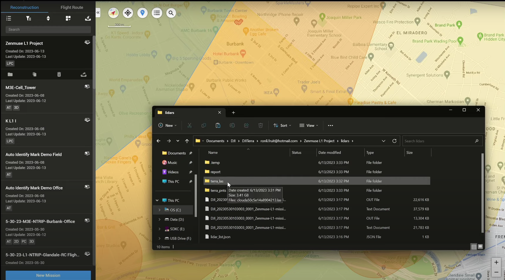
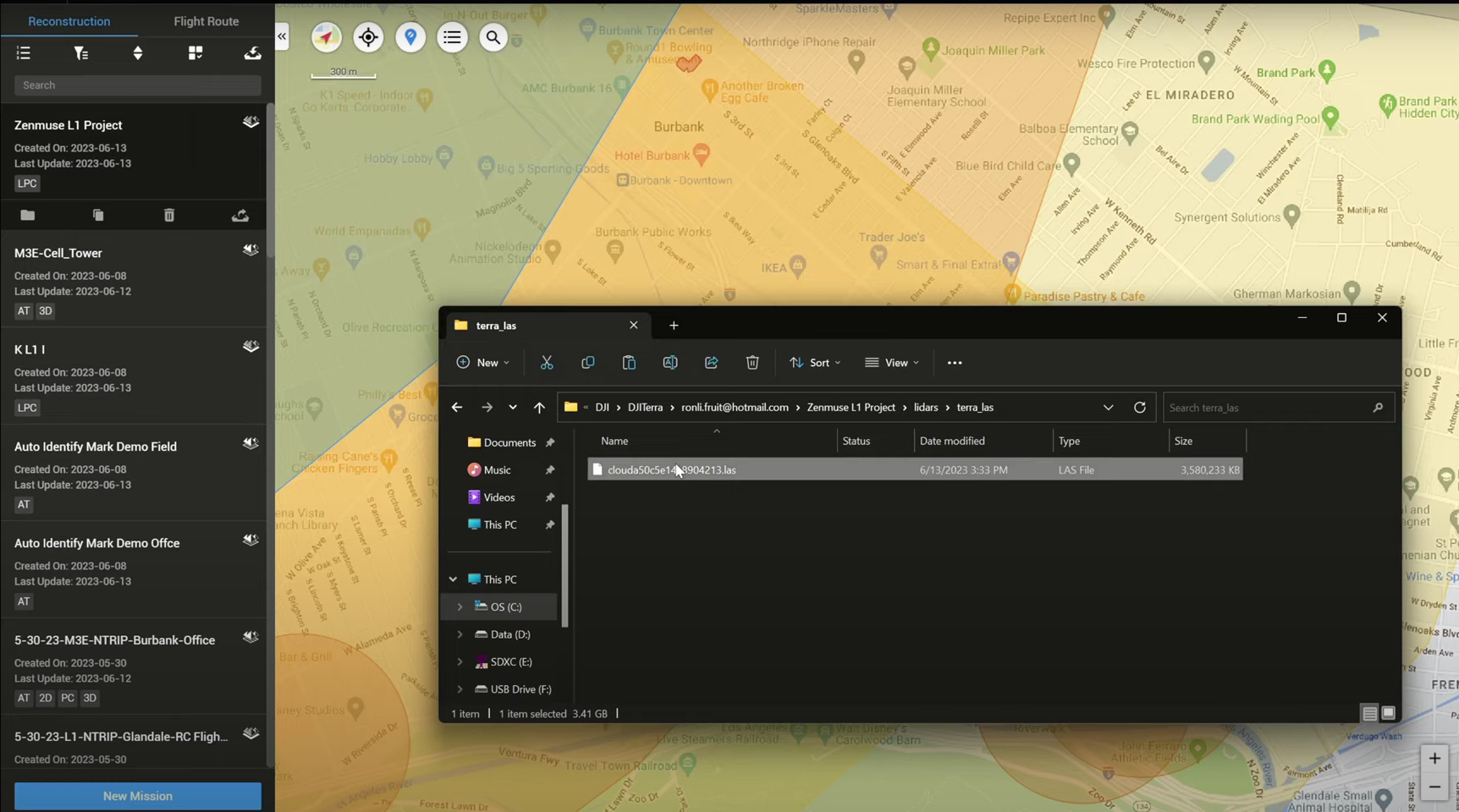
...and import to a third-party software ready for DEM creation.
