News
Free Terrasolid Licence For DJI Drone LiDAR Data
Terrasolid UAV for DJI L1 is a bespoke software package to simplify LiDAR data processing. The licence is currently free. Use with DJI Terra and turn raw point clouds into usable data and conduct in-depth analysis. ... Read More

Terrasolid UAV for DJI L1 is a bespoke software package to simplify LiDAR data processing;
The licence is free until the end of 2022;
Used in conjunction with DJI Terra, Terrasolid provides extra processing capabilities to turn raw point clouds into usable data;
Terrasolid enables more in-depth analysis, such as classification, cleaning and other important tools on L1 data;
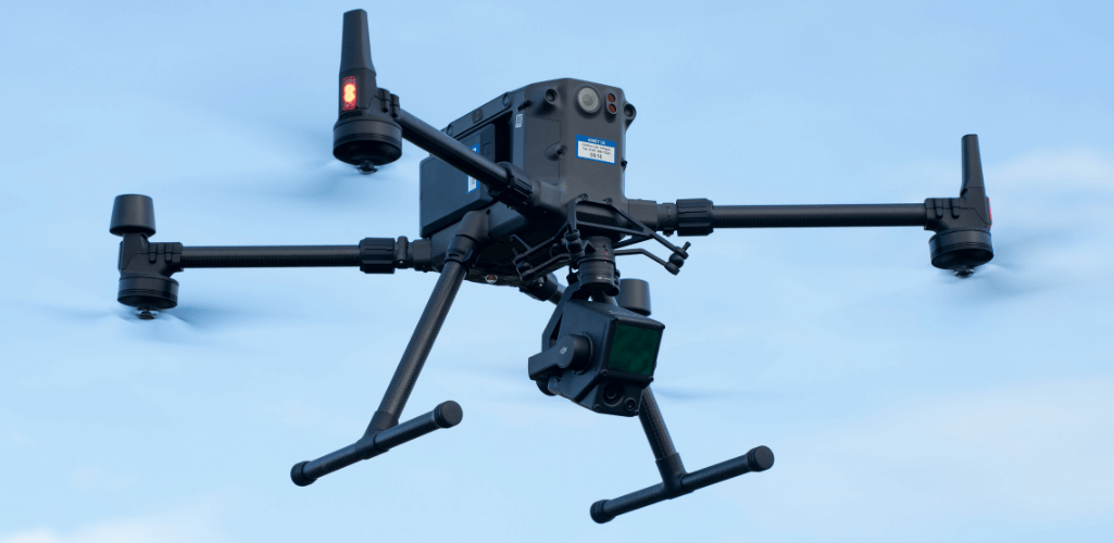
Terrasolid endorsed by DJI and forms part of the end-to-end DJI survey workflow of M300 RTK, L1 sensor, and DJI Terra.
Industry-leading software platform Terrasolid has developed a bespoke package to help surveyors process high-quality point clouds from DJI L1 drone data - and the licence is free until the end of 2022.
The Terrasolid UAV bundle for DJI L1 has been exclusively designed to process L1 point clouds automatically and seamlessly.
It provides extra processing capabilities - compared to DJI Terra - and provides a greater suite of powerful tools for in-depth analysis, such as object classification and cleaning. The software also enables feature extraction, volumetric calculations, terrain representations, and 3D vector creation.
Terrasolid is used in conjunction with DJI Terra, and so becomes a key component of DJI's end-to-end drone surveying workflow, which also incorporates the M300 RTK drone.
Arttu Soininen, Terrasolid software developer, said: "The L1 is a gamechanger in the UAV LIDAR industry.
"It brings survey-grade UAV LIDAR to a whole new price level, it is easy to operate in a nicely-integrated package, and enables quality colouring of LiDAR points.
"For these reasons, it will attract organisations to use drone LiDAR and it is a big opportunity for them to benefit from our software, which makes it easy to process L1 data and conduct detailed analysis."
Terrasolid UAV For DJI L1 - Free Licence
Used by thousands of customers around the world, Terrasolid has become the industry standard software for point clouds and image processing, developed specifically for the demanding requirements of geospatial, engineering, operations and environmental professionals.
Based on the L1's capabilities, the new Terrasolid UAV for L1 package has been specifically developed for this sensor, and features TerraScan UAV and TerraModeler UAV as standard.
TerraScan UAV: Manage and process all types of point clouds. Users can create 3D vector models, run corridor analysis and use classification tools.
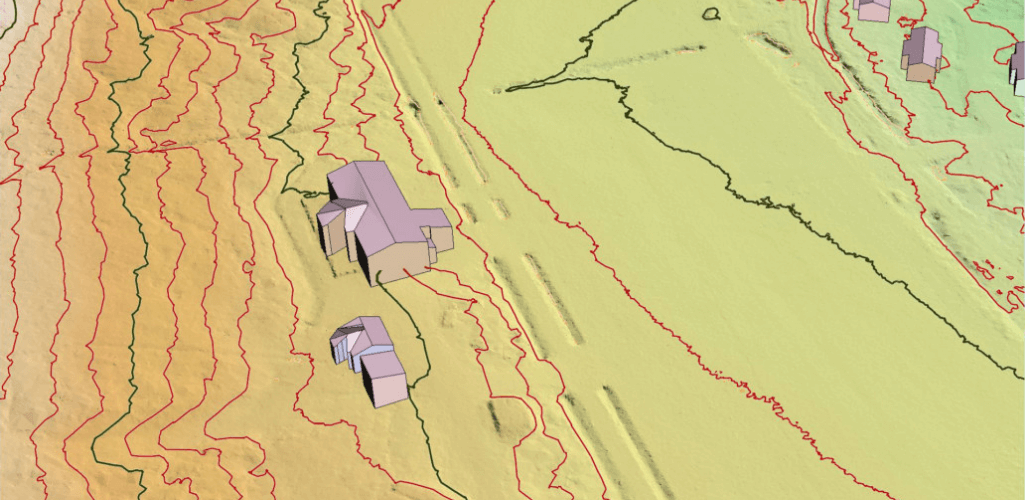
TerraModeler UAV: Create, edit, and visualise surface models, including the production of contour lines, DSM and DTM models, and volume calculations.
As this L1-specific processing software in its infancy, Terrasolid is offering a fully functional evaluation licence which is free to DJI L1 users until December 31, 2022.
This is compared to normal list prices of just shy of the £4,000 purchase price - plus 15% maintenance per year - and a subscription price of just over £1,300 annual subscription price.
The free Terrasolid UAV for L1 runs on Spatix or a MicroStation CAD system. As such, two types of free bundle are available:
Terrasolid UAV for DJI L1 Spatix package includes:
TerraScan UAV
TerraModeler UAV
Spatix (free, as part of the software)
License to run these until 31.12.2022 on same computer with DJI Terra.
Terrasolid UAV for DJI L1 MicroStation package includes:
TerraScan UAV
TerraModeler UAV
License to run these until 31.12.2022 on same computer with DJI Terra
You must have MicroStation / PowerDraft / Map PowerView to run this.
Enquire now with heliguy™ to access your free package and evaluation key.
DJI L1 Point Cloud Processing using TerraScan and TerraModeler UAV
The Terrasolid package makes it easier for users to process L1 data, using a .LAS file written by DJI Terra software, as well as a trajectory solution output from DJI Terra.
A streamlined solution, it can take less than 10 minutes for Terrasolid to read the point cloud, then users can begin to gain deep insights.
This can be done through the specialised drone processing wizard, which not only simplifies DJI L1 data import, but also simplifies typical processing and classification steps which are common for many end products.
For instance, the dataset can be viewed in 3D to provide the user with a better understanding of what is in front of them...
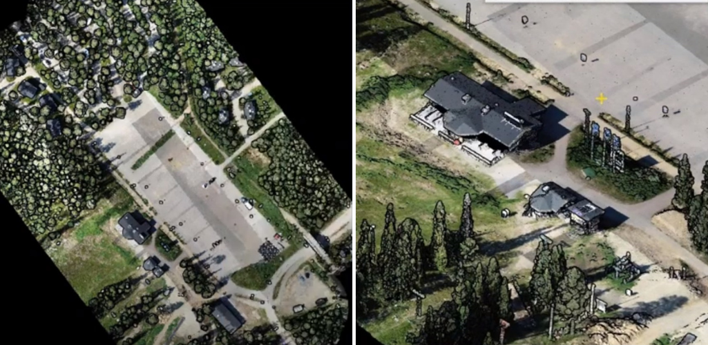
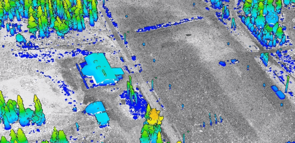
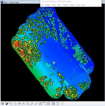
...while elevation colouring of the dataset helps users understand the terrain and how it changes. It also provides another way of viewing above-ground objects, such as trees and buildings in this example.
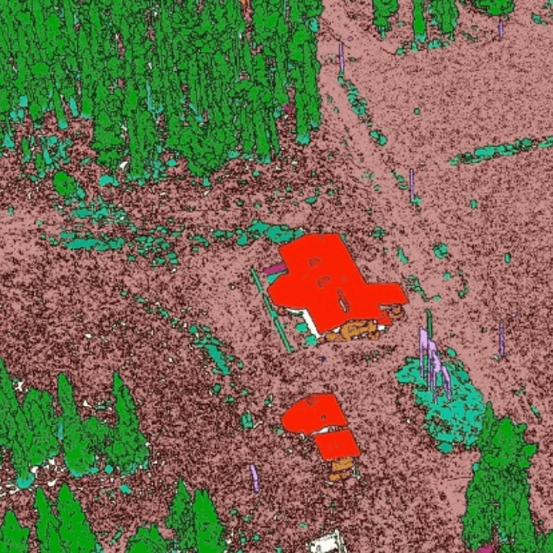
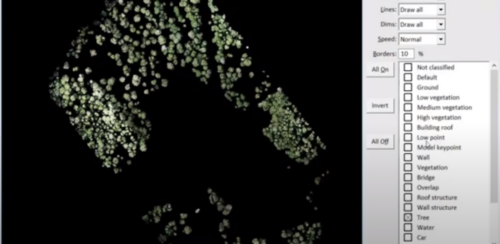
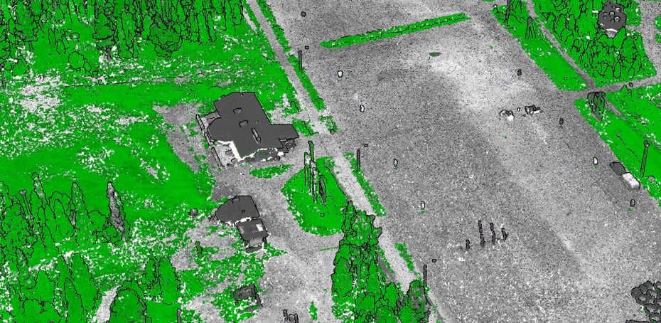
The Terrasolid platform can also be used to conduct classification of objects within the dataset. The image below shows the wizard classifying trees.
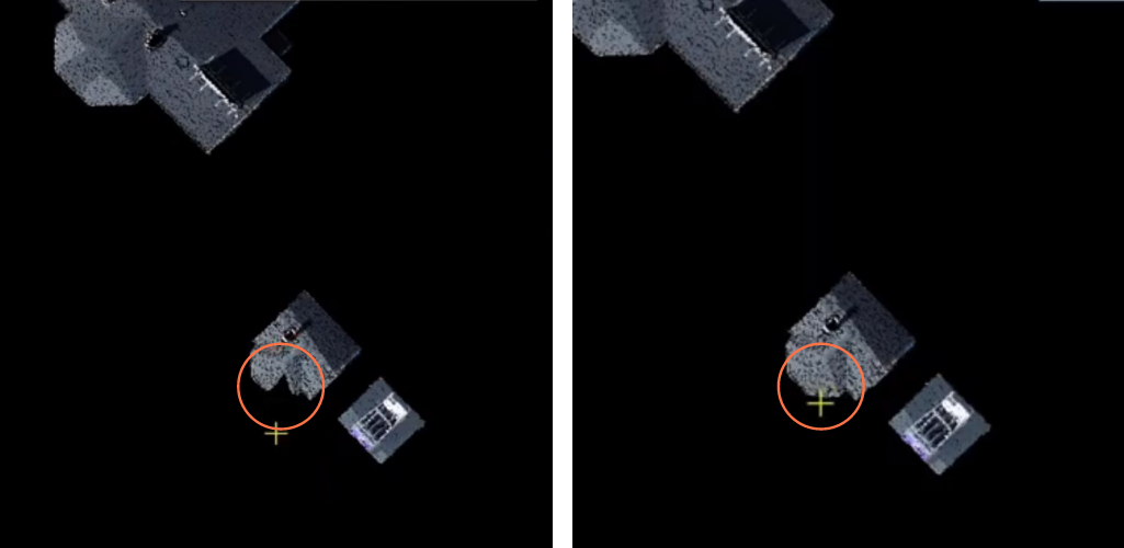
The wizard can conduct automatic classification, but manual classification is also available. This is particularly useful if parts are missing from certain objects on the dataset.
In this example, the left image shows a building which is missing a section of rooftop, as part of the automatic classification stage. But the right-hand picture demonstrates how this has been rectified - and completed - with a bit of manual classification.
Classification is an important step. Benefits include:
Once classified, all non-terrain data can be extracted to provide a Digital Terrain Model (DTM).
Perform further analysis tools on individual classes such as reidentifications or point cloud cleaning.
Extract specific classes. For example, you could pull out electricity line data to remove all unneeded data.
This image shows how the dataset looks following classification.
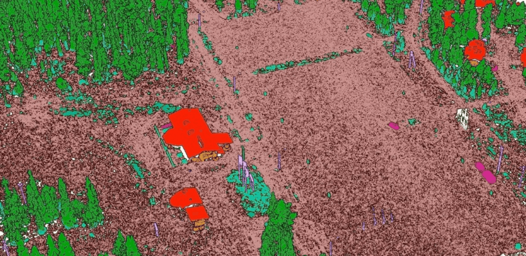
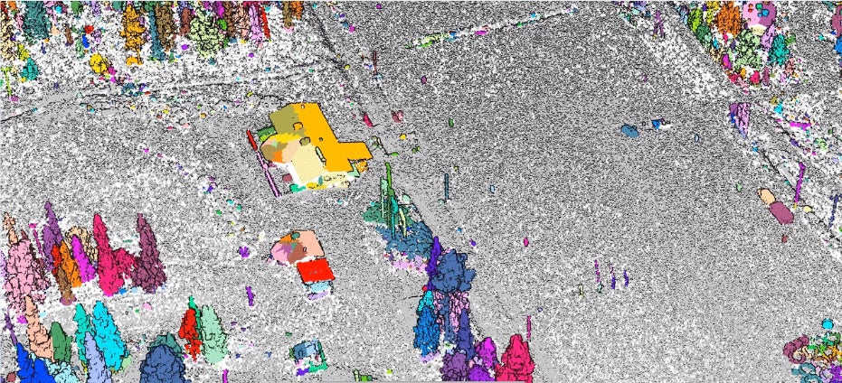
Meanwhile, grouping/segmentation tools enable the software to conduct analysis, such as count the number of trees/produce a list of trees.
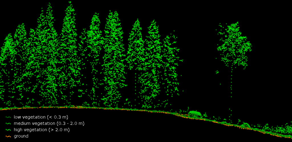
As an aside, the platform comes with default classification classes - including those that are industry standard, such as ground, low/medium/high vegetation, and building roof - or you can use your own.
Terrasolid can also be used to smoothen out the data and reduce the noise within the dataset. It does this by smoothing the surfaces by classifying outliers as noise - to create a prettier and narrower cross-section.
This is illustrated by the images below. The first of these shows the cross-section prior to smoothing, while the second is following the process.
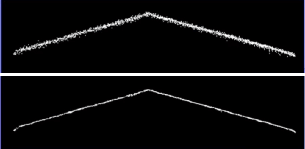
The smoothing process is done locally, too, to avoid losing features, such as kerb stones.
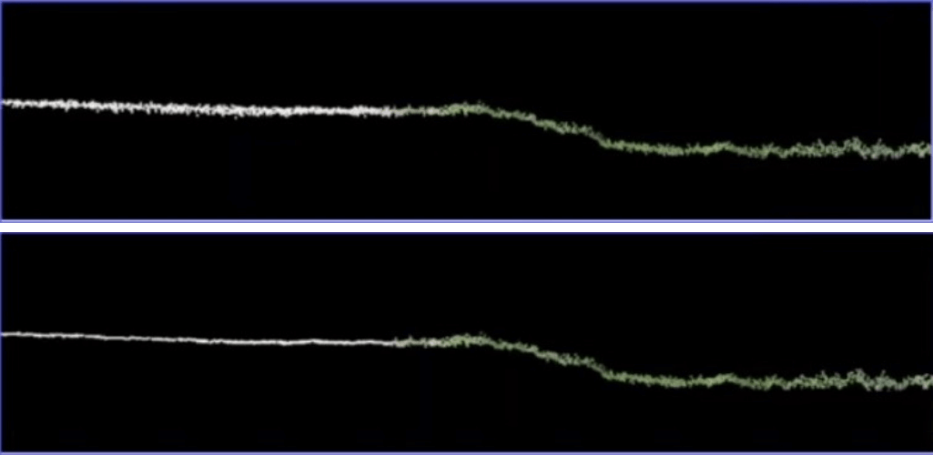
The wizard also uses the RGB colour of the points to recognise what is vegetation and applies smoothing to non-vegetation surfaces. It does this by utilising visual band Difference Vegetation Index to decide what is vegetation and what is not.
This is demonstrated by the pictures below. Looking at the cross-sections where asphalt is on left and grass is on the right, you can see the asphalt (white line) has been smoothed, but the grass (green line) has not.
Tools can be used to manipulate data at any point, including classifying bad data, removing unnecessary data, and cutting overlap to improve accuracy and simplify the data.
Once these basic steps are completed, users can then continue with end-product steps, such as using dedicated tools for tasks such as city modelling ((building vectorisation), or powerline processing (vectorise wires, find danger trees)...
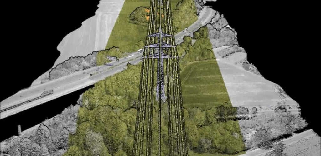
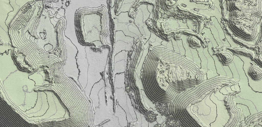
...or contour production (classify contour key points, display contours) which is especially useful for mining...
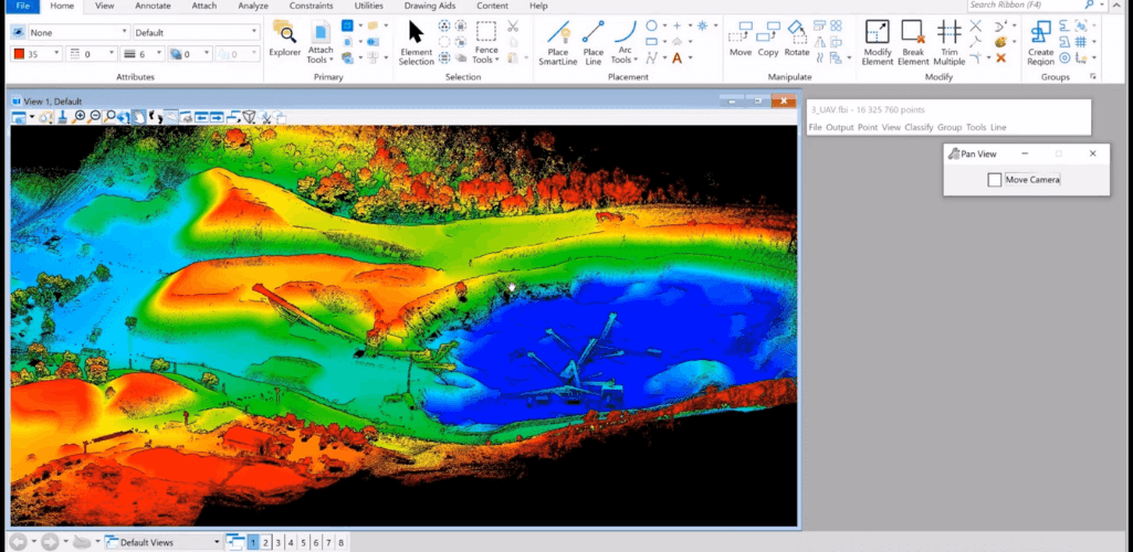
...or volume computation (classify model key points, compute volumes)...
...and forestry (height of trees, vegetation levels).
Using Terrasolid And DJI Terra
You might ask why you should bring Terrasolid into your ecosystem when you are already using DJI Terra.
The simple answer is that as the DJI Terra Pro licence is a basic processing solution, most (if not all) L1 users will require extra processing capabilities in order to turn their raw point cloud into usable data.
As highlighted previously, Terrasolid allows for classification, segmentation (image below), cleaning and many other important tools on L1 data.
During a recent webinar, Simba Wang, Director of Geospatial Business & Solutions, picked up on this point.

He highlighted that both software platforms complement each other: Processing the .LAS file from Terra within Terrasolid.
He said: "DJI Terra and Terrasolid are very much part of a workflow - they are not competing against each other.
"The mission for DJI Terra right now is trying to produce the high quality and standardised .LAS file which can then be imported to Terrasolid to do further analysis, for example classifications, DEMs, and other types of analysis."
Summary
Traditionally, aerial LiDAR was an expensive, and often bulky, process. But the compact, highly-integrated and cost-effective DJI Zenmuse L1 has changed all that, making drone LiDAR more accessible.
As such, the software is needed to enable users to draw actionable insights from their LiDAR data.
DJI Terra provides a great springboard for this, but when used in conjunction with Terrasolid, surveyors are able to gain even deeper and more meaningful results, driving more effective decision-making.
Terrasolid is a proven software, trusted around the world, so its dedicated package for the DJI L1 drone data is an exciting move for the industry. And the fact that it is free until the end of 2022 is an added bonus.
Contact us by phone or email to discuss Terrasolid and how it can improve drone surveying workflows.
