News
Getting Started with Drone Surveying: Laws, Licence and Regulations
In-depth guide to help you understand UK drone laws for mapping and how to obtain a licence for drone surveying. ... Read More

So, you want to start using drones for surveying. Good move - because they help collect accurate data quicker and safer than traditional ground-based methods.
However, before you take to the skies, you need to ensure you are flying legally and safely.
This blog will highlight the UK drone laws and detail what steps you need to take to obtain a licence for drone surveying - with a particular focus on DJI's principal drone mapping solutions: The M300 RTK and Phantom 4 RTK.
Drone Surveying Laws In The UK
UK drone laws define where you can fly. And this all depends on the drone you have, the risk of the operation and where you want to fly your aircraft.
In a nutshell, there are three operational categories which dictate how you can fly. These are:
Open: Low risk to third parties. Divided into subcategories: A1 (fly over people); A2 (fly close to people); A3 (fly far from people). Certain drones can fly under the rules of certain subcategories.
Specific: For operations that fall outside the boundaries of the Open Category. An Operational Authorisation (formerly PfCO) is required.
Classified: Very complex operations, presenting an equivalent risk to that of manned aviation.
Drone training is required for certain operations: The A2 CofC relates to the Open Category and the GVC is for Specific Category missions. Training will be discussed later.
For an in-depth guide to UK Drone Laws, read this blog.
Drone Surveying: Where Can I Fly?
The above is a fairly broad brushstroke of UK drone laws. So how do these rules apply to your surveying missions?
To help, we'll focus on DJI's leading mapping drones, the Phantom 4 RTK and M300 RTK.
To find out how these rules apply to other drones, please use our Drone Licence Calculator tool.
Phantom 4 RTK
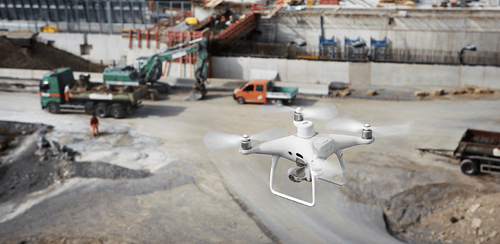
Because the Phantom 4 RTK weighs less than 2kg, it offers operators a degree of flexibility of where the drone can be operated.
Open Category:
A2 Subcategory | A3 Subcategory | |
Overview | Fly near to people | Fly far from people |
Operating Area | No flights within restricted airspace (Restricted Areas, Danger Areas, FRZs) without relevant permission. Flights allowed within residential, commercial, industrial and recreational areas. | No flights within 150m horizontally of residential, commercial, industrial or recreational areas. No flights within restricted airspace (Restricted Areas, Danger Areas, FRZs) without relevant permission. |
Separation From Uninvolved People | No closer than 50m horizontally. | No uninvolved persons to be present within the area of the flight. No closer than 50m horizontally at any time. |
Training Requirements | You must have an A2 CofC to fly in the A2 Subcategory. | A2 CofC not applicable for flights in the A3 subcategory. |
This table highlights how the Phantom 4 RTK can be operated within the confines of the Open Category and how an A2 CofC can be useful.
However, businesses using the Phantom 4 RTK may choose to go down the GVC/Operational Authorisation route - more of that later.
M300 RTK
The M300 RTK is a larger drone than the P4 RTK, with a maximum take-off weight of 9kg, including payload (this could be the P1 photogrammetry camera or L1 LiDAR sensor).
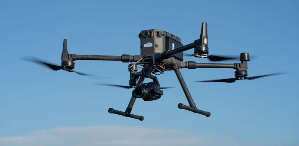
For this reason, M300 RTK operators have two choices:
Open Category - A3: By all means operate in this category, but this does restrict surveys somewhat because flights cannot be conducted within 150m horizontally of residential, commercial, industrial or recreational areas.
Specific Category: This applies to the majority of M300 RTK surveying operations, and is similar in scope to the former PfCO. An Operational Authorisation is required to operate in the Specific Category, either by completing a GVC drone training course or using a PfCO which is still valid. Operating in the Specific Category will enable M300 RTK surveys to be conducted up to 50m from uninvolved people/properties.
Obtaining Your Surveying Permit - Drone Training
There are two drone training courses in the UK: The A2 CofC and GVC.
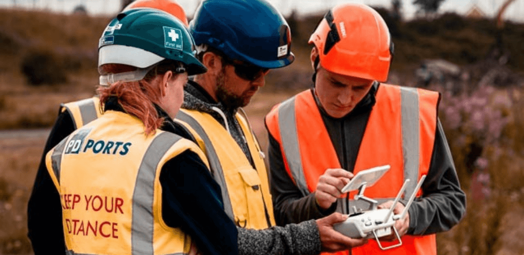
The type of course you take depends on the drone you have and how you plan to fly it.
The theory courses for the A2 CofC and GVC can be completed online with heliguy™.
A2 CofC | GVC | |
Category | Open | Specific |
What It Includes | Theory Course and Test (30 questions) Self-guided Practical Flight Training | Theory Course and Test (40 questions) Operations Manual Practical Flight Assessment |
Validation Length | 5 Years | 5 Years |
Qualification | A2 CofC | GVC to apply for Operational Authorisation (risk assessment). |
CAA Authorisation Required | No | Yes |
Course cost (inc VAT, correct as of September 16 2021) | £249.99 | £749.99 |
A2 CofC Vs GVC For Drone Surveying
Depending on your surveying operations, an A2 CofC can be a vital drone training course to complete - especially if you have a Phantom 4 RTK.
However, while an A2 CofC may meet your criteria, there are some factors you should consider which may make it more prudent to obtain a GVC.
Operational Aspirations
The A2 CofC is limited in its scope, as it only caters for drones up to 2kg (A2 Transitional Aircraft, such as P4 RTK (below), Mavic 2 Series) or 4kg with a C2 marking, which is not available yet. More details on transitional aircraft in the 'Legacy' section below.
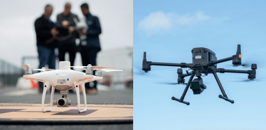
This rules out more substantial aircraft, like the M300 RTK, which can be integrated with the powerful P1 photogrammetry camera, or the L1 LiDAR sensor (above).
Obtaining a GVC puts you in a great place to utilise larger surveying drones like the M300 RTK: Whether that is immediately or by seamlessly scaling your surveying programme.
Competitive Edge
The A2 CofC is a certificate of competence, whereas the GVC is a fully-fledged drone accreditation.
There's nothing wrong with having an A2 CofC, but, by its very nature, the GVC is a higher standard, geared towards enterprise drone operators and organisations.
Therefore, having a GVC/Operational Authorisation is great validation to clients, setting the bar high and giving you the competitive edge.
Complex OSC
Sometimes, the nature of your surveying operations will require you to fly outside the confines of standard permissions.
For instance, a survey in a congested area, flying less than 50m from uninvolved people/properties, or conducting EVLOS missions.
For this, an OSC (Operating Safety Case) will be required. Having a GVC is an integral part of the OSC application process. heliguy™ can assist in this process with our OSC consultancy.
Legacy Aircraft
Currently, drones such as the Phantom 4 RTK and M300 RTK are known as Transitional aircraft and will become 'legacy' at the end of December 2022 because they do not have a class marking - introduced as part of last year's changes to drone laws to govern how drones can be flown.
For the record, no drones have these class markings yet.
From the end of December 2022, and within the Open Category, 'legacy' drones such as the P4 RTK will be limited to the A3 subcategory - ie flying far from people. Needless to say, this could hinder your surveying operations.
However, within the Specific Category, there will be no change to the rules. In other words, come the end of December 2022, legacy aircraft in the Specific Category can continue to be flown as they are now.
Therefore, having a GVC/Operational Authorisation will provide added longevity to your current non-class-marked drones.
As an aside, there is a chance that 'legacy' aircraft will receive retrospective class marking, enabling them to be used as they are now, in the Open Category, after December 2022. However, this is not guaranteed at the moment, so don't bank on this.
UK Drone Registration For Drone Surveyors
UK drone registration is a must for aerial surveyors, because of the type of aircraft used for these missions.
Drone registration comprises two elements, and depending on your situation, you may need to do both.
Flyer ID: Anyone who is flying a surveying drone must pass a 40-question multiple choice theory test and obtain a Flyer ID. This is free and the Flyer ID is valid for five years, before being renewed. Find out more here.
Operator ID: The operator is the person responsible for managing the drone, ie maintaining it and making sure that anyone who flies it has a Flyer ID. This costs £10 and the Operator ID is valid for one year. You must be 18 or over to register. If you’re responsible for drones, but will not fly them, you can register as an operator only.
Labelling Your Surveying Drones
As part of the Operator ID process, each surveying drone you have must be labelled with your Operator ID.
You can use the Operator ID for all your drones.
It must be:
Visible from the outside, or within a compartment that can easily be accessed without using a tool;
Clear and in block capitals taller than 3mm;
Secure and safe from damage;
On the main body of the aircraft.
Drone Surveying: Insurance requirements
You're surveying, so chances are you're operating commercially. If that is the case, you must have third-party insurance.
If, by chance, your surveying operation isn't commercial, and your drone is under 25kg, then insurance is not mandatory, but advised.
If your drone is 25kg or more, you must always have third party insurance, no matter what you use it for.
UK Drone Laws For Surveying: Other Things You Need To Know
Obtaining the correct drone training and flying within the right operational category are crucial things to adhere to.
But there are other factors you need to be aware of before you fly your drone for surveying. These include:
Airports: Most airports and airfields have a flight restriction zone (FRZ). Never fly in this zone unless you have permission from the airport. The zone is in place to avoid any collisions with aircraft at or near the airport.
Restricted Airspace: This includes areas around prisons, military bases, royal palaces, government sites and more.
Events: Flying may be temporarily banned in specific areas during some events, such as airshows or festivals. This is to keep everyone safe.
Emergency Incidents: Temporary restrictions may be established at very short notice due to emergency incidents, such as road traffic accidents, fires and floods.
Byelaws: Byelaws may restrict when and where you can fly. Look out for local signs for information and contact details where you can find out more. Byelaws are unlikely to be shown on apps or drone websites.
Animals: Do not fly where you’ll disturb animals.
Fit To Fly: Do not fly under the influence of alcohol or drugs, or if you are tired or unwell.
Weather: Make sure you check the weather beforehand and know if it could change during your drone flight.
There are numerous apps and websites available to help you fly safely and legally and check UK airspace. To find out more about some of these apps, and others in the industry, read our in-depth Drone Apps blog.
heliguy™ delivers UK CAA-approved drone training, as well as industry-specific closed courses, including specialist GIS training utilising our in-house surveying professionals. On top of this, the heliguy™ Drone Assistive Programme empowers in-house drone teams by delivering hands-on, on-site, real-world training to bolster pilot competence.
heliguy™ supports the drone programmes of GIS and AEC clients such as Komatsu, Balfour Beatty and Laing O’Rourke.
